
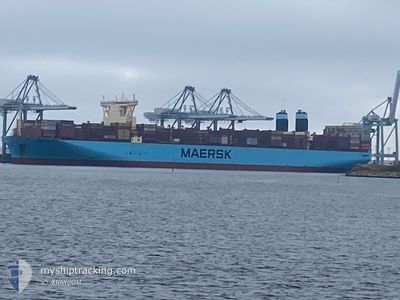
MURCIA MAERSK
Cargo A
Current Trip
| Time Travelled | 21 days |
|---|---|
| Remaining Time | 2 days |
| Distance Travelled | 9326.30 nm |
| Remaining Distance | 2032.45 nm |
| AVG Speed | 17.8 Knots |
| MAX Speed | 24.2 Knots |
| AVG Wind | 14.2 knots |
| MAX Wind | 37 knots |
| MIN Temp | 8.8°C / 47.84°F |
| MAX Temp | 28.1°C / 82.58°F |
| Draught | 15.4 m |
| Position Received | 7 d ago |
Current Position
| Longitude | --- |
|---|---|
| Latitude | --- |
| Status | Under way using engine |
| Speed | 20.3 Knots |
| Course | 114.2° |
| Area | South Atlantic Ocean |
| Station | T-AIS |
| Position Received | 7 d ago |
Info
Information
The current position of MURCIA MAERSK is in South Atlantic Ocean with coordinates -34.67673° / 18.20825° as reported on 2025-12-27 02:45 by AIS to our vessel tracker app. The vessel's current speed is 20.3 Knots and is heading at the port of SINGAPORE. The estimated time of arrival as calculated by MyShipTracking vessel tracking app is 2026-01-07 08:31 LT
The vessel MURCIA MAERSK (IMO: 9780457, MMSI: 219036000) is a Cargo A It's sailing under the flag of [DK] Denmark.
In this page you can find informations about the vessels current position, last detected port calls, and current voyage information. If the vessels is not in coverage by AIS you will find the latest position.
The current position of MURCIA MAERSK is detected by our AIS receivers and we are not responsible for the reliability of the data. The last position was recorded while the vessel was in Coverage by the Ais receivers of our vessel tracking app.
The current draught of MURCIA MAERSK as reported by AIS is 15.4 meters
Weather
| Temperature | 27.9°C / 82.22°F |
|---|---|
| Wind Speed | 13 knots |
| Direction | 323° NW |
| Pressure | 1010.5 hPa |
| Humidity | 67 % |
| Cloud Coverage | 100 % |
Featured Company
Last Port Calls
| Port | Arrival | Departure | Time In Port |
|---|---|---|---|
| 2025-12-12 17:25 | 2025-12-13 12:12 | 18 h | |
| 2025-12-05 07:35 | 2025-12-07 11:33 | 2 d | |
| 2025-11-27 20:47 | 2025-11-30 10:16 | 2 d | |
| 2025-11-24 07:12 | 2025-11-26 14:01 | 2 d |
Most Visited Ports (Last year)
| Port | Arrivals | |
|---|---|---|
| 4 | ||
| 4 | ||
| 3 | ||
| 3 | ||
| 3 | ||
| 3 |
Last Trips
| Origin | Departure | Destination | Arrival | Distance | |
|---|---|---|---|---|---|
| 2025-12-07 11:33 | 2025-12-12 17:25 | 1490.90 nm | |||
| 2025-11-30 10:16 | 2025-12-05 07:35 | 534.12 nm | |||
| 2025-11-26 14:01 | 2025-11-27 20:47 | 325.84 nm | |||
| 2025-10-28 01:15 | 2025-11-24 07:12 | 11841.53 nm |
Events
| Time | Event | Details | Position / Dest | Info |
|---|---|---|---|---|
| 2025-12-27 02:51 | Status Changed | Default Under way using engine |
-34.69047 / 18.24523
ESALRAN>SGSIN
|
Speed: 20.3 kn Course: 114.2° |
| 2025-12-27 02:45 | Status Changed | Under way using engine Default |
-34.67673 / 18.20825
ESALRAN>SGSIN
|
Speed: 20.3 kn Course: 117° |
| 2025-12-27 02:45 | OUT of Coverage |
-34.67673 / 18.20825
South Atlantic Ocean
ESALRAN>SGSIN
|
Speed: 20.3 kn Course: 114.2° |
|
| 2025-12-27 02:39 | IN Coverage |
-34.67673 / 18.20825
South Atlantic Ocean
ESALRAN>SGSIN
|
Speed: 20.3 kn Course: 114.2° |
|
| 2025-12-27 01:38 | Status Changed | Default Under way using engine |
-34.44833 / 17.85667
ESALRAN>SGSIN
|
Speed: 19.7 kn Course: 136.3° |
| 2025-12-27 01:34 | OUT of Coverage |
-34.43280 / 17.83932
South Atlantic Ocean
ESALRAN>SGSIN
|
Speed: 19.7 kn Course: 136.3° |
|
| 2025-12-27 01:22 | Status Changed | Under way using engine Default |
-34.38663 / 17.78748
ESALRAN>SGSIN
|
Speed: 19.5 kn Course: 137° |
| 2025-12-27 01:14 | Status Changed | Default Under way using engine |
-34.35166 / 17.74833
ESALRAN>SGSIN
|
Speed: 19.6 kn Course: 138° |
| 2025-12-27 01:11 | Status Changed | Under way using engine Default |
-34.34223 / 17.73750
ESALRAN>SGSIN
|
Speed: 19.5 kn Course: 138° |
| 2025-12-27 00:58 | Status Changed | Default Under way using engine |
-34.29163 / 17.68062
ESALRAN>SGSIN
|
Speed: 19.3 kn Course: 137.7° |