

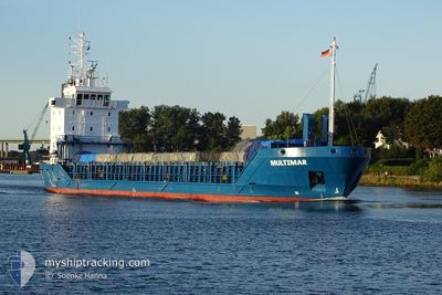
MULTIMAR
General Cargo

Current Trip
| Time Travelled | 3 days |
|---|---|
| Remaining Time | --- |
| Distance Travelled | 928.33 nm |
| Remaining Distance | --- |
| AVG Speed | 10.5 Knots |
| MAX Speed | 14.9 Knots |
| AVG Wind | 14.5 knots |
| MAX Wind | 32 knots |
| MIN Temp | 1.6°C / 34.88°F |
| MAX Temp | 11.3°C / 52.34°F |
| Draught | 5.3 m |
| Position Received | 1 m ago |
Current Position
| Longitude | --- |
|---|---|
| Latitude | --- |
| Status | At anchor |
| Speed | |
| Course | 205° |
| Area | Irish Sea and St. George's Channel |
| Station | T-AIS |
| Position Received | 1 m ago |
Information
The current position of MULTIMAR is in Irish Sea and St. George's Channel with coordinates 53.74167° / -6.17032° as reported on 2025-02-04 11:18 by AIS to our vessel tracker app. The vessel's current speed is 0 Knots
The vessel MULTIMAR (IMO: 9143788, MMSI: 212575000) is a General Cargo that was built in 1997 ( 28 years old ). It's sailing under the flag of [CY] Cyprus.
In this page you can find informations about the vessels current position, last detected port calls, and current voyage information. If the vessels is not in coverage by AIS you will find the latest position.
The current position of MULTIMAR is detected by our AIS receivers and we are not responsible for the reliability of the data. The last position was recorded while the vessel was in Coverage by the Ais receivers of our vessel tracking app.
The current draught of MULTIMAR as reported by AIS is 5.3 meters
Weather
| Temperature | 8.8°C / 47.84°F |
|---|---|
| Wind Speed | 17 knots |
| Direction | 244° WSW |
| Pressure | 1009.6 hPa |
| Humidity | 77.4 % |
| Cloud Coverage | 100 % |


Featured Company
Last Port Calls
| Port | Arrival | Departure | Time In Port |
|---|---|---|---|
| 2025-01-29 14:33 | 2025-01-31 17:50 | 2 d | |
| 2025-01-27 15:50 | 2025-01-28 17:07 | 1 d | |
| 2025-01-21 16:00 | 2025-01-25 17:02 | 4 d | |
| 2025-01-16 14:49 | 2025-01-17 18:29 | 1 d | |
| 2025-01-14 03:53 | 2025-01-15 10:48 | 1 d | |
| 2025-01-09 23:01 | 2025-01-10 23:17 | 1 d | |
| 2025-01-05 22:26 | 2025-01-09 03:40 | 3 d | |
| 2024-12-31 17:25 | 2025-01-03 09:23 | 2 d | |
| 2024-12-24 12:08 | 2024-12-29 14:22 | 5 d | |
| 2024-12-22 07:02 | 2024-12-22 07:07 | 4 m |
Last Trips
| Origin | Departure | Destination | Arrival | Distance | |
|---|---|---|---|---|---|
| 2025-01-28 18:07 | 2025-01-29 15:33 | 124.85 nm | |||
| 2025-01-25 18:02 | 2025-01-27 16:50 | 259.39 nm | |||
| 2025-01-17 19:29 | 2025-01-21 17:00 | 46.43 nm | |||
| 2025-01-15 11:48 | 2025-01-16 15:49 | 302.26 nm | |||
| 2025-01-11 01:17 | 2025-01-14 04:53 | 804.39 nm | |||
| 2025-01-09 05:40 | 2025-01-10 01:01 | 205.26 nm | |||
| 2025-01-03 10:23 | 2025-01-06 00:26 | 641.11 nm | |||
| 2024-12-29 15:22 | 2024-12-31 18:25 | 384.33 nm | |||
| 2024-12-22 08:07 | 2024-12-24 13:08 | 444.94 nm | |||
| 2024-12-20 10:49 | 2024-12-22 08:02 | 426.00 nm |
Events
| Time | Event | Details | Position / Dest | Info |
|---|---|---|---|---|
| 2025-02-04 07:49 | STOP Moving | 3.92 nm, South East of CLOGHERHEAD |
53.74067 / -6.17150
DROGHEDA
|
Speed: 0.3 kn Course: 179° |
| 2025-02-04 07:49 | Status Changed | At anchor Under way using engine |
53.74050 / -6.17150
DROGHEDA
|
Speed: 0.5 kn Course: 172° |
| 2025-02-04 01:33 | Status Changed | Under way using engine Default |
52.79733 / -5.61200
DROGHEDA
|
Speed: 12.4 kn Course: 7° |
| 2025-02-04 01:31 | Status Changed | Default Under way using engine |
52.79216 / -5.61300
DROGHEDA
|
Speed: 12.8 kn Course: 8.5° |
| 2025-02-04 01:25 | Status Changed | Under way using engine Default |
52.77150 / -5.61650
DROGHEDA
|
Speed: 12.9 kn Course: 8° |
| 2025-02-04 01:23 | Status Changed | Default Under way using engine |
52.76400 / -5.61800
DROGHEDA
|
Speed: 12.6 kn Course: 1.6° |
| 2025-02-04 01:18 | Change Sea Area | Irish part of the Irish Sea and St. George's Channel United Kingdom part of the Celtic Sea |
52.74517 / -5.62133
Irish Sea and St. George's Channel
DROGHEDA
|
Speed: 12.6 kn Course: 1.6° |
| 2025-02-04 01:18 | Status Changed | Under way using engine Default |
52.74517 / -5.62133
DROGHEDA
|
Speed: 12.8 kn Course: 6° |
| 2025-02-04 01:07 | IN Coverage |
52.74517 / -5.62133
Irish Sea and St. George's Channel
DROGHEDA
|
Speed: 12.6 kn Course: 1.6° |
|
| 2025-02-03 16:12 | OUT of Coverage |
51.01667 / -5.85850
Celtic Sea
DROGHEDA
|
Speed: 10.7 kn Course: 1.9° |