

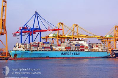
MSC TAVVISHI
Container Ship

Current Trip
| Time Travelled | 6 days |
|---|---|
| Remaining Time | --- |
| Distance Travelled | 946.46 nm |
| Remaining Distance | --- |
| AVG Speed | 12 Knots |
| MAX Speed | 22.6 Knots |
| AVG Wind | 15.3 knots |
| MAX Wind | 32 knots |
| MIN Temp | 5°C / 41°F |
| MAX Temp | 10.1°C / 50.18°F |
| Draught | 9.8 m |
| Position Received | 2024-10-18 23:02 |
Current Position
| Longitude | --- |
|---|---|
| Latitude | --- |
| Status | Under way using engine |
| Speed | 12 Knots |
| Course | 47° |
| Area | South China Sea |
| Station | T-AIS |
| Position Received | 2024-10-18 23:02 |
Information
The current position of MSC TAVVISHI is in South China Sea with coordinates 23.75667° / 118.46667° as reported on 2024-10-18 23:02 by AIS to our vessel tracker app. The vessel's current speed is 12 Knots and is heading at the port of VUNG TAU.
The vessel MSC TAVVISHI (IMO: 9189366, MMSI: 636016978) is a Container Ship that was built in 2000 ( 25 years old ). It's sailing under the flag of [LR] Liberia.
In this page you can find informations about the vessels current position, last detected port calls, and current voyage information. If the vessels is not in coverage by AIS you will find the latest position.
The current position of MSC TAVVISHI is detected by our AIS receivers and we are not responsible for the reliability of the data. The last position was recorded while the vessel was in Coverage by the Ais receivers of our vessel tracking app.
The current draught of MSC TAVVISHI as reported by AIS is 9.8 meters
Weather
| Temperature | 13.5°C / 56.3°F |
|---|---|
| Wind Speed | 18 knots |
| Direction | 281° W |
| Pressure | 1005.7 hPa |
| Humidity | 66.3 % |
| Cloud Coverage | --- |


Featured Company
Last Port Calls
| Port | Arrival | Departure | Time In Port |
|---|---|---|---|
| 2025-03-21 17:33 |
Most Visited Ports (Last year)
| Port | Arrivals | |
|---|---|---|
| 3 | ||
| 3 | ||
| 2 | ||
| 2 | ||
| 2 | ||
| 1 |
Last Trips
| Origin | Departure | Destination | Arrival | Distance |
|---|
Events
| Time | Event | Details | Position / Dest | Info |
|---|---|---|---|---|
| 2025-03-26 08:30 | START Moving | 9.14 nm, North East of DALIAN |
39.01338 / 121.87161
VNVUT
|
Speed: 4.8 kn Course: 103° |
| 2025-03-25 16:46 | STOP Moving | 9.06 nm, North East of DALIAN |
39.01099 / 121.87111
VNVUT
|
Speed: 0.3 kn Course: 303° |
| 2025-03-25 14:10 | START Moving | 16.92 nm, South of DALIAN |
38.67604 / 121.78500
VNVUT
|
Speed: 4.1 kn Course: 75° |
| 2025-03-25 11:53 | STOP Moving | 15.51 nm, South East of DALIAN |
38.72407 / 121.85761
VNVUT
|
Speed: 0.3 kn Course: 40° |
| 2025-03-24 23:17 | START Moving |
38.87323 / 120.38646
VNVUT
|
Speed: 8.3 kn Course: 127° |
|
| 2025-03-24 15:41 | STOP Moving |
38.82294 / 120.42042
VNVUT
|
Speed: Course: 274° |
|
| 2025-03-24 01:26 | START Moving | 11.21 nm, South West of CHANGXINDAO |
39.34093 / 121.21654
VNVUT
|
Speed: 5.2 kn Course: 72° |
| 2025-03-23 11:57 | STOP Moving | 10.4 nm, South West of CHANGXINDAO |
39.35521 / 121.21895
VNVUT
|
Speed: 0.2 kn Course: 188° |
| 2025-03-21 09:33 | PORT DEPARTURE |
|
39.46056 / 121.22469
VNVUT
|
Speed: 8.3 kn Course: 243° |