
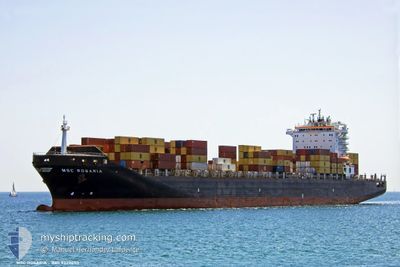
MSC ROSARIA
Not available
Current Trip
| Time Travelled | 4 days |
|---|---|
| Remaining Time | 2 h, 8 mins |
| Distance Travelled | 153.03 nm |
| Remaining Distance | 7.96 nm |
| AVG Speed | 8.2 Knots |
| MAX Speed | 10.1 Knots |
| AVG Wind | 10.7 knots |
| MAX Wind | 16 knots |
| MIN Temp | 24.4°C / 75.92°F |
| MAX Temp | 26.7°C / 80.06°F |
| Draught | 9 m |
| Position Received | 1 m ago |
Current Position
| Longitude | -78.77674° |
|---|---|
| Latitude | 26.38271° |
| Status | Under way using engine |
| Speed | 2.1 Knots |
| Course | 344° |
| Area | North Atlantic Ocean |
| Station | T-AIS |
| Position Received | 1 m ago |
Info
Information
The current position of MSC ROSARIA is in North Atlantic Ocean with coordinates 26.38271° / -78.77674° as reported on 2024-05-10 19:37 by AIS to our vessel tracker app. The vessel's current speed is 2.1 Knots and is heading at the port of FREEPORT (BS). The estimated time of arrival as calculated by MyShipTracking vessel tracking app is 2024-05-10 21:46 LT
The vessel MSC ROSARIA (MMSI: 372737000) is a Not available It's sailing under the flag of [PA] Panama.
In this page you can find informations about the vessels current position, last detected port calls, and current voyage information. If the vessels is not in coverage by AIS you will find the latest position.
The current position of MSC ROSARIA is detected by our AIS receivers and we are not responsible for the reliability of the data. The last position was recorded while the vessel was in Coverage by the Ais receivers of our vessel tracking app.
The current draught of MSC ROSARIA as reported by AIS is 9 meters
Weather
| Temperature | 26.7°C / 80.06°F |
|---|---|
| Wind Speed | 10 knots |
| Direction | 228° SW |
| Pressure | 1012.2 hPa |
| Humidity | 77.8 % |
| Cloud Coverage | --- |
Featured Company
Last Port Calls
| Port | Arrival | Departure | Time In Port |
|---|---|---|---|
| 2024-05-06 00:10 | 2024-05-06 00:17 | 6 m | |
| 2024-05-05 07:31 | 2024-05-06 00:00 | 16 h | |
| 2024-05-05 07:05 | 2024-05-05 07:17 | 11 m | |
| 2024-05-02 17:31 | 2024-05-03 09:27 | 15 h | |
| 2024-04-30 14:01 | 2024-05-01 03:37 | 13 h | |
| 2024-04-28 13:04 | 2024-04-29 02:09 | 13 h | |
| 2024-04-26 10:16 | 2024-04-26 19:00 | 8 h | |
| 2024-04-24 08:17 | 2024-04-25 08:32 | 1 d | |
| 2024-04-22 09:51 | 2024-04-22 22:30 | 12 h | |
| 2024-04-13 01:44 | 2024-04-14 01:47 | 1 d |
Most Visited Ports (Last year)
| Port | Arrivals | |
|---|---|---|
| 8 | ||
| 5 | ||
| 5 | ||
| 5 | ||
| 4 | ||
| 4 |
Last Trips
| Origin | Departure | Destination | Arrival | Distance | |
|---|---|---|---|---|---|
| 2024-05-05 20:00 | 2024-05-05 20:10 | 0.51 nm | |||
| 2024-05-05 03:17 | 2024-05-05 03:31 | 0.76 nm | |||
| 2024-05-03 05:27 | 2024-05-05 03:05 | 396.04 nm | |||
| 2024-04-30 23:37 | 2024-05-02 13:31 | 114.71 nm | |||
| 2024-04-28 22:09 | 2024-04-30 10:01 | 457.71 nm | |||
| 2024-04-26 15:00 | 2024-04-28 09:04 | 256.96 nm | |||
| 2024-04-25 04:32 | 2024-04-26 06:16 | 254.00 nm | |||
| 2024-04-22 18:30 | 2024-04-24 04:17 | 384.59 nm | |||
| 2024-04-14 02:47 | 2024-04-22 05:51 | 2920.19 nm | |||
| 2024-04-08 13:37 | 2024-04-13 02:44 | 1317.54 nm |
Events
| Time | Event | Details | Position / Dest | Info |
|---|---|---|---|---|
| 2024-05-10 18:48 | Status Changed | Under way using engine Default |
26.40472 / -78.79971
FREEPORT
|
Speed: 2.2 kn Course: 334° |
| 2024-05-10 18:47 | Status Changed | Default Under way using engine |
26.40521 / -78.80030
FREEPORT
|
Speed: Course: 50° |
| 2024-05-10 18:15 | Status Changed | Under way using engine Default |
26.40741 / -78.76501
FREEPORT
|
Speed: 2.1 kn Course: 325° |
| 2024-05-10 18:15 | STOP Moving | 6.94 nm, South of FREEPORT (BS) |
26.40741 / -78.76501
FREEPORT
|
Speed: Course: 48° |
| 2024-05-10 18:07 | IN Coverage |
26.40740 / -78.76503
North Atlantic Ocean
|
Speed: Course: 134° |
|
| 2024-05-10 15:39 | Status Changed | Default Under way using engine |
26.45132 / -78.89786
FREEPORT
|
Speed: 1 kn Course: 301° |
| 2024-05-10 15:38 | OUT of Coverage |
26.45133 / -78.89794
North Atlantic Ocean
|
Speed: 1 kn Course: 96° |
|
| 2024-05-10 15:31 | Status Changed | Under way using engine Default |
26.45164 / -78.90124
FREEPORT
|
Speed: 1.4 kn Course: 299° |
| 2024-05-10 14:38 | Status Changed | Default Under way using engine |
26.45035 / -78.92095
FREEPORT
|
Speed: 0.7 kn Course: 289° |
| 2024-05-10 12:37 | START Moving | 5.34 nm, South East of FREEPORT (BS) |
26.45386 / -78.71176
FREEPORT
|
Speed: 3.4 kn Course: 135° |