

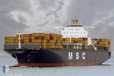
MSC PARIS
Container Ship

Current Trip
| Trip Time | 16 h, 51 mins |
|---|---|
| Trip Distance | 202.09 nm |
| AVG Speed | 13.6 Knots |
| MAX Speed | 19.2 Knots |
| Draught | 13.4 m |
| AVG Wind | 8.5 knots |
| MAX Wind | 12.8 knots |
| MIN Temp | 12°C / 53.6°F |
| MAX Temp | 14°C / 57.2°F |
| Position Received | 1 m ago |
Current Position
| Longitude | --- |
|---|---|
| Latitude | --- |
| Status | Under way using engine |
| Speed | |
| Course | 311° |
| Area | Mediterranean Sea - Western Basin |
| Station | T-AIS |
| Position Received | 1 m ago |
Information
The current position of MSC PARIS is in Mediterranean Sea - Western Basin with coordinates 43.41588° / 4.83810° as reported on 2025-03-24 09:42 by AIS to our vessel tracker app. The vessel's current speed is 0 Knots and is currently inside the port of FOS.
The vessel MSC PARIS (IMO: 9301483, MMSI: 255803201) is a Container Ship that was built in 2006 ( 19 years old ). It's sailing under the flag of [PT] Portugal.
In this page you can find informations about the vessels current position, last detected port calls, and current voyage information. If the vessels is not in coverage by AIS you will find the latest position.
The current position of MSC PARIS is detected by our AIS receivers and we are not responsible for the reliability of the data. The last position was recorded while the vessel was in Coverage by the Ais receivers of our vessel tracking app.
The current draught of MSC PARIS as reported by AIS is 13.4 meters
Weather
| Temperature | 12.7°C / 54.86°F |
|---|---|
| Wind Speed | 5 knots |
| Direction | 2° N |
| Pressure | 1012 hPa |
| Humidity | 73.9 % |
| Cloud Coverage | 84 % |


Featured Company
Last Port Calls
| Port | Arrival | Departure | Time In Port |
|---|---|---|---|
| 2025-03-23 17:24 | |||
| 2025-03-22 12:43 | 2025-03-23 00:33 | 11 h | |
| 2025-03-13 06:32 | 2025-03-16 04:49 | 2 d | |
| 2025-03-10 12:12 | 2025-03-11 14:53 | 1 d | |
| 2025-03-08 20:11 | 2025-03-09 19:17 | 23 h | |
| 2025-03-06 23:10 | 2025-03-07 09:27 | 10 h | |
| 2025-03-05 15:56 | 2025-03-06 15:39 | 23 h | |
| 2025-02-28 05:53 | 2025-03-02 01:26 | 1 d | |
| 2025-02-24 12:21 | 2025-02-25 00:16 | 11 h | |
| 2025-02-12 13:41 | 2025-02-13 14:14 | 1 d |
Most Visited Ports (Last year)
| Port | Arrivals | |
|---|---|---|
| 5 | ||
| 5 | ||
| 5 | ||
| 5 | ||
| 4 | ||
| 4 |
Last Trips
| Origin | Departure | Destination | Arrival | Distance | |
|---|---|---|---|---|---|
| 2025-03-23 00:33 | 2025-03-23 17:24 | 202.09 nm | |||
| 2025-03-16 04:49 | 2025-03-22 12:43 | 1992.83 nm | |||
| 2025-03-11 14:53 | 2025-03-13 06:32 | 673.92 nm | |||
| 2025-03-09 19:17 | 2025-03-10 12:12 | 210.43 nm | |||
| 2025-03-07 09:27 | 2025-03-08 20:11 | 326.45 nm | |||
| 2025-03-06 15:39 | 2025-03-06 23:10 | 101.27 nm | |||
| 2025-03-02 01:26 | 2025-03-05 15:56 | 917.80 nm | |||
| 2025-02-25 00:16 | 2025-02-28 05:53 | 1296.37 nm | |||
| 2025-02-13 14:14 | 2025-02-24 12:21 | 4502.13 nm | |||
| 2025-02-09 08:02 | 2025-02-12 13:41 | 136.83 nm |
Events
| Time | Event | Details | Position / Dest | Info |
|---|---|---|---|---|
| 2025-03-24 03:07 | Destination Changed | ESVLC FRFOS |
43.41589 / 4.83816
[FR] FOS
|
Speed: Course: 311° |
| 2025-03-24 03:07 | ETA Changed | 2025/03/25 11:00 2025/03/23 16:00 |
43.41589 / 4.83816
[FR] FOS
|
Speed: Course: 311° |
| 2025-03-23 17:02 | STOP Moving |
43.41616 / 4.83878
[FR] FOS
|
Speed: 0.3 kn Course: 313° |
|
| 2025-03-23 16:24 | PORT ARRIVAL |
|
43.39411 / 4.92306
[FR] FOS
|
Speed: 14.9 kn Course: 287.3° |
| 2025-03-23 14:47 | Change Sea Area | French part of the Mediterranean Sea - Western Basin Spanish part of the Mediterranean Sea - Western Basin |
43.06936 / 5.01417
Mediterranean Sea - Western Basin
FRFOS
|
Speed: 18.7 kn Course: 35.7° |
| 2025-03-23 14:47 | Status Changed | Under way using engine Default |
43.06936 / 5.01417
FRFOS
|
Speed: 18.7 kn Course: 36° |
| 2025-03-23 14:42 | IN Coverage |
43.06936 / 5.01417
Mediterranean Sea - Western Basin
FRFOS
|
Speed: 18.7 kn Course: 35.7° |
|
| 2025-03-23 11:21 | START Moving |
42.25112 / 4.17853
FRFOS
|
Speed: 17.6 kn Course: 36° |
|
| 2025-03-23 09:50 | Status Changed | Default Under way using engine |
42.18278 / 4.11496
FRFOS
|
Speed: 0.1 kn Course: 106° |
| 2025-03-23 09:37 | OUT of Coverage |
42.18462 / 4.11514
Mediterranean Sea - Western Basin
FRFOS
|
Speed: 0.1 kn Course: 247.3° |