
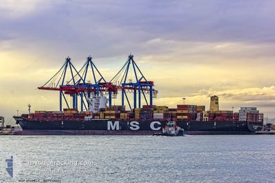
MSC MICHELA
Cargo A
Current Trip
BR ITJ
| Time Travelled | 21 h, 28 mins |
|---|---|
| Remaining Time | --- |
| Distance Travelled | 216.07 nm |
| Remaining Distance | --- |
| AVG Speed | 15.1 Knots |
| MAX Speed | 19.7 Knots |
| AVG Wind | 6.2 knots |
| MAX Wind | 18.3 knots |
| MIN Temp | 20.7°C / 69.26°F |
| MAX Temp | 27.7°C / 81.86°F |
| Draught | 11.8 m |
| Position Received | 3 d ago |
Current Position
| Longitude | --- |
|---|---|
| Latitude | --- |
| Status | Under way using engine |
| Speed | 9 Knots |
| Course | 184.3° |
| Area | South Atlantic Ocean |
| Station | T-AIS |
| Position Received | 3 d ago |
Info
Information
The current position of MSC MICHELA is in South Atlantic Ocean with coordinates -26.79517° / -48.47169° as reported on 2025-12-31 18:25 by AIS to our vessel tracker app. The vessel's current speed is 9 Knots
The vessel MSC MICHELA (IMO: 9720512, MMSI: 255805929) is a Cargo A It's sailing under the flag of [PT] Portugal.
In this page you can find informations about the vessels current position, last detected port calls, and current voyage information. If the vessels is not in coverage by AIS you will find the latest position.
The current position of MSC MICHELA is detected by our AIS receivers and we are not responsible for the reliability of the data. The last position was recorded while the vessel was in Coverage by the Ais receivers of our vessel tracking app.
The current draught of MSC MICHELA as reported by AIS is 11.8 meters
Weather
| Temperature | 26.4°C / 79.52°F |
|---|---|
| Wind Speed | 16 knots |
| Direction | 158° SSE |
| Pressure | 1007.8 hPa |
| Humidity | 82.9 % |
| Cloud Coverage | 100 % |
Featured Company
Last Port Calls
| Port | Arrival | Departure | Time In Port |
|---|---|---|---|
| 2025-12-31 17:58 | 2026-01-03 01:17 | 2 d | |
| 2025-12-30 04:53 | 2025-12-31 09:25 | 1 d | |
| 2025-12-19 23:05 | 2025-12-21 13:17 | 1 d | |
| 2025-12-16 13:30 | 2025-12-17 08:51 | 19 h | |
| 2025-12-15 06:59 | 2025-12-15 22:39 | 15 h | |
| 2025-12-06 21:55 | 2025-12-07 10:21 | 12 h | |
| 2025-12-03 00:02 | 2025-12-03 23:34 | 23 h | |
| 2025-11-30 09:26 | 2025-11-30 09:32 | 5 m | |
| 2025-11-01 20:42 | 2025-11-03 04:23 | 1 d |
Last Trips
| Origin | Departure | Destination | Arrival | Distance | |
|---|---|---|---|---|---|
| 2025-12-31 09:25 | 2025-12-31 17:58 | 105.57 nm | |||
| 2025-12-21 13:17 | 2025-12-30 04:53 | 1083.75 nm | |||
| 2025-12-17 08:51 | 2025-12-19 23:05 | 826.45 nm | |||
| 2025-12-15 22:39 | 2025-12-16 13:30 | 77.03 nm | |||
| 2025-12-07 10:21 | 2025-12-15 06:59 | 261.81 nm | |||
| 2025-12-03 23:34 | 2025-12-06 21:55 | 196.01 nm | |||
| 2025-11-30 09:32 | 2025-12-03 00:02 | 278.06 nm | |||
| 2025-11-03 04:23 | 2025-11-30 09:26 | 9496.25 nm | |||
| 2025-10-13 17:20 | 2025-11-01 20:42 | 4123.65 nm |
Events
| Time | Event | Details | Position / Dest | Info |
|---|---|---|---|---|
| 2026-01-03 17:29 | STOP Moving | 14.26 nm, South of SANTOS |
-24.20556 / -46.31361
BR ITJ
|
Speed: 0.2 kn Course: 194° |
| 2026-01-03 04:30 | START Moving | 1.25 nm, South East of ITAJAI |
-26.91308 / -48.64165
BR ITJ
|
Speed: 6.1 kn Course: 101° |
| 2026-01-03 04:17 | PORT DEPARTURE |
|
-26.91308 / -48.64165
BR ITJ
|
Speed: 0.3 kn Course: 204° |
| 2025-12-31 21:01 | STOP Moving |
-26.90078 / -48.66294
[BR] ITAJAI
|
Speed: 0.2 kn Course: 276° |
|
| 2025-12-31 20:58 | PORT ARRIVAL |
|
-26.90079 / -48.66263
[BR] ITAJAI
|
Speed: 2.5 kn Course: 290° |
| 2025-12-31 19:58 | START Moving | 5.18 nm, East of ITAJAI |
-26.90515 / -48.56417
BR ITJ
|
Speed: 4.3 kn Course: 254° |
| 2025-12-31 19:41 | STOP Moving | 5.35 nm, East of ITAJAI |
-26.90403 / -48.56093
BR ITJ
|
Speed: 0.2 kn Course: 269° |
| 2025-12-31 18:34 | Status Changed | Default Under way using engine |
-26.81769 / -48.47376
BR ITJ
|
Speed: 9 kn Course: 184.3° |
| 2025-12-31 18:25 | OUT of Coverage |
-26.79517 / -48.47169
South Atlantic Ocean
BR ITJ
|
Speed: 9 kn Course: 184.3° |
|
| 2025-12-31 17:16 | Status Changed | Under way using engine Default |
-26.62650 / -48.42794
BR ITJ
|
Speed: 17.1 kn Course: 198° |