

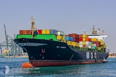
MSC HANNAH
Container Ship

Current Trip
| Time Travelled | 2 days |
|---|---|
| Remaining Time | 8 h, 28 mins |
| Distance Travelled | 591.64 nm |
| Remaining Distance | 95.44 nm |
| AVG Speed | 9.7 Knots |
| MAX Speed | 12.2 Knots |
| AVG Wind | 3.7 knots |
| MAX Wind | 21.5 knots |
| MIN Temp | 3°C / 37.4°F |
| MAX Temp | 14.7°C / 58.46°F |
| Draught | 10.3 m |
| Position Received | 11 h, 48 m ago |
Current Position
| Longitude | --- |
|---|---|
| Latitude | --- |
| Status | Under way using engine |
| Speed | 8 Knots |
| Course | 224.2° |
| Area | Ionian Sea |
| Station | T-AIS |
| Position Received | 11 h, 48 m ago |
Information
The current position of MSC HANNAH is in Ionian Sea with coordinates 39.38856° / 18.06535° as reported on 2025-03-21 22:34 by AIS to our vessel tracker app. The vessel's current speed is 8 Knots and is heading at the port of MESSINA. The estimated time of arrival as calculated by MyShipTracking vessel tracking app is 2025-03-22 19:50 LT
The vessel MSC HANNAH (IMO: 9316347, MMSI: 351400000) is a Container Ship that was built in 2006 ( 19 years old ). It's sailing under the flag of [PA] Panama.
In this page you can find informations about the vessels current position, last detected port calls, and current voyage information. If the vessels is not in coverage by AIS you will find the latest position.
The current position of MSC HANNAH is detected by our AIS receivers and we are not responsible for the reliability of the data. The last position was recorded while the vessel was in Coverage by the Ais receivers of our vessel tracking app.
The current draught of MSC HANNAH as reported by AIS is 10.3 meters
Weather
| Temperature | 14.6°C / 58.28°F |
|---|---|
| Wind Speed | 18 knots |
| Direction | 204° SSW |
| Pressure | 1021.3 hPa |
| Humidity | 79.4 % |
| Cloud Coverage | 100 % |


Featured Company
Last Port Calls
| Port | Arrival | Departure | Time In Port |
|---|---|---|---|
| 2025-03-19 08:28 | 2025-03-19 23:09 | 14 h | |
| 2025-03-16 09:41 | 2025-03-17 06:42 | 21 h | |
| 2025-03-14 06:34 | 2025-03-15 06:21 | 23 h | |
| 2025-03-11 21:39 | 2025-03-13 11:36 | 1 d | |
| 2025-03-10 14:49 | 2025-03-11 11:24 | 20 h | |
| 2025-03-02 23:13 | 2025-03-05 07:48 | 2 d | |
| 2025-02-24 17:38 | 2025-02-25 10:11 | 16 h | |
| 2025-02-23 11:26 | 2025-02-24 01:41 | 14 h | |
| 2025-02-23 10:22 | 2025-02-23 11:20 | 57 m | |
| 2025-02-20 12:27 | 2025-02-21 16:48 | 1 d |
Last Trips
| Origin | Departure | Destination | Arrival | Distance | |
|---|---|---|---|---|---|
| 2025-03-17 06:42 | 2025-03-19 08:28 | 156.58 nm | |||
| 2025-03-15 06:21 | 2025-03-16 09:41 | 162.41 nm | |||
| 2025-03-13 11:36 | 2025-03-14 06:34 | 78.87 nm | |||
| 2025-03-11 11:24 | 2025-03-11 21:39 | 91.56 nm | |||
| 2025-03-05 07:48 | 2025-03-10 14:49 | 1183.74 nm | |||
| 2025-02-25 10:11 | 2025-03-02 23:13 | 318.08 nm | |||
| 2025-02-24 01:41 | 2025-02-24 17:38 | 134.64 nm | |||
| 2025-02-23 11:20 | 2025-02-23 11:26 | 1.06 nm | |||
| 2025-02-21 16:48 | 2025-02-23 10:22 | 395.58 nm | |||
| 2025-02-15 22:45 | 2025-02-20 12:27 | 878.79 nm |
Events
| Time | Event | Details | Position / Dest | Info |
|---|---|---|---|---|
| 2025-03-21 22:39 | Status Changed | Default Under way using engine |
39.38109 / 18.05612
ITMSN
|
Speed: 8 kn Course: 224.2° |
| 2025-03-21 22:34 | Status Changed | Under way using engine Default |
39.38856 / 18.06535
ITMSN
|
Speed: 7.9 kn Course: 222° |
| 2025-03-21 22:34 | OUT of Coverage |
39.38856 / 18.06535
Ionian Sea
ITMSN
|
Speed: 8 kn Course: 224.2° |
|
| 2025-03-21 22:20 | IN Coverage |
39.38856 / 18.06535
Ionian Sea
ITMSN
|
Speed: 8 kn Course: 224.2° |
|
| 2025-03-21 21:05 | Status Changed | Default Under way using engine |
39.53500 / 18.24000
ITMSN
|
Speed: 8.1 kn Course: 224.3° |
| 2025-03-21 20:58 | OUT of Coverage |
39.54872 / 18.25638
Ionian Sea
ITMSN
|
Speed: 8.1 kn Course: 224.3° |
|
| 2025-03-21 20:54 | Status Changed | Under way using engine Default |
39.55394 / 18.26300
ITMSN
|
Speed: 8.1 kn Course: 222° |
| 2025-03-21 20:41 | Status Changed | Default Under way using engine |
39.57583 / 18.28890
ITMSN
|
Speed: 8 kn Course: 221.6° |
| 2025-03-21 19:59 | Status Changed | Under way using engine Default |
39.64932 / 18.36604
ITMSN
|
Speed: 7.7 kn Course: 214° |
| 2025-03-21 19:55 | Status Changed | Default Under way using engine |
39.65720 / 18.37292
ITMSN
|
Speed: 7.6 kn Course: 214.3° |