

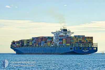
MSC EVEREST VIII
Container Ship

Current Trip
| Time Travelled | 2 days |
|---|---|
| Remaining Time | 5 days |
| Distance Travelled | 905.43 nm |
| Remaining Distance | 2232.74 nm |
| AVG Speed | 17.1 Knots |
| MAX Speed | 18.9 Knots |
| AVG Wind | 12.6 knots |
| MAX Wind | 24.3 knots |
| MIN Temp | 11.1°C / 51.98°F |
| MAX Temp | 16°C / 60.8°F |
| Draught | 13.8 m |
| Position Received | 1 h, 28 m ago |
Current Position
| Longitude | --- |
|---|---|
| Latitude | --- |
| Status | Under way using engine |
| Speed | 17.9 Knots |
| Course | 268.4° |
| Area | North Atlantic Ocean |
| Station | T-AIS |
| Position Received | 1 h, 28 m ago |
Information
The current position of MSC EVEREST VIII is in North Atlantic Ocean with coordinates 36.34090° / -26.71613° as reported on 2025-03-27 23:07 by AIS to our vessel tracker app. The vessel's current speed is 17.9 Knots and is heading at the port of NEW YORK. The estimated time of arrival as calculated by MyShipTracking vessel tracking app is 2025-04-02 01:31 LT
The vessel MSC EVEREST VIII (IMO: 9286231, MMSI: 636021393) is a Container Ship that was built in 2004 ( 21 years old ). It's sailing under the flag of [LR] Liberia.
In this page you can find informations about the vessels current position, last detected port calls, and current voyage information. If the vessels is not in coverage by AIS you will find the latest position.
The current position of MSC EVEREST VIII is detected by our AIS receivers and we are not responsible for the reliability of the data. The last position was recorded while the vessel was in Coverage by the Ais receivers of our vessel tracking app.
The current draught of MSC EVEREST VIII as reported by AIS is 13.8 meters
Weather
| Temperature | 15.6°C / 60.08°F |
|---|---|
| Wind Speed | 19 knots |
| Direction | 12° NNE |
| Pressure | 1029.9 hPa |
| Humidity | 74.3 % |
| Cloud Coverage | 100 % |


Featured Company
Last Port Calls
| Port | Arrival | Departure | Time In Port |
|---|---|---|---|
| 2025-03-24 07:41 | 2025-03-25 21:15 | 1 d | |
| 2025-03-19 04:31 | 2025-03-19 19:24 | 14 h | |
| 2025-03-16 00:21 | 2025-03-17 04:34 | 1 d | |
| 2025-03-15 00:26 | 2025-03-15 09:44 | 9 h | |
| 2025-03-12 04:47 | 2025-03-13 01:50 | 21 h | |
| 2025-03-05 21:13 | 2025-03-07 14:00 | 1 d | |
| 2025-03-04 12:52 | 2025-03-05 06:43 | 17 h | |
| 2025-03-01 21:09 | 2025-03-02 14:35 | 17 h | |
| 2025-02-28 20:38 | 2025-03-01 06:11 | 9 h | |
| 2025-02-26 05:08 | 2025-02-26 12:12 | 7 h |
Most Visited Ports (Last year)
| Port | Arrivals | |
|---|---|---|
| 8 | ||
| 6 | ||
| 6 | ||
| 6 | ||
| 6 | ||
| 6 |
Last Trips
| Origin | Departure | Destination | Arrival | Distance | |
|---|---|---|---|---|---|
| 2025-03-19 19:24 | 2025-03-24 07:41 | 591.90 nm | |||
| 2025-03-17 04:34 | 2025-03-19 04:31 | 459.61 nm | |||
| 2025-03-15 09:44 | 2025-03-16 00:21 | 174.93 nm | |||
| 2025-03-13 01:50 | 2025-03-15 00:26 | 298.69 nm | |||
| 2025-03-07 14:00 | 2025-03-12 04:47 | 1707.01 nm | |||
| 2025-03-05 06:43 | 2025-03-05 21:13 | 201.22 nm | |||
| 2025-03-02 14:35 | 2025-03-04 12:52 | 606.01 nm | |||
| 2025-03-01 06:11 | 2025-03-01 21:09 | 199.33 nm | |||
| 2025-02-26 12:12 | 2025-02-28 20:38 | 322.42 nm | |||
| 2025-02-25 19:38 | 2025-02-26 05:08 | 98.86 nm |
Events
| Time | Event | Details | Position / Dest | Info |
|---|---|---|---|---|
| 2025-03-27 23:14 | Status Changed | Default Under way using engine |
36.34061 / -26.75437
USNYC
|
Speed: 17.9 kn Course: 268.4° |
| 2025-03-27 23:07 | OUT of Coverage |
36.34090 / -26.71613
North Atlantic Ocean
USNYC
|
Speed: 17.9 kn Course: 268.4° |
|
| 2025-03-27 22:53 | Status Changed | Under way using engine Default |
36.34038 / -26.62387
USNYC
|
Speed: 17.9 kn Course: 271° |
| 2025-03-27 22:44 | Status Changed | Default Under way using engine |
36.33998 / -26.57194
USNYC
|
Speed: 17.7 kn Course: 270.2° |
| 2025-03-27 22:38 | Status Changed | Under way using engine Default |
36.33988 / -26.53526
USNYC
|
Speed: 17.3 kn Course: 270° |
| 2025-03-27 22:21 | Status Changed | Default Under way using engine |
36.33866 / -26.43198
USNYC
|
Speed: 17.3 kn Course: 271.2° |
| 2025-03-27 22:14 | Status Changed | Under way using engine Default |
36.33802 / -26.39187
USNYC
|
Speed: 17.3 kn Course: 270° |
| 2025-03-27 22:01 | Status Changed | Default Under way using engine |
36.33915 / -26.31513
USNYC
|
Speed: 17.4 kn Course: 268.9° |
| 2025-03-27 15:34 | Status Changed | Under way using engine Default |
36.36307 / -23.91249
USNYC
|
Speed: 17.8 kn Course: 269° |
| 2025-03-27 15:34 | IN Coverage |
36.36291 / -23.92766
North Atlantic Ocean
USNYC
|
Speed: 17.7 kn Course: 269.6° |