
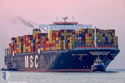
MSC DANIELA
Container Ship
Current Trip
SINGAPORE
| Time Travelled | 24 days |
|---|---|
| Remaining Time | --- |
| Distance Travelled | 7029.39 nm |
| Remaining Distance | --- |
| AVG Speed | 14 Knots |
| MAX Speed | 18.6 Knots |
| AVG Wind | 8.9 knots |
| MAX Wind | 17 knots |
| MIN Temp | 23.5°C / 74.3°F |
| MAX Temp | 29.6°C / 85.28°F |
| Draught | 15.3 m |
| Position Received | 2 d ago |
Current Position
| Longitude | --- |
|---|---|
| Latitude | --- |
| Status | Under way using engine |
| Speed | 8.1 Knots |
| Course | 25.3° |
| Area | South China Sea |
| Station | T-AIS |
| Position Received | 2 d ago |
Info
Information
The current position of MSC DANIELA is in South China Sea with coordinates 13.49977° / 111.63830° as reported on 2026-03-30 15:36 by AIS to our vessel tracker app. The vessel's current speed is 8.1 Knots
The vessel MSC DANIELA (IMO: 9399002, MMSI: 370892000) is a Container Ship that was built in 2008 ( 18 years old ). It's sailing under the flag of [PA] Panama.
In this page you can find informations about the vessels current position, last detected port calls, and current voyage information. If the vessels is not in coverage by AIS you will find the latest position.
The current position of MSC DANIELA is detected by our AIS receivers and we are not responsible for the reliability of the data. The last position was recorded while the vessel was in Coverage by the Ais receivers of our vessel tracking app.
The current draught of MSC DANIELA as reported by AIS is 15.3 meters
Weather
| Temperature | 23.5°C / 74.3°F |
|---|---|
| Wind Speed | 10 knots |
| Direction | 99° E |
| Pressure | 1013.8 hPa |
| Humidity | 92.7 % |
| Cloud Coverage | --- |
Featured Company
Last Port Calls
Last Trips
| Origin | Departure | Destination | Arrival | Distance | |
|---|---|---|---|---|---|
| 2026-03-02 22:15 | 2026-03-09 07:23 | 1554.17 nm | |||
| 2026-02-19 09:05 | 2026-03-02 11:02 | 1533.28 nm | |||
| 2026-02-13 17:53 | 2026-02-18 04:25 | 540.47 nm | |||
| 2026-02-07 12:53 | 2026-02-12 08:25 | 802.88 nm | |||
| 2025-12-29 08:23 | 2026-02-04 20:41 | 14104.13 nm |
Events
| Time | Event | Details | Position / Dest | Info |
|---|---|---|---|---|
| 2026-03-30 15:41 | Status Changed | Default Under way using engine |
13.50860 / 111.64260
SINGAPORE
|
Speed: 8.1 kn Course: 25.3° |
| 2026-03-30 15:36 | Detected in Sea | Vietnamese part of the South China Sea |
13.49977 / 111.63830
South China Sea
|
Speed: 8.1 kn Course: 25.3° |
| 2026-03-30 15:36 | Status Changed | Under way using engine Default |
13.49977 / 111.63830
SINGAPORE
|
Speed: 8.1 kn Course: 26° |
| 2026-03-30 15:36 | OUT of Coverage |
13.49977 / 111.63830
South China Sea
|
Speed: 8.1 kn Course: 25.3° |
|
| 2026-03-30 15:26 | IN Coverage |
13.49977 / 111.63830
South China Sea
|
Speed: 8.1 kn Course: 25.3° |
|
| 2026-03-28 08:05 | Status Changed | Default Under way using engine |
1.35030 / 104.41188
SINGAPORE
|
Speed: 16 kn Course: 46° |
| 2026-03-28 07:58 | Change Sea Area | Malaysian part of the South China Sea Malaysian part of the Singapore Strait |
1.32792 / 104.38842
South China Sea
|
Speed: 16 kn Course: 46° |
| 2026-03-28 07:58 | Status Changed | Under way using engine Default |
1.32792 / 104.38842
SINGAPORE
|
Speed: 15.9 kn Course: 46° |
| 2026-03-28 07:58 | OUT of Coverage |
1.32792 / 104.38842
South China Sea
|
Speed: 16 kn Course: 46° |
|
| 2026-03-28 07:53 | Status Changed | Default Under way using engine |
1.31383 / 104.37434
SINGAPORE
|
Speed: 15.6 kn Course: 47.5° |