
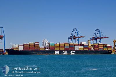
MSC CARLOTTA
Not available
Current Trip
BRRDJ
| Time Travelled | 23 days |
|---|---|
| Remaining Time | --- |
| Distance Travelled | 8402.80 nm |
| Remaining Distance | --- |
| AVG Speed | 14.9 Knots |
| MAX Speed | 21.3 Knots |
| AVG Wind | 8.4 knots |
| MAX Wind | 25 knots |
| MIN Temp | 19.6°C / 67.28°F |
| MAX Temp | 28.8°C / 83.84°F |
| Draught | 14 m |
| Position Received | 3 d ago |
Current Position
| Longitude | --- |
|---|---|
| Latitude | --- |
| Status | Under way using engine |
| Speed | 17 Knots |
| Course | 269.1° |
| Area | South Atlantic Ocean |
| Station | T-AIS |
| Position Received | 3 d ago |
Info
Information
The current position of MSC CARLOTTA is in South Atlantic Ocean with coordinates -28.29494° / 7.87297° as reported on 2025-02-05 23:53 by AIS to our vessel tracker app. The vessel's current speed is 17 Knots
The vessel MSC CARLOTTA (MMSI: 636018106) is a Not available It's sailing under the flag of [LR] Liberia.
In this page you can find informations about the vessels current position, last detected port calls, and current voyage information. If the vessels is not in coverage by AIS you will find the latest position.
The current position of MSC CARLOTTA is detected by our AIS receivers and we are not responsible for the reliability of the data. The last position was recorded while the vessel was in Coverage by the Ais receivers of our vessel tracking app.
The current draught of MSC CARLOTTA as reported by AIS is 14 meters
Weather
| Temperature | 25.9°C / 78.62°F |
|---|---|
| Wind Speed | 5 knots |
| Direction | 24° NNE |
| Pressure | 1019.2 hPa |
| Humidity | 66.7 % |
| Cloud Coverage | 73 % |
Featured Company
Last Port Calls
| Port | Arrival | Departure | Time In Port |
|---|---|---|---|
| 2025-01-16 04:33 | 2025-01-17 03:35 | 23 h | |
| 2025-01-01 16:36 | 2025-01-03 01:56 | 1 d |
Last Trips
| Origin | Departure | Destination | Arrival | Distance | |
|---|---|---|---|---|---|
| 2025-01-03 10:56 | 2025-01-16 12:33 | 3425.34 nm |
Events
| Time | Event | Details | Position / Dest | Info |
|---|---|---|---|---|
| 2025-02-06 00:03 | Status Changed | Default Under way using engine |
-28.29499 / 7.82150
BRRDJ
|
Speed: 17 kn Course: 269.1° |
| 2025-02-05 23:53 | OUT of Coverage |
-28.29494 / 7.87297
South Atlantic Ocean
|
Speed: 17 kn Course: 269.1° |
|
| 2025-02-05 22:56 | Detected in Sea | High seas of the South Atlantic Ocean |
-28.30739 / 8.17900
South Atlantic Ocean
|
Speed: 17.1 kn Course: 272.4° |
| 2025-02-05 22:55 | Status Changed | Under way using engine Default |
-28.30774 / 8.18654
BRRDJ
|
Speed: 17.2 kn Course: 273° |
| 2025-02-05 22:55 | IN Coverage |
-28.30739 / 8.17900
South Atlantic Ocean
|
Speed: 17.1 kn Course: 272.4° |
|
| 2025-02-04 10:06 | Status Changed | Default Under way using engine |
-34.51149 / 18.22173
BRRDJ
|
Speed: 18.8 kn Course: 296.4° |
| 2025-02-04 09:57 | OUT of Coverage |
-34.53224 / 18.27287
South Atlantic Ocean
|
Speed: 18.8 kn Course: 296.4° |
|
| 2025-02-04 09:50 | Status Changed | Under way using engine Default |
-34.54864 / 18.31236
BRRDJ
|
Speed: 18.9 kn Course: 298° |
| 2025-02-04 09:50 | IN Coverage |
-34.54864 / 18.31236
South Atlantic Ocean
|
Speed: 18.7 kn Course: 297.4° |
|
| 2025-02-04 06:43 | OUT of Coverage |
-34.84573 / 19.39063
South Atlantic Ocean
|
Speed: 17.8 kn Course: 280.6° |