
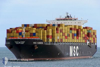
MSC CANDICE
Container Ship
Current Trip
| Time Travelled | 2 days |
|---|---|
| Remaining Time | 6 h, 25 mins |
| Distance Travelled | 992.00 nm |
| Remaining Distance | 122.00 nm |
| AVG Speed | 15.3 Knots |
| MAX Speed | 18.7 Knots |
| AVG Wind | 10.3 knots |
| MAX Wind | 21.9 knots |
| MIN Temp | 13.4°C / 56.12°F |
| MAX Temp | 28°C / 82.4°F |
| Draught | 12.2 m |
| Position Received | 2 h, 26 m ago |
Current Position
| Longitude | 15.26892° |
|---|---|
| Latitude | 38.94476° |
| Status | Under way using engine |
| Speed | 14.3 Knots |
| Course | 332° |
| Area | Tyrrhenian Sea |
| Station | T-AIS |
| Position Received | 2 h, 26 m ago |
Info
Information
The current position of MSC CANDICE is in Tyrrhenian Sea with coordinates 38.94476° / 15.26892° as reported on 2024-04-26 20:32 by AIS to our vessel tracker app. The vessel's current speed is 14.3 Knots and is heading at the port of NAPOLI. The estimated time of arrival as calculated by MyShipTracking vessel tracking app is 2024-04-27 05:24 LT
The vessel MSC CANDICE (IMO: 9339284, MMSI: 352871000) is a Container Ship that was built in 2007 ( 17 years old ). It's sailing under the flag of [PA] Panama.
In this page you can find informations about the vessels current position, last detected port calls, and current voyage information. If the vessels is not in coverage by AIS you will find the latest position.
The current position of MSC CANDICE is detected by our AIS receivers and we are not responsible for the reliability of the data. The last position was recorded while the vessel was in Coverage by the Ais receivers of our vessel tracking app.
The current draught of MSC CANDICE as reported by AIS is 12.2 meters
Weather
| Temperature | 16.3°C / 61.34°F |
|---|---|
| Wind Speed | 9 knots |
| Direction | 108° ESE |
| Pressure | 1014.6 hPa |
| Humidity | 71 % |
| Cloud Coverage | 100 % |
Featured Company
Last Port Calls
| Port | Arrival | Departure | Time In Port |
|---|---|---|---|
| 2024-04-23 17:12 | 2024-04-24 08:48 | 15 h | |
| 2024-04-21 21:36 | 2024-04-23 06:41 | 1 d | |
| 2024-04-20 14:38 | |||
| 2024-04-17 15:14 | 2024-04-18 22:48 | 1 d | |
| 2024-04-16 03:39 | 2024-04-16 12:45 | 9 h | |
| 2024-04-12 16:32 | 2024-04-13 12:25 | 19 h | |
| 2024-04-10 17:22 | 2024-04-12 09:15 | 1 d | |
| 2024-04-05 02:25 | 2024-04-05 11:25 | 9 h | |
| 2024-03-29 21:08 | 2024-04-01 13:13 | 2 d | |
| 2024-03-27 08:38 | 2024-03-27 23:20 | 14 h |
Most Visited Ports (Last year)
| Port | Arrivals | |
|---|---|---|
| 9 | ||
| 8 | ||
| 6 | ||
| 6 | ||
| 6 | ||
| 5 |
Last Trips
| Origin | Departure | Destination | Arrival | Distance | |
|---|---|---|---|---|---|
| 2024-04-23 08:41 | 2024-04-23 19:12 | 138.10 nm | |||
| 2024-04-20 17:38 | 2024-04-21 23:36 | 449.33 nm | |||
| 2024-04-13 15:25 | 2024-04-17 18:14 | 1128.77 nm | |||
| 2024-04-13 15:25 | 2024-04-16 05:39 | 605.23 nm | |||
| 2024-04-12 12:15 | 2024-04-12 19:32 | 83.19 nm | |||
| 2024-04-01 15:13 | 2024-04-10 20:22 | 2021.95 nm | |||
| 2024-04-01 15:13 | 2024-04-05 04:25 | 1037.83 nm | |||
| 2024-03-28 00:20 | 2024-03-29 22:08 | 228.07 nm | |||
| 2024-03-25 00:30 | 2024-03-27 09:38 | 765.95 nm | |||
| 2024-03-22 20:55 | 2024-03-23 08:39 | 164.33 nm |
Events
| Time | Event | Details | Position / Dest | Info |
|---|---|---|---|---|
| 2024-04-26 20:44 | Status Changed | Default Under way using engine |
38.98676 / 15.24018
ITNAP
|
Speed: 14.3 kn Course: 332° |
| 2024-04-26 20:32 | OUT of Coverage |
38.94476 / 15.26892
Tyrrhenian Sea
ITNAP
|
Speed: 14.3 kn Course: 332° |
|
| 2024-04-26 17:28 | Change Sea Area | Italian part of the Tyrrhenian Sea Italian part of the Ionian Sea |
38.29857 / 15.71320
Tyrrhenian Sea
ITNAP
|
Speed: 14.3 kn Course: 0.6° |
| 2024-04-26 17:26 | Status Changed | Under way using engine Default |
38.28865 / 15.71144
ITNAP
|
Speed: 14.6 kn Course: 19° |
| 2024-04-26 17:16 | Status Changed | Default Under way using engine |
38.25927 / 15.67940
ITNAP
|
Speed: 18.6 kn Course: 67.8° |
| 2024-04-26 15:24 | ETA Changed | 2024/04/27 06:00 2024/04/27 05:00 |
37.92597 / 15.60868
ITNAP
|
Speed: 13.7 kn Course: 343.8° |
| 2024-04-26 12:37 | Destination Changed | ITNAP EGDAM |
37.54628 / 16.42640
ITNAP
|
Speed: 16.9 kn Course: 298.8° |
| 2024-04-26 12:37 | ETA Changed | 2024/04/27 05:00 2024/04/27 03:00 |
37.54628 / 16.42640
ITNAP
|
Speed: 16.9 kn Course: 298.8° |
| 2024-04-26 12:27 | Change Sea Area | Italian part of the Ionian Sea Greek part of the Mediterranean Sea - Eastern Basin |
37.52457 / 16.47549
Ionian Sea
EGDAM
|
Speed: 16.9 kn Course: 299.2° |
| 2024-04-26 12:26 | Status Changed | Under way using engine Default |
37.52112 / 16.48326
EGDAM
|
Speed: 16.9 kn Course: 300° |