
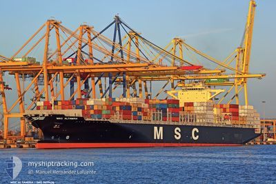
MSC ALTAMIRA
Container Ship
Current Trip
| Time Travelled | 1 day |
|---|---|
| Remaining Time | 2 days |
| Distance Travelled | 66.79 nm |
| Remaining Distance | 942.71 nm |
| AVG Speed | 9 Knots |
| MAX Speed | 15.5 Knots |
| AVG Wind | 3.2 knots |
| MAX Wind | 10 knots |
| MIN Temp | 23°C / 73.4°F |
| MAX Temp | 27.2°C / 80.96°F |
| Draught | 9.1 m |
| Position Received | 4 h, 8 m ago |
Current Position
| Longitude | -46.32214° |
|---|---|
| Latitude | -23.99241° |
| Status | Under way using engine |
| Speed | 8.3 Knots |
| Course | 259.5° |
| Area | South Atlantic Ocean |
| Station | T-AIS |
| Position Received | 4 h, 8 m ago |
Info
Information
The current position of MSC ALTAMIRA is in South Atlantic Ocean with coordinates -23.99241° / -46.32214° as reported on 2024-05-05 21:20 by AIS to our vessel tracker app. The vessel's current speed is 8.3 Knots and is heading at the port of BUENOS AIRES. The estimated time of arrival as calculated by MyShipTracking vessel tracking app is 2024-05-08 15:01 LT
The vessel MSC ALTAMIRA (IMO: 9619426, MMSI: 636015664) is a Container Ship that was built in 2012 ( 12 years old ). It's sailing under the flag of [LR] Liberia.
In this page you can find informations about the vessels current position, last detected port calls, and current voyage information. If the vessels is not in coverage by AIS you will find the latest position.
The current position of MSC ALTAMIRA is detected by our AIS receivers and we are not responsible for the reliability of the data. The last position was recorded while the vessel was in Coverage by the Ais receivers of our vessel tracking app.
The current draught of MSC ALTAMIRA as reported by AIS is 9.1 meters
Weather
| Temperature | 24.5°C / 76.1°F |
|---|---|
| Wind Speed | 9 knots |
| Direction | 60° ENE |
| Pressure | 1016.1 hPa |
| Humidity | 89.2 % |
| Cloud Coverage | --- |
Featured Company
Last Port Calls
| Port | Arrival | Departure | Time In Port |
|---|---|---|---|
| 2024-05-04 15:09 | 2024-05-04 16:01 | 52 m | |
| 2024-04-22 02:30 | 2024-04-24 13:26 | 2 d | |
| 2024-04-16 01:04 | 2024-04-19 03:12 | 3 d | |
| 2024-04-07 08:05 | 2024-04-07 23:48 | 15 h | |
| 2024-04-07 07:32 | 2024-04-07 07:46 | 14 m | |
| 2024-04-04 17:52 | 2024-04-05 21:07 | 1 d | |
| 2024-04-02 08:36 | 2024-04-03 00:55 | 16 h | |
| 2024-03-31 06:59 | 2024-04-01 02:43 | 19 h | |
| 2024-03-29 01:39 | 2024-03-29 13:52 | 12 h | |
| 2024-03-25 08:10 | 2024-03-28 00:36 | 2 d |
Most Visited Ports (Last year)
| Port | Arrivals | |
|---|---|---|
| 11 | ||
| 9 | ||
| 6 | ||
| 5 | ||
| 5 | ||
| 4 |
Last Trips
| Origin | Departure | Destination | Arrival | Distance | |
|---|---|---|---|---|---|
| 2024-04-24 08:26 | 2024-05-04 12:09 | 4509.16 nm | |||
| 2024-04-18 23:12 | 2024-04-21 21:30 | 1235.55 nm | |||
| 2024-04-07 19:48 | 2024-04-15 21:04 | 602.91 nm | |||
| 2024-04-07 03:46 | 2024-04-07 04:05 | 0.24 nm | |||
| 2024-04-05 17:07 | 2024-04-07 03:32 | 410.51 nm | |||
| 2024-04-02 20:55 | 2024-04-04 13:52 | 125.62 nm | |||
| 2024-03-31 22:43 | 2024-04-02 04:36 | 425.79 nm | |||
| 2024-03-29 09:52 | 2024-03-31 02:59 | 272.33 nm | |||
| 2024-03-27 20:36 | 2024-03-28 21:39 | 244.02 nm | |||
| 2024-03-15 20:55 | 2024-03-25 04:10 | 3075.55 nm |
Events
| Time | Event | Details | Position / Dest | Info |
|---|---|---|---|---|
| 2024-05-05 21:21 | Status Changed | Default Under way using engine |
-23.99291 / -46.32408
ARBUE
|
Speed: 8.3 kn Course: 259.5° |
| 2024-05-05 21:20 | OUT of Coverage |
-23.99241 / -46.32214
South Atlantic Ocean
ARBUE
|
Speed: 8.3 kn Course: 259.5° |
|
| 2024-05-05 20:25 | Draught Changed | 9.1 9.9 |
-23.91889 / -46.34433
ARBUE
|
Speed: 5.4 kn Course: 88.5° |
| 2024-05-05 20:25 | Destination Changed | ARBUE BRSSZ |
-23.91889 / -46.34433
ARBUE
|
Speed: 5.4 kn Course: 88.5° |
| 2024-05-05 20:25 | ETA Changed | 2024/05/08 09:00 2024/05/04 15:00 |
-23.91889 / -46.34433
ARBUE
|
Speed: 5.4 kn Course: 88.5° |
| 2024-05-05 20:22 | START Moving | 3.17 nm, North West of SANTOS |
-23.91926 / -46.34786
BRSSZ
|
Speed: 5.2 kn Course: 75.9° |
| 2024-05-05 20:17 | Status Changed | Under way using engine Default |
-23.92020 / -46.35135
BRSSZ
|
Speed: Course: 102° |
| 2024-05-05 20:04 | IN Coverage |
-23.92020 / -46.35135
South Atlantic Ocean
|
Speed: 1 kn Course: 2.9° |
|
| 2024-05-05 12:49 | Status Changed | Default Moored |
-23.92069 / -46.35138
BRSSZ
|
Speed: Course: 102° |
| 2024-05-05 12:43 | OUT of Coverage |
-23.92073 / -46.35142
South Atlantic Ocean
|
Speed: Course: 330.6° |