
MSC ALIX 3
Container Ship
Current Trip
| Time Travelled | 1 day |
|---|---|
| Remaining Time | --- |
| Distance Travelled | 179.25 nm |
| Remaining Distance | --- |
| AVG Speed | 8.9 Knots |
| MAX Speed | 12.9 Knots |
| AVG Wind | 19.8 knots |
| MAX Wind | 26.7 knots |
| MIN Temp | 7.6°C / 45.68°F |
| MAX Temp | 17.2°C / 62.96°F |
| Draught | 9.9 m |
| Position Received | 1 d ago |
Current Position
| Longitude | --- |
|---|---|
| Latitude | --- |
| Status | Under way using engine |
| Speed | 8.5 Knots |
| Course | 145.2° |
| Area | Aegean Sea |
| Station | T-AIS |
| Position Received | 1 d ago |
Info
Information
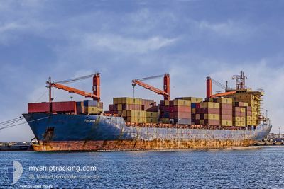
The current position of MSC ALIX 3 is in Aegean Sea with coordinates 40.02888° / 23.09668° as reported on 2026-01-03 11:00 by AIS to our vessel tracker app. The vessel's current speed is 8.5 Knots and is heading at the port of CANAKKALE. The estimated time of arrival as calculated by MyShipTracking vessel tracking app is 2026-01-03 23:00 LT
The vessel MSC ALIX 3 (IMO: 9166651, MMSI: 636016014) is a Container Ship that was built in 1998 ( 28 years old ). It's sailing under the flag of [LR] Liberia.
In this page you can find informations about the vessels current position, last detected port calls, and current voyage information. If the vessels is not in coverage by AIS you will find the latest position.
The current position of MSC ALIX 3 is detected by our AIS receivers and we are not responsible for the reliability of the data. The last position was recorded while the vessel was in Coverage by the Ais receivers of our vessel tracking app.
The current draught of MSC ALIX 3 as reported by AIS is 9.9 meters
Weather
| Temperature | 16°C / 60.8°F |
|---|---|
| Wind Speed | 24 knots |
| Direction | 193° SSW |
| Pressure | 1016.1 hPa |
| Humidity | 79.7 % |
| Cloud Coverage | 57 % |
Featured Company
Last Port Calls
| Port | Arrival | Departure | Time In Port |
|---|---|---|---|
| 2025-12-31 17:09 | 2026-01-03 08:25 | 2 d | |
| 2025-12-26 23:12 | 2025-12-27 15:21 | 16 h | |
| 2025-12-21 23:24 | 2025-12-24 10:17 | 2 d | |
| 2025-12-19 22:14 | 2025-12-21 10:18 | 1 d | |
| 2025-12-17 07:29 | 2025-12-17 19:19 | 11 h | |
| 2025-12-16 01:18 | 2025-12-16 10:14 | 8 h | |
| 2025-12-14 04:12 | 2025-12-14 15:28 | 11 h | |
| 2025-12-12 07:50 | 2025-12-13 01:45 | 17 h | |
| 2025-12-11 15:51 | 2025-12-12 01:37 | 9 h | |
| 2025-12-11 02:13 | 2025-12-11 08:37 | 6 h |
Most Visited Ports (Last year)
| Port | Arrivals | |
|---|---|---|
| 188 | ||
| 18 | ||
| 14 | ||
| 7 | ||
| 6 | ||
| 5 |
Last Trips
| Origin | Departure | Destination | Arrival | Distance | |
|---|---|---|---|---|---|
| 2025-12-27 15:21 | 2025-12-31 17:09 | 324.02 nm | |||
| 2025-12-24 10:17 | 2025-12-26 23:12 | 565.56 nm | |||
| 2025-12-21 10:18 | 2025-12-21 23:24 | 169.39 nm | |||
| 2025-12-17 19:19 | 2025-12-19 22:14 | 687.72 nm | |||
| 2025-12-16 10:14 | 2025-12-17 07:29 | 195.72 nm | |||
| 2025-12-14 15:28 | 2025-12-16 01:18 | 215.37 nm | |||
| 2025-12-13 01:45 | 2025-12-14 04:12 | 110.66 nm | |||
| 2025-12-12 01:37 | 2025-12-12 07:50 | 58.94 nm | |||
| 2025-12-11 08:37 | 2025-12-11 15:51 | 46.75 nm | |||
| 2025-12-09 11:01 | 2025-12-11 02:13 | 345.87 nm |
Events
| Time | Event | Details | Position / Dest | Info |
|---|---|---|---|---|
| 2026-01-03 11:05 | Status Changed | Default Under way using engine |
40.01897 / 23.10535
TRCKZ
|
Speed: 8.5 kn Course: 145.2° |
| 2026-01-03 11:00 | OUT of Coverage |
40.02888 / 23.09668
Aegean Sea
TRCKZ
|
Speed: 8.5 kn Course: 145.2° |
|
| 2026-01-03 10:56 | Status Changed | Under way using engine Default |
40.03575 / 23.09050
TRCKZ
|
Speed: 8.1 kn Course: 146° |
| 2026-01-03 10:48 | Status Changed | Default Under way using engine |
40.05026 / 23.07805
TRCKZ
|
Speed: 8.3 kn Course: 144° |
| 2026-01-03 10:29 | Status Changed | Under way using engine Default |
40.08613 / 23.04603
TRCKZ
|
Speed: 8.7 kn Course: 149° |
| 2026-01-03 10:22 | Status Changed | Default Under way using engine |
40.10191 / 23.03208
TRCKZ
|
Speed: 8.7 kn Course: 149.4° |
| 2026-01-03 10:07 | Status Changed | Under way using engine Default |
40.13062 / 23.00823
TRCKZ
|
Speed: 8.6 kn Course: 144° |
| 2026-01-03 10:02 | Status Changed | Default Under way using engine |
40.14011 / 22.99942
TRCKZ
|
Speed: 8.4 kn Course: 142.7° |
| 2026-01-03 09:46 | Status Changed | Under way using engine Default |
40.17240 / 22.96950
TRCKZ
|
Speed: 8.7 kn Course: 146° |
| 2026-01-03 09:45 | Status Changed | Default Under way using engine |
40.17505 / 22.96712
TRCKZ
|
Speed: 8.7 kn Course: 147° |