

MOSCOW MAERSK
Cargo A

Current Trip
| Time Travelled | 13 days |
|---|---|
| Remaining Time | --- |
| Distance Travelled | 5906.92 nm |
| Remaining Distance | --- |
| AVG Speed | 17.5 Knots |
| MAX Speed | 20.5 Knots |
| AVG Wind | 15 knots |
| MAX Wind | 27 knots |
| MIN Temp | 3.6°C / 38.48°F |
| MAX Temp | 28.1°C / 82.58°F |
| Draught | 16.4 m |
| Position Received | 9 d ago |
Current Position
| Longitude | --- |
|---|---|
| Latitude | --- |
| Status | Under way using engine |
| Speed | 17.2 Knots |
| Course | 195.1° |
| Area | North Atlantic Ocean |
| Station | T-AIS |
| Position Received | 9 d ago |
Information
The current position of MOSCOW MAERSK is in North Atlantic Ocean with coordinates 27.57268° / -16.48562° as reported on 2025-03-19 13:44 by AIS to our vessel tracker app. The vessel's current speed is 17.2 Knots and is heading at the port of TANJUNG PELEPAS. The estimated time of arrival as calculated by MyShipTracking vessel tracking app is 2025-04-11 20:00 LT
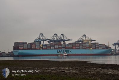
The vessel MOSCOW MAERSK (IMO: 9778818, MMSI: 219864000) is a Cargo A It's sailing under the flag of [DK] Denmark.
In this page you can find informations about the vessels current position, last detected port calls, and current voyage information. If the vessels is not in coverage by AIS you will find the latest position.
The current position of MOSCOW MAERSK is detected by our AIS receivers and we are not responsible for the reliability of the data. The last position was recorded while the vessel was in Coverage by the Ais receivers of our vessel tracking app.
The current draught of MOSCOW MAERSK as reported by AIS is 16.4 meters
Weather
| Temperature | 20.5°C / 68.9°F |
|---|---|
| Wind Speed | 13 knots |
| Direction | 190° S |
| Pressure | 1016.1 hPa |
| Humidity | 76.4 % |
| Cloud Coverage | 1 % |


Featured Company
Last Port Calls
| Port | Arrival | Departure | Time In Port |
|---|---|---|---|
| 2025-03-13 04:33 | 2025-03-14 23:45 | 1 d | |
| 2025-03-07 18:36 | 2025-03-10 00:58 | 2 d | |
| 2025-02-26 20:49 | 2025-02-28 13:02 | 1 d | |
| 2025-02-18 23:30 | 2025-02-20 06:37 | 1 d | |
| 2025-01-22 16:32 | 2025-01-24 01:30 | 1 d | |
| 2025-01-17 17:17 | 2025-01-18 22:45 | 1 d | |
| 2025-01-09 18:16 | 2025-01-10 19:53 | 1 d | |
| 2025-01-07 14:49 | 2025-01-08 15:44 | 1 d | |
| 2025-01-02 16:01 | 2025-01-03 14:21 | 22 h |
Most Visited Ports (Last year)
| Port | Arrivals | |
|---|---|---|
| 5 | ||
| 5 | ||
| 3 | ||
| 3 | ||
| 3 | ||
| 3 |
Last Trips
| Origin | Departure | Destination | Arrival | Distance | |
|---|---|---|---|---|---|
| 2025-03-10 01:58 | 2025-03-13 05:33 | 1070.65 nm | |||
| 2025-02-28 14:02 | 2025-03-07 19:36 | 1025.26 nm | |||
| 2025-02-20 07:37 | 2025-02-26 21:49 | 1658.48 nm | |||
| 2025-01-24 09:30 | 2025-02-19 00:30 | 10851.84 nm | |||
| 2025-01-19 06:45 | 2025-01-23 00:32 | 1531.24 nm | |||
| 2025-01-11 04:53 | 2025-01-18 01:17 | 1311.71 nm | |||
| 2025-01-08 23:44 | 2025-01-10 03:16 | 469.28 nm | |||
| 2025-01-03 22:21 | 2025-01-07 22:49 | 580.07 nm | |||
| 2024-11-09 19:18 | 2025-01-03 00:01 | 7434.20 nm |
Events
| Time | Event | Details | Position / Dest | Info |
|---|---|---|---|---|
| 2025-03-19 13:51 | Status Changed | Default Under way using engine |
27.54257 / -16.49533
NLRTM > MYTPP
|
Speed: 17.2 kn Course: 195.1° |
| 2025-03-19 13:44 | OUT of Coverage |
27.57268 / -16.48562
North Atlantic Ocean
NLRTM > MYTPP
|
Speed: 17.2 kn Course: 195.1° |
|
| 2025-03-19 13:40 | Status Changed | Under way using engine Default |
27.59145 / -16.47962
NLRTM > MYTPP
|
Speed: 17.2 kn Course: 196° |
| 2025-03-19 13:31 | Status Changed | Default Under way using engine |
27.63940 / -16.46427
NLRTM > MYTPP
|
Speed: 17.4 kn Course: 195.5° |
| 2025-03-19 13:21 | Status Changed | Under way using engine Default |
27.67735 / -16.45212
NLRTM > MYTPP
|
Speed: 17.3 kn Course: 196° |
| 2025-03-19 13:13 | Status Changed | Default Under way using engine |
27.71670 / -16.43930
NLRTM > MYTPP
|
Speed: 17.3 kn Course: 195.2° |
| 2025-03-19 07:44 | Status Changed | Under way using engine Default |
29.08812 / -15.59077
NLRTM > MYTPP
|
Speed: 18 kn Course: 195° |
| 2025-03-19 07:44 | Status Changed | Default Under way using engine |
29.09197 / -15.58952
NLRTM > MYTPP
|
Speed: 17.9 kn Course: 195.4° |
| 2025-03-19 07:36 | Status Changed | Under way using engine Default |
29.12853 / -15.57837
NLRTM > MYTPP
|
Speed: 17.9 kn Course: 195° |
| 2025-03-19 07:32 | Status Changed | Default Under way using engine |
29.14928 / -15.57190
NLRTM > MYTPP
|
Speed: 17.9 kn Course: 194.8° |