

MONTPELLIER
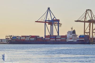
Container Ship

Current Trip
| Trip Time | 3 days |
|---|---|
| Trip Distance | 1269.37 nm |
| AVG Speed | 13.1 Knots |
| MAX Speed | 17.8 Knots |
| Draught | 11.6 m |
| AVG Wind | 10.8 knots |
| MAX Wind | 33 knots |
| MIN Temp | 12.4°C / 54.32°F |
| MAX Temp | 18.5°C / 65.3°F |
| Position Received | 1 m ago |
Current Position
| Longitude | --- |
|---|---|
| Latitude | --- |
| Status | Moored |
| Speed | |
| Course | 23° |
| Area | Balearic Sea |
| Station | T-AIS |
| Position Received | 1 m ago |
Information
The current position of MONTPELLIER is in Balearic Sea with coordinates 39.43105° / -0.31430° as reported on 2025-03-27 23:14 by AIS to our vessel tracker app. The vessel's current speed is 0 Knots and is currently inside the port of VALENCIA.
The vessel MONTPELLIER (IMO: 9314973, MMSI: 636090971) is a Container Ship that was built in 2006 ( 19 years old ). It's sailing under the flag of [LR] Liberia.
In this page you can find informations about the vessels current position, last detected port calls, and current voyage information. If the vessels is not in coverage by AIS you will find the latest position.
The current position of MONTPELLIER is detected by our AIS receivers and we are not responsible for the reliability of the data. The last position was recorded while the vessel was in Coverage by the Ais receivers of our vessel tracking app.
The current draught of MONTPELLIER as reported by AIS is 11.6 meters
Weather
| Temperature | 13.1°C / 55.58°F |
|---|---|
| Wind Speed | 4 knots |
| Direction | 335° NNW |
| Pressure | 1016.1 hPa |
| Humidity | 75.8 % |
| Cloud Coverage | 72 % |


Featured Company
Last Port Calls
| Port | Arrival | Departure | Time In Port |
|---|---|---|---|
| 2025-03-26 20:41 | |||
| 2025-03-20 07:50 | 2025-03-23 07:15 | 2 d | |
| 2025-03-12 18:05 | 2025-03-14 09:12 | 1 d | |
| 2025-03-10 10:37 | 2025-03-11 19:30 | 1 d | |
| 2025-03-08 21:28 | 2025-03-09 16:09 | 18 h | |
| 2025-03-05 15:43 | 2025-03-08 06:52 | 2 d | |
| 2025-02-17 03:04 | 2025-02-17 20:33 | 17 h | |
| 2025-02-14 08:04 | 2025-02-14 20:34 | 12 h | |
| 2025-02-07 20:21 | 2025-02-09 13:00 | 1 d | |
| 2025-02-03 12:06 | 2025-02-05 08:42 | 1 d |
Last Trips
| Origin | Departure | Destination | Arrival | Distance | |
|---|---|---|---|---|---|
| 2025-03-23 07:15 | 2025-03-26 20:41 | 1269.37 nm | |||
| 2025-03-14 09:12 | 2025-03-20 07:50 | 401.30 nm | |||
| 2025-03-11 19:30 | 2025-03-12 18:05 | 242.91 nm | |||
| 2025-03-09 16:09 | 2025-03-10 10:37 | 249.52 nm | |||
| 2025-03-08 06:52 | 2025-03-08 21:28 | 213.97 nm | |||
| 2025-02-17 20:33 | 2025-03-05 15:43 | 1653.24 nm | |||
| 2025-02-14 20:34 | 2025-02-17 03:04 | 530.23 nm | |||
| 2025-02-09 13:00 | 2025-02-14 08:04 | 379.55 nm | |||
| 2025-02-05 08:42 | 2025-02-07 20:21 | 598.84 nm | |||
| 2025-01-28 07:23 | 2025-02-03 12:06 | 1270.10 nm |
Events
| Time | Event | Details | Position / Dest | Info |
|---|---|---|---|---|
| 2025-03-26 20:23 | Status Changed | Moored Under way using engine |
39.43110 / -.31419
[ES] VALENCIA
|
Speed: Course: 23° |
| 2025-03-26 20:07 | STOP Moving |
39.43165 / -.31466
[ES] VALENCIA
|
Speed: 0.3 kn Course: 357° |
|
| 2025-03-26 19:41 | PORT ARRIVAL |
|
39.43208 / -.30372
[ES] VALENCIA
|
Speed: 5.8 kn Course: 314° |
| 2025-03-26 15:38 | Status Changed | Under way using engine Default |
39.33815 / .70990
ESVLC
|
Speed: 13.3 kn Course: 281° |
| 2025-03-26 15:38 | IN Coverage |
39.33874 / .70137
Balearic Sea
ESVLC
|
Speed: 13.2 kn Course: 275.9° |
|
| 2025-03-26 11:26 | Status Changed | Default Under way using engine |
39.08563 / 2.13475
ESVLC
|
Speed: 17.2 kn Course: 289.2° |
| 2025-03-26 11:25 | OUT of Coverage |
39.08343 / 2.14289
Balearic Sea
ESVLC
|
Speed: 17.2 kn Course: 289.2° |
|
| 2025-03-26 11:04 | Change Sea Area | Spanish part of the Balearic Sea Italian part of the Mediterranean Sea - Eastern Basin |
39.04911 / 2.26734
Balearic Sea
ESVLC
|
Speed: 17.3 kn Course: 288° |
| 2025-03-26 11:04 | Status Changed | Under way using engine Default |
39.04911 / 2.26734
ESVLC
|
Speed: 17.2 kn Course: 288° |
| 2025-03-26 10:52 | IN Coverage |
39.04911 / 2.26734
Balearic Sea
ESVLC
|
Speed: 17.3 kn Course: 288° |