

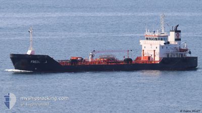
MONJASA PROMOTER
Tanker

Current Trip
| Time Travelled | 2 days |
|---|---|
| Remaining Time | 7 h, 43 mins |
| Distance Travelled | 349.16 nm |
| Remaining Distance | 60.60 nm |
| AVG Speed | 7.6 Knots |
| MAX Speed | 12.9 Knots |
| AVG Wind | 17.8 knots |
| MAX Wind | 23.3 knots |
| MIN Temp | 2.9°C / 37.22°F |
| MAX Temp | 9.4°C / 48.92°F |
| Draught | 4.5 m |
| Position Received | 1 m ago |
Current Position
| Longitude | --- |
|---|---|
| Latitude | --- |
| Status | Under way using engine |
| Speed | 7.8 Knots |
| Course | 272.9° |
| Area | English Channel |
| Station | T-AIS |
| Position Received | 1 m ago |
Information
The current position of MONJASA PROMOTER is in English Channel with coordinates 50.53492° / -0.91329° as reported on 2025-02-28 09:30 by AIS to our vessel tracker app. The vessel's current speed is 7.8 Knots and is heading at the port of PORTLAND UK. The estimated time of arrival as calculated by MyShipTracking vessel tracking app is 2025-02-28 17:15 LT
The vessel MONJASA PROMOTER (IMO: 9341421, MMSI: 636018716) is a Tanker It's sailing under the flag of [LR] Liberia.
In this page you can find informations about the vessels current position, last detected port calls, and current voyage information. If the vessels is not in coverage by AIS you will find the latest position.
The current position of MONJASA PROMOTER is detected by our AIS receivers and we are not responsible for the reliability of the data. The last position was recorded while the vessel was in Coverage by the Ais receivers of our vessel tracking app.
The current draught of MONJASA PROMOTER as reported by AIS is 4.5 meters
Weather
| Temperature | 5.8°C / 42.44°F |
|---|---|
| Wind Speed | 9 knots |
| Direction | 38° NE |
| Pressure | 1029.2 hPa |
| Humidity | 74.6 % |
| Cloud Coverage | --- |


Featured Company
Last Port Calls
| Port | Arrival | Departure | Time In Port |
|---|---|---|---|
| 2025-02-25 08:01 | 2025-02-25 14:25 | 6 h | |
| 2025-02-24 11:31 | 2025-02-24 16:31 | 5 h | |
| 2025-02-19 16:51 | 2025-02-20 00:32 | 7 h | |
| 2025-02-17 13:42 | 2025-02-19 08:58 | 1 d | |
| 2025-02-15 07:54 | 2025-02-15 11:20 | 3 h | |
| 2025-02-14 12:23 | 2025-02-14 15:43 | 3 h | |
| 2025-02-11 12:52 | 2025-02-12 10:51 | 21 h | |
| 2025-02-10 11:47 | 2025-02-10 15:01 | 3 h | |
| 2025-02-06 08:00 | 2025-02-06 16:16 | 8 h | |
| 2025-02-01 08:09 | 2025-02-01 20:00 | 11 h |
Most Visited Ports (Last year)
| Port | Arrivals | |
|---|---|---|
| 97 | ||
| 16 | ||
| 8 | ||
| 3 | ||
| 3 | ||
| 2 |
Last Trips
| Origin | Departure | Destination | Arrival | Distance | |
|---|---|---|---|---|---|
| 2025-02-24 16:31 | 2025-02-25 08:01 | 5.70 nm | |||
| 2025-02-20 00:32 | 2025-02-24 11:31 | 9.07 nm | |||
| 2025-02-19 08:58 | 2025-02-19 16:51 | 4.74 nm | |||
| 2025-02-15 12:20 | 2025-02-17 13:42 | 145.16 nm | |||
| 2025-02-14 16:43 | 2025-02-15 08:54 | 121.73 nm | |||
| 2025-02-12 10:51 | 2025-02-14 13:23 | 123.68 nm | |||
| 2025-02-10 16:01 | 2025-02-11 12:52 | 120.32 nm | |||
| 2025-02-06 16:16 | 2025-02-10 12:47 | 125.73 nm | |||
| 2025-02-01 20:00 | 2025-02-06 08:00 | 255.88 nm | |||
| 2025-01-27 16:22 | 2025-02-01 08:09 | 351.82 nm |
Events
| Time | Event | Details | Position / Dest | Info |
|---|---|---|---|---|
| 2025-02-28 03:39 | Status Changed | Under way using engine Default |
50.63440 / .53107
GBPTL
|
Speed: 11.5 kn Course: 255° |
| 2025-02-28 03:38 | Status Changed | Default Under way using engine |
50.63591 / .54006
GBPTL
|
Speed: 11.5 kn Course: 255° |
| 2025-02-28 03:37 | Status Changed | Under way using engine Default |
50.63603 / .54080
GBPTL
|
Speed: 11.6 kn Course: 234° |
| 2025-02-28 02:46 | Status Changed | Default Under way using engine |
50.72852 / .75084
GBPTL
|
Speed: 10.7 kn Course: 234.7° |
| 2025-02-27 23:02 | Change Sea Area | United Kingdom part of the English Channel United Kingdom part of the North Sea |
51.08030 / 1.46084
English Channel
GBPTL
|
Speed: 9.2 kn Course: 231.7° |
| 2025-02-27 20:17 | START Moving | 11.35 nm, North of RAMSGATE |
51.50206 / 1.52933
GBPTL
|
Speed: 4.9 kn Course: 160° |
| 2025-02-27 20:14 | Status Changed | Under way using engine Moored |
51.50285 / 1.52626
GBPTL
|
Speed: 0.2 kn Course: 22° |
| 2025-02-27 19:50 | Draught Changed | 4.5 4.7 |
51.50286 / 1.52625
GBPTL
|
Speed: Course: 16° |
| 2025-02-27 19:43 | Destination Changed | GBPTL TONGUE ANCHORAGE |
51.50286 / 1.52648
GBPTL
|
Speed: 0.1 kn Course: 10° |
| 2025-02-27 19:43 | ETA Changed | 2025/02/28 18:00 2025/02/28 10:30 |
51.50286 / 1.52648
GBPTL
|
Speed: 0.1 kn Course: 10° |