
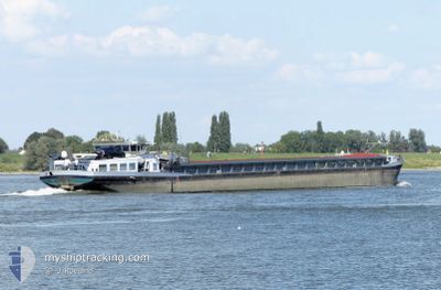
MONDIAL
Other Type
Current Trip
MONDIAL is out of coverage. Learn how you can join the community and extend the coverage to your area by clicking here!
| Time Travelled | 1 day |
|---|---|
| Remaining Time | --- |
| Distance Travelled | 42.11 nm |
| Remaining Distance | --- |
| AVG Speed | 4.7 Knots |
| MAX Speed | 6.1 Knots |
| AVG Wind | 8.4 knots |
| MAX Wind | 12 knots |
| MIN Temp | 12.5°C / 54.5°F |
| MAX Temp | 14.2°C / 57.56°F |
| Draught | 0 m |
| Position Received | 23 h, 39 m ago |
Current Position
| Longitude | 8.17268° |
|---|---|
| Latitude | 48.92717° |
| Status | Under way using engine |
| Speed | 4.2 Knots |
| Course | 209.8° |
| Area | North Sea |
| Station | T-AIS |
| Position Received | 23 h, 39 m ago |
Info
info
Information
The current position of MONDIAL is in North Sea with coordinates 48.92717° / 8.17268° as reported on 2024-05-06 12:59 by AIS to our vessel tracker app. The vessel's current speed is 4.2 Knots
The vessel MONDIAL (MMSI: 244700942) is a Other Type It's sailing under the flag of [NL] Netherlands.
In this page you can find informations about the vessels current position, last detected port calls, and current voyage information. If the vessels is not in coverage by AIS you will find the latest position.
The current position of MONDIAL is detected by our AIS receivers and we are not responsible for the reliability of the data. The last position was recorded while the vessel was in Coverage by the Ais receivers of our vessel tracking app.
Weather
| Temperature | 12.9°C / 55.22°F |
|---|---|
| Wind Speed | 12 knots |
| Direction | 215° SW |
| Pressure | 1009 hPa |
| Humidity | 94.5 % |
| Cloud Coverage | 100 % |
Featured Company
Limited time offer - Install a base station receiver to your area and list your company on MyShipTracking Free forever!
Last Port Calls
| Port | Arrival | Departure | Time In Port |
|---|---|---|---|
| 2024-05-05 10:53 | 2024-05-06 04:18 | 17 h | |
| 2024-05-02 08:01 | 2024-05-02 08:59 | 57 m | |
| 2024-05-01 10:11 | 2024-05-01 13:51 | 3 h | |
| 2024-04-30 18:25 | 2024-05-01 04:08 | 9 h | |
| 2024-04-29 15:42 | |||
| 2024-04-28 20:44 | 2024-04-28 20:55 | 10 m | |
| 2024-04-28 13:47 | 2024-04-28 14:04 | 17 m | |
| 2024-04-25 08:45 | 2024-04-28 05:53 | 2 d | |
| 2024-04-23 16:23 | 2024-04-24 02:39 | 10 h | |
| 2024-04-22 16:27 | 2024-04-23 07:27 | 15 h |
Most Visited Ports (Last year)
| Port | Arrivals | |
|---|---|---|
| 30 | ||
| 27 | ||
| 26 | ||
| 13 | ||
| 9 | ||
| 8 |
Last Trips
| Origin | Departure | Destination | Arrival | Distance | |
|---|---|---|---|---|---|
| 2024-05-02 10:59 | 2024-05-05 12:53 | 218.15 nm | |||
| 2024-05-01 15:51 | 2024-05-02 10:01 | 73.23 nm | |||
| 2024-05-01 06:08 | 2024-05-01 12:11 | 52.89 nm | |||
| 2024-04-28 22:55 | 2024-04-29 17:42 | 33.63 nm | |||
| 2024-04-28 16:04 | 2024-04-28 22:44 | 29.57 nm | |||
| 2024-04-28 07:53 | 2024-04-28 15:47 | 19.40 nm | |||
| 2024-04-24 04:39 | 2024-04-25 10:45 | 87.07 nm | |||
| 2024-04-23 09:27 | 2024-04-23 18:23 | 59.32 nm | |||
| 2024-04-22 18:05 | 2024-04-22 18:27 | 4.08 nm | |||
| 2024-04-22 16:41 | 2024-04-22 16:47 | 0.43 nm |
Events
| Time | Event | Details | Position / Dest | Info |
|---|---|---|---|---|
| 2024-05-06 12:59 | OUT of Coverage |
48.92717 / 8.17268
North Sea
WEIL AM RHEIN
|
Speed: 4.2 kn Course: 209.8° |
|
| 2024-05-06 04:18 | PORT DEPARTURE |
|
49.47192 / 8.46443
WEIL AM RHEIN
|
Speed: 5.9 kn Course: 150.7° |
| 2024-05-06 04:04 | START Moving |
49.49060 / 8.44532
[DE] MANNHEIM
|
Speed: 4.8 kn Course: 152.7° |
|
| 2024-05-06 04:03 | Status Changed | Under way using engine Moored |
49.49214 / 8.44461
[DE] MANNHEIM
|
Speed: Course: 511° |
| 2024-05-06 03:53 | Status Changed | Moored Under way using engine |
49.49276 / 8.44453
[DE] MANNHEIM
|
Speed: Course: 511° |
| 2024-05-06 03:38 | IN Coverage |
49.49277 / 8.44455
North Sea
[DE] MANNHEIM
|
Speed: Course: 65.7° |
|
| 2024-05-06 02:25 | OUT of Coverage |
49.49279 / 8.44455
North Sea
[DE] MANNHEIM
|
Speed: Course: 66.5° |
|
| 2024-05-06 02:04 | IN Coverage |
49.49280 / 8.44455
North Sea
[DE] MANNHEIM
|
Speed: Course: 66.5° |
|
| 2024-05-05 23:48 | OUT of Coverage |
49.49281 / 8.44455
North Sea
[DE] MANNHEIM
|
Speed: Course: 66.5° |
|
| 2024-05-05 19:37 | IN Coverage |
49.49282 / 8.44456
North Sea
[DE] MANNHEIM
|
Speed: Course: 66.5° |