
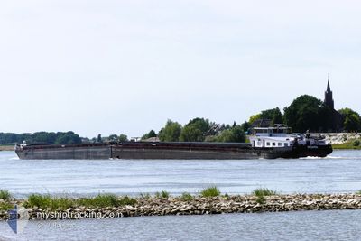
MOANA
Cargo
Current Trip
| Time Travelled | 23 h, 4 mins |
|---|---|
| Remaining Time | 16 h, 44 mins |
| Distance Travelled | 51.46 nm |
| Remaining Distance | 88.77 nm |
| AVG Speed | 6.1 Knots |
| MAX Speed | 7.3 Knots |
| AVG Wind | 8.4 knots |
| MAX Wind | 16 knots |
| MIN Temp | 3.9°C / 39.02°F |
| MAX Temp | 7.2°C / 44.96°F |
| Draught | 2.4 m |
| Position Received | 2 h, 49 m ago |
Current Position
| Longitude | --- |
|---|---|
| Latitude | --- |
| Status | Under way using engine |
| Speed | 4 Knots |
| Course | 83.8° |
| Area | North Sea |
| Station | T-AIS |
| Position Received | 2 h, 49 m ago |
Info
Information
The current position of MOANA is in North Sea with coordinates 51.64309° / 6.72023° as reported on 2025-12-06 11:06 by AIS to our vessel tracker app. The vessel's current speed is 4 Knots and is heading at the port of DORDRECHT. The estimated time of arrival as calculated by MyShipTracking vessel tracking app is 2025-12-07 07:40 LT
The vessel MOANA (MMSI: 205580490) is a Cargo It's sailing under the flag of [BE] Belgium.
In this page you can find informations about the vessels current position, last detected port calls, and current voyage information. If the vessels is not in coverage by AIS you will find the latest position.
The current position of MOANA is detected by our AIS receivers and we are not responsible for the reliability of the data. The last position was recorded while the vessel was in Coverage by the Ais receivers of our vessel tracking app.
The current draught of MOANA as reported by AIS is 2.4 meters
Weather
| Temperature | 6.9°C / 44.42°F |
|---|---|
| Wind Speed | 12 knots |
| Direction | 180° S |
| Pressure | 1002.7 hPa |
| Humidity | 84.6 % |
| Cloud Coverage | 100 % |
Featured Company
Last Port Calls
| Port | Arrival | Departure | Time In Port |
|---|---|---|---|
| 2025-12-05 15:24 | 2025-12-05 15:52 | 27 m | |
| 2025-12-05 07:05 | 2025-12-05 11:17 | 4 h | |
| 2025-12-04 17:10 | 2025-12-05 03:14 | 10 h | |
| 2025-12-04 14:34 | 2025-12-04 14:39 | 4 m | |
| 2025-11-29 10:30 | 2025-11-29 19:18 | 8 h | |
| 2025-11-29 09:42 | 2025-11-29 10:28 | 45 m | |
| 2025-11-28 11:27 | 2025-11-28 11:46 | 19 m | |
| 2025-11-25 13:18 | 2025-11-25 13:45 | 26 m | |
| 2025-11-24 13:55 | 2025-11-24 17:58 | 4 h | |
| 2025-11-19 15:11 | 2025-11-20 06:32 | 15 h |
Last Trips
| Origin | Departure | Destination | Arrival | Distance | |
|---|---|---|---|---|---|
| 2025-12-05 11:17 | 2025-12-05 15:24 | 28.55 nm | |||
| 2025-12-05 03:14 | 2025-12-05 07:05 | 34.39 nm | |||
| 2025-12-04 14:39 | 2025-12-04 17:10 | 24.98 nm | |||
| 2025-11-29 19:18 | 2025-12-04 14:34 | 205.81 nm | |||
| 2025-11-29 10:28 | 2025-11-29 10:30 | 0.24 nm | |||
| 2025-11-28 11:46 | 2025-11-29 09:42 | 83.42 nm | |||
| 2025-11-25 13:45 | 2025-11-28 11:27 | 102.34 nm | |||
| 2025-11-24 17:58 | 2025-11-25 13:18 | 86.42 nm | |||
| 2025-11-20 06:32 | 2025-11-24 13:55 | 206.95 nm | |||
| 2025-11-15 03:30 | 2025-11-19 15:11 | 211.27 nm |
Events
| Time | Event | Details | Position / Dest | Info |
|---|---|---|---|---|
| 2025-12-06 11:06 | OUT of Coverage |
51.64309 / 6.72023
North Sea
DATTELN
|
Speed: 4 kn Course: 83.8° |
|
| 2025-12-06 10:45 | ETA Changed | 2025/12/06 15:25 2025/12/06 04:26 |
51.63506 / 6.68097
DATTELN
|
Speed: 4.4 kn Course: 73.6° |
| 2025-12-06 10:09 | IN Coverage |
51.62796 / 6.61832
North Sea
|
Speed: 2.4 kn Course: 198.4° |
|
| 2025-12-06 08:54 | OUT of Coverage |
51.63552 / 6.60666
North Sea
|
Speed: 5.9 kn Course: 177.8° |
|
| 2025-12-06 08:36 | IN Coverage |
51.65872 / 6.58467
North Sea
DATTELN
|
Speed: 6.3 kn Course: 105.2° |
|
| 2025-12-06 05:13 | OUT of Coverage |
51.82823 / 6.21663
North Sea
DATTELN
|
Speed: 5.7 kn Course: 88.2° |
|
| 2025-12-06 04:13 | START Moving | 0.71 nm, West of LOBITH |
51.85917 / 6.07632
DATTELN
|
Speed: 3.1 kn Course: 121.8° |
| 2025-12-06 04:10 | Status Changed | Under way using engine Moored |
51.85992 / 6.07313
DATTELN
|
Speed: Course: 511° |
| 2025-12-05 19:00 | Status Changed | Moored Under way using engine |
51.86016 / 6.07267
DATTELN
|
Speed: Course: 511° |
| 2025-12-05 18:49 | STOP Moving | 0.85 nm, West of LOBITH |
51.86016 / 6.07267
DATTELN
|
Speed: Course: 511° |