
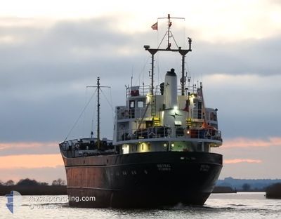
MISTRAL
General Cargo
Current Trip
| Trip Time | 11 h, 45 mins |
|---|---|
| Trip Distance | 98.33 nm |
| AVG Speed | 8.7 Knots |
| MAX Speed | 10.1 Knots |
| Draught | 2.8 m |
| AVG Wind | 9.9 knots |
| MAX Wind | 15 knots |
| MIN Temp | 23.4°C / 74.12°F |
| MAX Temp | 26.8°C / 80.24°F |
| Position Received | 11 h, 56 m ago |
Current Position
| Longitude | --- |
|---|---|
| Latitude | --- |
| Status | Under way using engine |
| Speed | 9.1 Knots |
| Course | 81° |
| Area | Caribbean Sea |
| Station | T-AIS |
| Position Received | 11 h, 56 m ago |
Info
Information
The current position of MISTRAL is in Caribbean Sea with coordinates 10.63022° / -61.60430° as reported on 2025-12-16 11:19 by AIS to our vessel tracker app. The vessel's current speed is 9.1 Knots and is currently inside the port of PORT OF SPAIN.
The vessel MISTRAL (IMO: 6617855, MMSI: 304010366) is a General Cargo that was built in 1966 ( 59 years old ). It's sailing under the flag of [AG] Antigua Barbuda.
In this page you can find informations about the vessels current position, last detected port calls, and current voyage information. If the vessels is not in coverage by AIS you will find the latest position.
The current position of MISTRAL is detected by our AIS receivers and we are not responsible for the reliability of the data. The last position was recorded while the vessel was in Coverage by the Ais receivers of our vessel tracking app.
The current draught of MISTRAL as reported by AIS is 2.8 meters
Weather
| Temperature | 24.1°C / 75.38°F |
|---|---|
| Wind Speed | 6 knots |
| Direction | 90° E |
| Pressure | 1011.9 hPa |
| Humidity | 88.2 % |
| Cloud Coverage | 97 % |
Featured Company
Last Port Calls
| Port | Arrival | Departure | Time In Port |
|---|---|---|---|
| 2025-12-16 07:56 | |||
| 2025-12-15 06:57 | 2025-12-15 20:11 | 13 h | |
| 2025-12-13 09:12 | 2025-12-14 06:01 | 20 h | |
| 2025-12-08 05:53 | 2025-12-08 20:59 | 15 h | |
| 2025-12-03 10:15 | 2025-12-08 02:15 | 4 d | |
| 2025-11-27 06:52 | 2025-11-27 23:45 | 16 h | |
| 2025-11-26 10:36 | 2025-11-26 18:16 | 7 h | |
| 2025-11-19 07:14 | 2025-11-19 12:03 | 4 h | |
| 2025-11-08 06:33 | 2025-11-10 12:54 | 2 d | |
| 2025-11-07 09:11 | 2025-11-07 17:19 | 8 h |
Most Visited Ports (Last year)
| Port | Arrivals | |
|---|---|---|
| 8 | ||
| 7 | ||
| 6 | ||
| 6 | ||
| 5 | ||
| 5 |
Last Trips
| Origin | Departure | Destination | Arrival | Distance | |
|---|---|---|---|---|---|
| 2025-12-15 20:11 | 2025-12-16 07:56 | 98.33 nm | |||
| 2025-12-14 06:01 | 2025-12-15 06:57 | 1.97 nm | |||
| 2025-12-08 20:59 | 2025-12-13 09:12 | 352.28 nm | |||
| 2025-12-08 02:15 | 2025-12-08 05:53 | 26.82 nm | |||
| 2025-11-27 23:45 | 2025-12-03 10:15 | 745.08 nm | |||
| 2025-11-26 18:16 | 2025-11-27 06:52 | 0.35 nm | |||
| 2025-11-19 12:03 | 2025-11-26 10:36 | 973.10 nm | |||
| 2025-11-10 12:54 | 2025-11-19 07:14 | 478.59 nm | |||
| 2025-11-07 17:19 | 2025-11-08 06:33 | 98.46 nm | |||
| 2025-11-05 20:01 | 2025-11-07 09:11 | 4.19 nm |
Events
| Time | Event | Details | Position / Dest | Info |
|---|---|---|---|---|
| 2025-12-16 12:02 | STOP Moving |
10.64703 / -61.51850
[TT] PORT OF SPAIN
|
Speed: 0.1 kn Course: 126° |
|
| 2025-12-16 11:56 | PORT ARRIVAL |
|
10.64752 / -61.52067
[TT] PORT OF SPAIN
|
Speed: 6.2 kn Course: 88° |
| 2025-12-16 11:20 | Status Changed | Default Under way using engine |
10.63062 / -61.60218
TT POS
|
Speed: 9.1 kn Course: 81° |
| 2025-12-16 11:19 | Status Changed | Under way using engine Default |
10.63022 / -61.60430
TT POS
|
Speed: 9.3 kn Course: 104° |
| 2025-12-16 11:19 | OUT of Coverage |
10.63022 / -61.60430
Caribbean Sea
[TT] PORT OF SPAIN
|
Speed: 9.1 kn Course: 81° |
|
| 2025-12-16 11:16 | Status Changed | Default Under way using engine |
10.63157 / -61.61338
TT POS
|
Speed: 9.3 kn Course: 104.5° |
| 2025-12-16 10:58 | Draught Changed | 2.8 2 |
10.64743 / -61.65790
TT POS
|
Speed: 9.1 kn Course: 117.1° |
| 2025-12-16 10:58 | ETA Changed | 2025/12/16 13:00 |
10.64743 / -61.65790
TT POS
|
Speed: 9.1 kn Course: 117.1° |
| 2025-12-16 10:37 | Change Sea Area | Trinidad and Tobago part of the Caribbean Sea Grenadian part of the Caribbean Sea |
10.66518 / -61.70990
Caribbean Sea
|
Speed: 9.6 kn Course: 103.8° |
| 2025-12-16 10:37 | Status Changed | Under way using engine Default |
10.66518 / -61.70990
TT POS
|
Speed: 9.1 kn Course: 99° |