

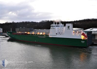
MISANA
Ro-Ro Cargo

Current Trip
| Time Travelled | 6 h, 25 mins |
|---|---|
| Remaining Time | 1 day |
| Distance Travelled | 71.94 nm |
| Remaining Distance | 395.77 nm |
| AVG Speed | 12.4 Knots |
| MAX Speed | 16.6 Knots |
| AVG Wind | 15.4 knots |
| MAX Wind | 19 knots |
| MIN Temp | 6.7°C / 44.06°F |
| MAX Temp | 9.1°C / 48.38°F |
| Draught | 6.3 m |
| Position Received | 1 h, 20 m ago |
Current Position
| Longitude | --- |
|---|---|
| Latitude | --- |
| Status | Under way using engine |
| Speed | 15 Knots |
| Course | 30.6° |
| Area | North Sea |
| Station | T-AIS |
| Position Received | 1 h, 20 m ago |
Information
The current position of MISANA is in North Sea with coordinates 52.85532° / 4.21655° as reported on 2025-02-25 00:23 by AIS to our vessel tracker app. The vessel's current speed is 15 Knots and is heading at the port of KARMOY. The estimated time of arrival as calculated by MyShipTracking vessel tracking app is 2025-02-26 03:31 LT
The vessel MISANA (IMO: 9348936, MMSI: 230994000) is a Ro-Ro Cargo that was built in 2007 ( 18 years old ). It's sailing under the flag of [FI] Finland.
In this page you can find informations about the vessels current position, last detected port calls, and current voyage information. If the vessels is not in coverage by AIS you will find the latest position.
The current position of MISANA is detected by our AIS receivers and we are not responsible for the reliability of the data. The last position was recorded while the vessel was in Coverage by the Ais receivers of our vessel tracking app.
The current draught of MISANA as reported by AIS is 6.3 meters
Weather
| Temperature | 6.5°C / 43.7°F |
|---|---|
| Wind Speed | 13 knots |
| Direction | 223° SW |
| Pressure | 1012.3 hPa |
| Humidity | 96.4 % |
| Cloud Coverage | --- |


Featured Company
Last Port Calls
| Port | Arrival | Departure | Time In Port |
|---|---|---|---|
| 2025-02-24 06:41 | 2025-02-24 20:19 | 13 h | |
| 2025-02-22 16:47 | 2025-02-22 19:13 | 2 h | |
| 2025-02-22 09:44 | 2025-02-22 14:47 | 5 h | |
| 2025-02-22 07:25 | 2025-02-22 09:23 | 1 h | |
| 2025-02-21 21:16 | 2025-02-22 00:29 | 3 h | |
| 2025-02-21 06:00 | 2025-02-21 13:58 | 7 h | |
| 2025-02-20 07:20 | 2025-02-21 00:05 | 16 h | |
| 2025-02-19 08:45 | 2025-02-19 12:07 | 3 h | |
| 2025-02-17 06:35 | 2025-02-17 18:49 | 12 h | |
| 2025-02-15 13:53 | 2025-02-15 16:20 | 2 h |
Most Visited Ports (Last year)
| Port | Arrivals | |
|---|---|---|
| 101 | ||
| 54 | ||
| 52 | ||
| 52 | ||
| 52 | ||
| 43 |
Last Trips
| Origin | Departure | Destination | Arrival | Distance | |
|---|---|---|---|---|---|
| 2025-02-22 19:13 | 2025-02-24 06:41 | 457.63 nm | |||
| 2025-02-22 14:47 | 2025-02-22 16:47 | 26.19 nm | |||
| 2025-02-22 09:23 | 2025-02-22 09:44 | 1.22 nm | |||
| 2025-02-22 00:29 | 2025-02-22 07:25 | 75.53 nm | |||
| 2025-02-21 13:58 | 2025-02-21 21:16 | 87.34 nm | |||
| 2025-02-21 00:05 | 2025-02-21 06:00 | 60.77 nm | |||
| 2025-02-19 12:07 | 2025-02-20 07:20 | 207.90 nm | |||
| 2025-02-17 18:49 | 2025-02-19 08:45 | 471.35 nm | |||
| 2025-02-15 16:20 | 2025-02-17 06:35 | 462.84 nm | |||
| 2025-02-15 11:36 | 2025-02-15 13:53 | 26.12 nm |
Events
| Time | Event | Details | Position / Dest | Info |
|---|---|---|---|---|
| 2025-02-25 00:27 | Status Changed | Default Under way using engine |
52.86972 / 4.23051
HAVIK
|
Speed: 15 kn Course: 30.6° |
| 2025-02-25 00:23 | Status Changed | Under way using engine Default |
52.85532 / 4.21655
HAVIK
|
Speed: 15.6 kn Course: 30° |
| 2025-02-25 00:23 | OUT of Coverage |
52.85532 / 4.21655
North Sea
HAVIK
|
Speed: 15 kn Course: 30.6° |
|
| 2025-02-24 23:36 | Status Changed | Default Under way using engine |
52.67620 / 4.05581
HAVIK
|
Speed: 16.1 kn Course: 28.1° |
| 2025-02-24 23:31 | Status Changed | Under way using engine Default |
52.65802 / 4.03966
HAVIK
|
Speed: 15.8 kn Course: 29° |
| 2025-02-24 23:26 | IN Coverage |
52.65802 / 4.03966
North Sea
HAVIK
|
Speed: 16.1 kn Course: 28.1° |
|
| 2025-02-24 22:06 | Status Changed | Default Under way using engine |
52.31579 / 3.85965
HAVIK
|
Speed: 14.6 kn Course: 349.8° |
| 2025-02-24 22:03 | OUT of Coverage |
52.30689 / 3.86207
North Sea
HAVIK
|
Speed: 14.6 kn Course: 349.8° |
|
| 2025-02-24 20:24 | Status Changed | Under way using engine Moored |
51.98502 / 4.07951
HAVIK
|
Speed: 16.3 kn Course: 287.4° |
| 2025-02-24 19:19 | PORT DEPARTURE |
|
51.89582 / 4.39288
HAVIK
|
Speed: 8.3 kn Course: 291° |