

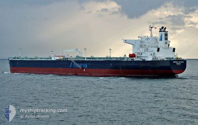
MINERVA KARTERIA
Tanker

Current Trip
EGSKT
| Time Travelled | 15 days |
|---|---|
| Remaining Time | --- |
| Distance Travelled | 1441.46 nm |
| Remaining Distance | --- |
| AVG Speed | 8.9 Knots |
| MAX Speed | 12.9 Knots |
| AVG Wind | 10.1 knots |
| MAX Wind | 21 knots |
| MIN Temp | 5.3°C / 41.54°F |
| MAX Temp | 19.4°C / 66.92°F |
| Draught | 8.2 m |
| Position Received | 5 d ago |
Current Position
| Longitude | --- |
|---|---|
| Latitude | --- |
| Status | Under way using engine |
| Speed | 10.8 Knots |
| Course | 130.3° |
| Area | Mediterranean Sea - Eastern Basin |
| Station | T-AIS |
| Position Received | 5 d ago |
Information
The current position of MINERVA KARTERIA is in Mediterranean Sea - Eastern Basin with coordinates 34.15039° / 25.77633° as reported on 2025-02-13 13:47 by AIS to our vessel tracker app. The vessel's current speed is 10.8 Knots
The vessel MINERVA KARTERIA (IMO: 9787170, MMSI: 241574000) is a Tanker It's sailing under the flag of [GR] Greece.
In this page you can find informations about the vessels current position, last detected port calls, and current voyage information. If the vessels is not in coverage by AIS you will find the latest position.
The current position of MINERVA KARTERIA is detected by our AIS receivers and we are not responsible for the reliability of the data. The last position was recorded while the vessel was in Coverage by the Ais receivers of our vessel tracking app.
The current draught of MINERVA KARTERIA as reported by AIS is 8.2 meters
Weather
| Temperature | 16.7°C / 62.06°F |
|---|---|
| Wind Speed | 9 knots |
| Direction | 318° NW |
| Pressure | 1018.4 hPa |
| Humidity | 72.5 % |
| Cloud Coverage | 96 % |


Featured Company
Most Visited Ports (Last year)
| Port | Arrivals | |
|---|---|---|
| 3 | ||
| 2 | ||
| 1 | ||
| 1 | ||
| 1 | ||
| 1 |
Events
| Time | Event | Details | Position / Dest | Info |
|---|---|---|---|---|
| 2025-02-18 16:47 | START Moving | 9.65 nm, West of EL DEKHEILA |
31.11887 / 29.62142
EGSKT
|
Speed: 7.3 kn Course: 324° |
| 2025-02-17 21:22 | STOP Moving | 10 nm, South West of EL DEKHEILA |
31.08019 / 29.62792
EGSKT
|
Speed: 0.2 kn Course: 40° |
| 2025-02-17 18:45 | START Moving | 12.25 nm, West of EL DEKHEILA |
31.13228 / 29.56864
EGSKT
|
Speed: 3.7 kn Course: 90° |
| 2025-02-14 15:45 | STOP Moving | 13 nm, West of EL DEKHEILA |
31.12668 / 29.55468
EGSKT
|
Speed: 0.1 kn Course: 28° |
| 2025-02-13 13:53 | Status Changed | Default Under way using engine |
34.13848 / 25.79358
EGSKT
|
Speed: 10.8 kn Course: 130.3° |
| 2025-02-13 13:47 | OUT of Coverage |
34.15039 / 25.77633
Mediterranean Sea - Eastern Basin
EGSKT
|
Speed: 10.8 kn Course: 130.3° |
|
| 2025-02-13 12:54 | ETA Changed | 2025/02/14 18:00 2025/02/14 10:00 |
34.24851 / 25.63433
EGSKT
|
Speed: 9.9 kn Course: 132.1° |
| 2025-02-13 11:02 | Status Changed | Under way using engine Default |
34.48755 / 25.35157
EGSKT
|
Speed: 11.1 kn Course: 134° |
| 2025-02-13 10:42 | Status Changed | Default Under way using engine |
34.53110 / 25.29596
EGSKT
|
Speed: 10.9 kn Course: 134.3° |
| 2025-02-13 09:53 | Status Changed | Under way using engine Default |
34.63579 / 25.16505
EGSKT
|
Speed: 10.7 kn Course: 133° |