
MILA
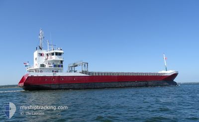
General Cargo
Current Trip
| Time Travelled | 3 days |
|---|---|
| Remaining Time | --- |
| Distance Travelled | 709.55 nm |
| Remaining Distance | --- |
| AVG Speed | 9.4 Knots |
| MAX Speed | 11.7 Knots |
| AVG Wind | 14.3 knots |
| MAX Wind | 26.6 knots |
| MIN Temp | 6.3°C / 43.34°F |
| MAX Temp | 14.9°C / 58.82°F |
| Draught | 5.4 m |
| Position Received | 5 h, 9 m ago |
Current Position
| Longitude | --- |
|---|---|
| Latitude | --- |
| Status | Under way using engine |
| Speed | 11.6 Knots |
| Course | 61.4° |
| Area | English Channel |
| Station | T-AIS |
| Position Received | 5 h, 9 m ago |
Info
Information
The current position of MILA is in English Channel with coordinates 49.76046° / -2.96777° as reported on 2025-02-17 09:53 by AIS to our vessel tracker app. The vessel's current speed is 11.6 Knots and is heading at the port of KOTKA. The estimated time of arrival as calculated by MyShipTracking vessel tracking app is 2025-02-23 08:00 LT
The vessel MILA (IMO: 9331335, MMSI: 246542000) is a General Cargo that was built in 2006 ( 19 years old ). It's sailing under the flag of [NL] Netherlands.
In this page you can find informations about the vessels current position, last detected port calls, and current voyage information. If the vessels is not in coverage by AIS you will find the latest position.
The current position of MILA is detected by our AIS receivers and we are not responsible for the reliability of the data. The last position was recorded while the vessel was in Coverage by the Ais receivers of our vessel tracking app.
The current draught of MILA as reported by AIS is 5.4 meters
Weather
| Temperature | 6.3°C / 43.34°F |
|---|---|
| Wind Speed | 16 knots |
| Direction | 107° ESE |
| Pressure | 1019.4 hPa |
| Humidity | 75.5 % |
| Cloud Coverage | 25 % |
Featured Company
Last Port Calls
| Port | Arrival | Departure | Time In Port |
|---|---|---|---|
| 2025-02-11 11:09 | 2025-02-14 13:49 | 3 d | |
| 2025-02-07 20:52 | 2025-02-10 21:23 | 3 d | |
| 2025-02-01 18:14 | 2025-02-03 13:40 | 1 d | |
| 2025-01-29 18:33 | 2025-01-31 19:09 | 2 d | |
| 2025-01-27 15:37 | 2025-01-27 17:19 | 1 h | |
| 2025-01-19 10:17 | 2025-01-21 01:21 | 1 d | |
| 2025-01-06 06:48 | 2025-01-07 14:18 | 1 d | |
| 2024-12-26 00:54 | 2024-12-29 06:34 | 3 d | |
| 2024-12-23 11:51 | 2024-12-24 10:14 | 22 h | |
| 2024-12-18 21:06 | 2024-12-20 19:07 | 1 d |
Last Trips
| Origin | Departure | Destination | Arrival | Distance | |
|---|---|---|---|---|---|
| 2025-02-10 21:23 | 2025-02-11 11:09 | 118.03 nm | |||
| 2025-02-03 13:40 | 2025-02-07 20:52 | 945.56 nm | |||
| 2025-01-31 19:09 | 2025-02-01 18:14 | 222.98 nm | |||
| 2025-01-27 17:19 | 2025-01-29 18:33 | 397.06 nm | |||
| 2025-01-21 01:21 | 2025-01-27 15:37 | 970.36 nm | |||
| 2025-01-07 14:18 | 2025-01-19 10:17 | 2212.74 nm | |||
| 2024-12-29 06:34 | 2025-01-06 06:48 | 999.55 nm | |||
| 2024-12-24 10:14 | 2024-12-26 00:54 | 424.33 nm | |||
| 2024-12-20 19:07 | 2024-12-23 11:51 | 524.45 nm | |||
| 2024-12-18 15:13 | 2024-12-18 21:06 | 55.82 nm |
Events
| Time | Event | Details | Position / Dest | Info |
|---|---|---|---|---|
| 2025-02-17 09:59 | Status Changed | Default Under way using engine |
49.76966 / -2.94173
KOTKA
|
Speed: 11.6 kn Course: 61.4° |
| 2025-02-17 09:53 | Status Changed | Under way using engine Default |
49.76046 / -2.96777
KOTKA
|
Speed: 11.5 kn Course: 60° |
| 2025-02-17 09:53 | OUT of Coverage |
49.76046 / -2.96777
English Channel
KOTKA
|
Speed: 11.6 kn Course: 61.4° |
|
| 2025-02-17 09:43 | Status Changed | Default Under way using engine |
49.74416 / -3.01032
KOTKA
|
Speed: 11.3 kn Course: 59° |
| 2025-02-17 09:30 | Status Changed | Under way using engine Default |
49.72193 / -3.06653
KOTKA
|
Speed: 11.3 kn Course: 58° |
| 2025-02-17 08:59 | Status Changed | Default Under way using engine |
49.67092 / -3.19554
KOTKA
|
Speed: 11.3 kn Course: 58.3° |
| 2025-02-17 08:49 | Status Changed | Under way using engine Default |
49.65363 / -3.24018
KOTKA
|
Speed: 11.3 kn Course: 59° |
| 2025-02-17 08:31 | Status Changed | Default Under way using engine |
49.62566 / -3.31310
KOTKA
|
Speed: 11 kn Course: 60.6° |
| 2025-02-17 08:25 | Status Changed | Under way using engine Default |
49.61655 / -3.33764
KOTKA
|
Speed: 11.2 kn Course: 59° |
| 2025-02-17 08:11 | Status Changed | Default Under way using engine |
49.59460 / -3.39650
KOTKA
|
Speed: 11.1 kn Course: 59.8° |