
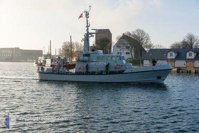
MHV 804 ANDROMEDA
Military ops
Current Trip
| Time Travelled | 19 h, 5 mins |
|---|---|
| Remaining Time | --- |
| Distance Travelled | 65.96 nm |
| Remaining Distance | --- |
| AVG Speed | 9 Knots |
| MAX Speed | 11.8 Knots |
| AVG Wind | 6.4 knots |
| MAX Wind | 8.6 knots |
| MIN Temp | 9.3°C / 48.74°F |
| MAX Temp | 11.2°C / 52.16°F |
| Draught | 2.5 m |
| Position Received | 2 h, 49 m ago |
Current Position
| Longitude | 8.72085° |
|---|---|
| Latitude | 56.47994° |
| Status | Under way using engine |
| Speed | 0.5 Knots |
| Course | 193° |
| Area | North Sea |
| Station | T-AIS |
| Position Received | 2 h, 49 m ago |
Info
Information
The current position of MHV 804 ANDROMEDA is in North Sea with coordinates 56.47994° / 8.72085° as reported on 2024-05-06 10:14 by AIS to our vessel tracker app. The vessel's current speed is 0.5 Knots and is heading at the port of KRISTIANSAND. The estimated time of arrival as calculated by MyShipTracking vessel tracking app is 2024-05-07 05:00 LT
The vessel MHV 804 ANDROMEDA (MMSI: 219000184) is a Military ops It's sailing under the flag of [DK] Denmark.
In this page you can find informations about the vessels current position, last detected port calls, and current voyage information. If the vessels is not in coverage by AIS you will find the latest position.
The current position of MHV 804 ANDROMEDA is detected by our AIS receivers and we are not responsible for the reliability of the data. The last position was recorded while the vessel was in Coverage by the Ais receivers of our vessel tracking app.
The current draught of MHV 804 ANDROMEDA as reported by AIS is 2.5 meters
Weather
| Temperature | 11.1°C / 51.98°F |
|---|---|
| Wind Speed | 5 knots |
| Direction | 262° W |
| Pressure | 1007.4 hPa |
| Humidity | 89.5 % |
| Cloud Coverage | 100 % |
Featured Company
Last Port Calls
| Port | Arrival | Departure | Time In Port |
|---|---|---|---|
| 2024-05-05 16:19 | 2024-05-05 17:59 | 1 h | |
| 2024-04-27 15:22 | 2024-04-28 09:51 | 18 h | |
| 2024-04-20 16:03 | 2024-04-21 06:17 | 14 h | |
| 2024-04-20 12:38 | 2024-04-20 14:00 | 1 h | |
| 2024-04-19 21:05 | 2024-04-20 05:38 | 8 h | |
| 2024-03-23 16:15 | 2024-03-23 17:55 | 1 h | |
| 2024-03-22 20:57 | 2024-03-23 07:39 | 10 h | |
| 2024-03-16 20:22 | 2024-03-17 07:12 | 10 h | |
| 2024-03-15 20:48 | 2024-03-16 07:10 | 10 h | |
| 2024-03-09 08:53 | 2024-03-09 12:13 | 3 h |
Last Trips
| Origin | Departure | Destination | Arrival | Distance | |
|---|---|---|---|---|---|
| 2024-04-28 11:51 | 2024-05-05 18:19 | 170.29 nm | |||
| 2024-04-21 08:17 | 2024-04-27 17:22 | 91.76 nm | |||
| 2024-04-20 16:00 | 2024-04-20 18:03 | 21.10 nm | |||
| 2024-04-20 07:38 | 2024-04-20 14:38 | 58.09 nm | |||
| 2024-03-23 18:55 | 2024-04-19 23:05 | 148.33 nm | |||
| 2024-03-23 08:39 | 2024-03-23 17:15 | 57.19 nm | |||
| 2024-03-17 08:12 | 2024-03-22 21:57 | 77.30 nm | |||
| 2024-03-16 08:10 | 2024-03-16 21:22 | 100.68 nm | |||
| 2024-03-09 13:13 | 2024-03-15 21:48 | 285.15 nm | |||
| 2024-03-09 09:25 | 2024-03-09 09:53 | 4.97 nm |
Events
| Time | Event | Details | Position / Dest | Info |
|---|---|---|---|---|
| 2024-05-06 10:14 | OUT of Coverage |
56.47994 / 8.72085
North Sea
KRISTIANSAND
|
Speed: 0.5 kn Course: 188.8° |
|
| 2024-05-06 10:14 | STOP Moving | 12.39 nm, South West of SKIVE |
56.47997 / 8.72083
KRISTIANSAND
|
Speed: Course: 176° |
| 2024-05-06 08:17 | START Moving | 1.58 nm, South of NYKOBING MORS |
56.76362 / 8.85755
KRISTIANSAND
|
Speed: 5.5 kn Course: 199.7° |
| 2024-05-06 08:11 | STOP Moving | 1.46 nm, South of NYKOBING MORS |
56.76559 / 8.85825
KRISTIANSAND
|
Speed: 0.3 kn Course: 186° |
| 2024-05-06 05:53 | START Moving | 16.5 nm, North East of NYKOBING MORS |
56.96964 / 9.24635
KRISTIANSAND
|
Speed: 6.9 kn Course: 267.3° |
| 2024-05-06 05:51 | Status Changed | Under way using engine Moored |
56.96918 / 9.24980
KRISTIANSAND
|
Speed: 0.1 kn Course: 248° |
| 2024-05-05 20:48 | Status Changed | Moored Under way using engine |
56.96920 / 9.25001
KRISTIANSAND
|
Speed: Course: 246° |
| 2024-05-05 20:40 | STOP Moving | 16.57 nm, North East of NYKOBING MORS |
56.96929 / 9.24992
KRISTIANSAND
|
Speed: 0.1 kn Course: 218° |
| 2024-05-05 19:59 | Change Sea Area | Danish part of the North Sea Danish part of the Kattegat |
57.01588 / 9.37637
North Sea
KRISTIANSAND
|
Speed: 8.4 kn Course: 271.7° |
| 2024-05-05 17:59 | PORT DEPARTURE |
|
57.06120 / 9.88344
KRISTIANSAND
|
Speed: 9.9 kn Course: 250° |