

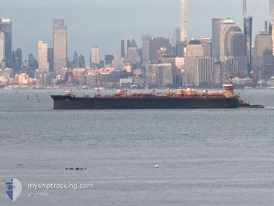
MEREDITH C REINAUER
Spare - Local Vessel

Current Trip
USNYC>HVN
| Time Travelled | 6 h, 57 mins |
|---|---|
| Remaining Time | --- |
| Distance Travelled | 2.82 nm |
| Remaining Distance | --- |
| AVG Speed | 5.7 Knots |
| MAX Speed | 7.5 Knots |
| AVG Wind | 13.5 knots |
| MAX Wind | 14 knots |
| MIN Temp | -3.7°C / 25.34°F |
| MAX Temp | -0.2°C / 31.64°F |
| Draught | 7.9 m |
| Position Received | 1 m ago |
Current Position
| Longitude | --- |
|---|---|
| Latitude | --- |
| Status | At anchor |
| Speed | 6.6 Knots |
| Course | 200.3° |
| Area | North Atlantic Ocean |
| Station | T-AIS |
| Position Received | 1 m ago |
Information
The current position of MEREDITH C REINAUER is in North Atlantic Ocean with coordinates 40.82524° / -73.96407° as reported on 2025-02-18 04:11 by AIS to our vessel tracker app. The vessel's current speed is 6.6 Knots
The vessel MEREDITH C REINAUER (MMSI: 366891140) is a Spare - Local Vessel It's sailing under the flag of [US] USA.
In this page you can find informations about the vessels current position, last detected port calls, and current voyage information. If the vessels is not in coverage by AIS you will find the latest position.
The current position of MEREDITH C REINAUER is detected by our AIS receivers and we are not responsible for the reliability of the data. The last position was recorded while the vessel was in Coverage by the Ais receivers of our vessel tracking app.
The current draught of MEREDITH C REINAUER as reported by AIS is 7.9 meters
Weather
| Temperature | -3.8°C / 25.16°F |
|---|---|
| Wind Speed | 13 knots |
| Direction | 290° WNW |
| Pressure | 1016.9 hPa |
| Humidity | 42.8 % |
| Cloud Coverage | 75 % |

Featured Company
Last Port Calls
| Port | Arrival | Departure | Time In Port |
|---|---|---|---|
| 2025-02-17 19:29 | 2025-02-17 21:15 | 1 h | |
| 2025-02-14 09:25 | 2025-02-16 03:49 | 1 d | |
| 2025-02-10 13:43 | 2025-02-10 22:22 | 8 h | |
| 2025-02-08 12:08 | 2025-02-09 22:49 | 1 d | |
| 2025-02-06 12:00 | 2025-02-07 12:28 | 1 d | |
| 2025-02-04 02:39 | 2025-02-04 06:26 | 3 h | |
| 2025-02-02 18:59 | 2025-02-04 00:02 | 1 d | |
| 2025-01-31 16:06 | 2025-02-01 16:43 | 1 d | |
| 2025-01-29 00:19 | 2025-01-29 01:59 | 1 h | |
| 2025-01-27 19:07 |
Most Visited Ports (Last year)
| Port | Arrivals | |
|---|---|---|
| 54 | ||
| 35 | ||
| 26 | ||
| 3 | ||
| 1 | ||
| 1 |
Last Trips
| Origin | Departure | Destination | Arrival | Distance | |
|---|---|---|---|---|---|
| 2025-02-15 22:49 | 2025-02-17 14:29 | 7.98 nm | |||
| 2025-02-10 17:22 | 2025-02-14 04:25 | 322.62 nm | |||
| 2025-02-09 17:49 | 2025-02-10 08:43 | 8.44 nm | |||
| 2025-02-07 07:28 | 2025-02-08 07:08 | 185.94 nm | |||
| 2025-02-04 01:26 | 2025-02-06 07:00 | 188.57 nm | |||
| 2025-02-03 19:02 | 2025-02-03 21:39 | 14.09 nm | |||
| 2025-02-01 11:43 | 2025-02-02 13:59 | 217.55 nm | |||
| 2025-01-28 20:59 | 2025-01-31 11:06 | 191.07 nm | |||
| 2025-01-26 12:29 | 2025-01-28 19:19 | 220.22 nm | |||
| 2025-01-26 12:29 | 2025-01-27 14:07 | 210.88 nm |
Events
| Time | Event | Details | Position / Dest | Info |
|---|---|---|---|---|
| 2025-02-18 04:08 | START Moving | 1.5 nm, North East of FAIR VIEW |
40.82934 / -73.96165
USNYC>HVN
|
Speed: 3.5 kn Course: 207° |
| 2025-02-17 21:55 | Status Changed | At anchor Moored |
40.82728 / -73.96218
USNYC>HVN
|
Speed: 0.6 kn Course: 39° |
| 2025-02-17 21:55 | STOP Moving | 1.39 nm, North East of FAIR VIEW |
40.82728 / -73.96218
USNYC>HVN
|
Speed: 0.2 kn Course: 12° |
| 2025-02-17 21:15 | PORT DEPARTURE |
|
40.78261 / -73.99256
USNYC>HVN
|
Speed: 7.5 kn Course: 33° |
| 2025-02-17 19:29 | PORT ARRIVAL |
|
40.64664 / -74.16658
[US] NEW YORK
|
Speed: 8.8 kn Course: 87.6° |
| 2025-02-17 18:49 | IN Coverage |
40.59253 / -74.20458
North Atlantic Ocean
USNYC>HVN
|
Speed: 4.3 kn Course: 38.7° |
|
| 2025-02-17 17:13 | OUT of Coverage |
40.59108 / -74.20691
North Atlantic Ocean
USNYC>HVN
|
Speed: Course: 123° |
|
| 2025-02-17 12:40 | IN Coverage |
40.59108 / -74.20691
North Atlantic Ocean
USNYC>HVN
|
Speed: Course: 12.3° |
|
| 2025-02-17 11:28 | OUT of Coverage |
40.59108 / -74.20692
North Atlantic Ocean
USNYC>HVN
|
Speed: Course: 12.3° |
|
| 2025-02-17 08:40 | OUT of Coverage |
40.59110 / -74.20691
North Atlantic Ocean
USNYC>HVN
|
Speed: Course: 12.3° |