

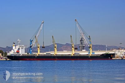
MELOI
Bulk Carrier

Current Trip
| Time Travelled | 1 day |
|---|---|
| Remaining Time | --- |
| Distance Travelled | 359.80 nm |
| Remaining Distance | --- |
| AVG Speed | 11.1 Knots |
| MAX Speed | 14 Knots |
| AVG Wind | 16.4 knots |
| MAX Wind | 25 knots |
| MIN Temp | 16.5°C / 61.7°F |
| MAX Temp | 24.8°C / 76.64°F |
| Draught | 6.2 m |
| Position Received | 1 d ago |
Current Position
| Longitude | --- |
|---|---|
| Latitude | --- |
| Status | Under way using engine |
| Speed | 12.2 Knots |
| Course | 131° |
| Area | North Atlantic Ocean |
| Station | T-AIS |
| Position Received | 1 d ago |
Information
The current position of MELOI is in North Atlantic Ocean with coordinates 32.40635° / -79.42682° as reported on 2025-03-24 14:44 by AIS to our vessel tracker app. The vessel's current speed is 12.2 Knots and is heading at the port of TERNEUZEN. The estimated time of arrival as calculated by MyShipTracking vessel tracking app is 2025-03-24 07:00 LT
The vessel MELOI (IMO: 9392119, MMSI: 351132000) is a Bulk Carrier that was built in 2009 ( 16 years old ). It's sailing under the flag of [PA] Panama.
In this page you can find informations about the vessels current position, last detected port calls, and current voyage information. If the vessels is not in coverage by AIS you will find the latest position.
The current position of MELOI is detected by our AIS receivers and we are not responsible for the reliability of the data. The last position was recorded while the vessel was in Coverage by the Ais receivers of our vessel tracking app.
The current draught of MELOI as reported by AIS is 6.2 meters
Weather
| Temperature | 24.7°C / 76.46°F |
|---|---|
| Wind Speed | 3 knots |
| Direction | 16° NNE |
| Pressure | 1017.4 hPa |
| Humidity | 69.7 % |
| Cloud Coverage | 100 % |


Featured Company
Last Port Calls
| Port | Arrival | Departure | Time In Port |
|---|---|---|---|
| 2025-03-20 16:32 | 2025-03-24 07:31 | 3 d | |
| 2025-03-07 13:32 | 2025-03-10 01:38 | 2 d | |
| 2025-02-14 10:32 | 2025-02-25 05:28 | 10 d | |
| 2025-01-18 10:28 | 2025-02-06 13:16 | 19 d | |
| 2025-01-07 18:21 | 2025-01-09 22:18 | 2 d |
Most Visited Ports (Last year)
| Port | Arrivals | |
|---|---|---|
| 4 | ||
| 3 | ||
| 2 | ||
| 2 | ||
| 2 | ||
| 1 |
Last Trips
| Origin | Departure | Destination | Arrival | Distance | |
|---|---|---|---|---|---|
| 2025-03-10 01:38 | 2025-03-20 16:32 | 2837.71 nm | |||
| 2025-02-25 05:28 | 2025-03-07 13:32 | 1912.64 nm | |||
| 2025-02-06 13:16 | 2025-02-14 10:32 | 1725.14 nm | |||
| 2025-01-09 22:18 | 2025-01-18 10:28 | 1866.68 nm | |||
| 2024-12-16 15:44 | 2025-01-07 18:21 | 5344.99 nm |
Events
| Time | Event | Details | Position / Dest | Info |
|---|---|---|---|---|
| 2025-03-24 14:48 | Status Changed | Default Under way using engine |
32.39683 / -79.41441
FOR ORDER
|
Speed: 12.2 kn Course: 131° |
| 2025-03-24 14:44 | OUT of Coverage |
32.40635 / -79.42682
North Atlantic Ocean
|
Speed: 12.2 kn Course: 131° |
|
| 2025-03-24 14:37 | Status Changed | Under way using engine At anchor |
32.42160 / -79.44673
FOR ORDER
|
Speed: 12.3 kn Course: 132° |
| 2025-03-24 14:33 | Status Changed | At anchor Default |
32.43047 / -79.45818
FOR ORDER
|
Speed: 12.3 kn Course: 132° |
| 2025-03-24 14:16 | START Moving |
32.46930 / -79.50748
FOR ORDER
|
Speed: 8.1 kn Course: 132° |
|
| 2025-03-24 14:16 | IN Coverage |
32.42818 / -79.45523
North Atlantic Ocean
|
Speed: 12.3 kn Course: 132° |
|
| 2025-03-24 13:55 | STOP Moving |
32.47682 / -79.50967
FOR ORDER
|
Speed: Course: 199° |
|
| 2025-03-24 12:20 | Status Changed | Default Under way using engine |
32.65007 / -79.65908
FOR ORDER
|
Speed: 11.2 kn Course: 124° |
| 2025-03-24 12:14 | OUT of Coverage |
32.65290 / -79.67728
North Atlantic Ocean
|
Speed: 11.2 kn Course: 124° |
|
| 2025-03-24 12:14 | Status Changed | Under way using engine Default |
32.65305 / -79.67762
FOR ORDER
|
Speed: 11.8 kn Course: 138° |