
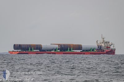
MEGA CARAVAN 2
Heavy Load Carrier
Current Trip
| Time Travelled | 7 days |
|---|---|
| Remaining Time | --- |
| Distance Travelled | 1476.13 nm |
| Remaining Distance | --- |
| AVG Speed | 10.1 Knots |
| MAX Speed | 14.1 Knots |
| AVG Wind | 12.7 knots |
| MAX Wind | 25 knots |
| MIN Temp | 2.5°C / 36.5°F |
| MAX Temp | 10.2°C / 50.36°F |
| Draught | 6.1 m |
| Position Received | 1 d ago |
Current Position
| Longitude | --- |
|---|---|
| Latitude | --- |
| Status | Under way using engine |
| Speed | 10.6 Knots |
| Course | 227.8° |
| Area | English Channel |
| Station | T-AIS |
| Position Received | 1 d ago |
Info
Information
The current position of MEGA CARAVAN 2 is in English Channel with coordinates 49.42656° / -5.04751° as reported on 2025-02-06 07:43 by AIS to our vessel tracker app. The vessel's current speed is 10.6 Knots and is heading at the port of NORFOLK. The estimated time of arrival as calculated by MyShipTracking vessel tracking app is 2025-02-23 08:00 LT
The vessel MEGA CARAVAN 2 (IMO: 9586758, MMSI: 441946000) is a Heavy Load Carrier that was built in 2011 ( 14 years old ). It's sailing under the flag of [KR] Korea.
In this page you can find informations about the vessels current position, last detected port calls, and current voyage information. If the vessels is not in coverage by AIS you will find the latest position.
The current position of MEGA CARAVAN 2 is detected by our AIS receivers and we are not responsible for the reliability of the data. The last position was recorded while the vessel was in Coverage by the Ais receivers of our vessel tracking app.
The current draught of MEGA CARAVAN 2 as reported by AIS is 6.1 meters
Weather
| Temperature | 10°C / 50°F |
|---|---|
| Wind Speed | 11 knots |
| Direction | 28° NNE |
| Pressure | 1020.8 hPa |
| Humidity | 57.3 % |
| Cloud Coverage | 5 % |
Featured Company
Last Port Calls
| Port | Arrival | Departure | Time In Port |
|---|---|---|---|
| 2025-01-29 21:05 | 2025-01-31 15:11 | 1 d | |
| 2025-01-24 16:27 | 2025-01-26 11:40 | 1 d | |
| 2024-12-29 14:31 | 2025-01-04 14:31 | 6 d | |
| 2024-12-05 12:18 |
Most Visited Ports (Last year)
| Port | Arrivals | |
|---|---|---|
| 5 | ||
| 4 | ||
| 2 | ||
| 2 | ||
| 1 | ||
| 1 |
Last Trips
| Origin | Departure | Destination | Arrival | Distance | |
|---|---|---|---|---|---|
| 2025-01-26 12:40 | 2025-01-29 22:05 | 743.82 nm | |||
| 2025-01-04 09:31 | 2025-01-24 17:27 | 5294.11 nm | |||
| 2024-12-05 13:18 | 2024-12-29 09:31 | 5600.83 nm |
Events
| Time | Event | Details | Position / Dest | Info |
|---|---|---|---|---|
| 2025-02-06 07:43 | Status Changed | Default Under way using engine |
49.42590 / -5.04860
USORF
|
Speed: 10.6 kn Course: 227.8° |
| 2025-02-06 07:43 | Status Changed | Under way using engine Default |
49.42656 / -5.04751
USORF
|
Speed: 10.7 kn Course: 228° |
| 2025-02-06 07:43 | OUT of Coverage |
49.42656 / -5.04751
English Channel
USORF
|
Speed: 10.6 kn Course: 227.8° |
|
| 2025-02-06 07:39 | Status Changed | Default Under way using engine |
49.43350 / -5.03572
USORF
|
Speed: 10.7 kn Course: 228.4° |
| 2025-02-06 07:38 | Status Changed | Under way using engine Default |
49.43549 / -5.03231
USORF
|
Speed: 10.4 kn Course: 238° |
| 2025-02-06 06:43 | Status Changed | Default Under way using engine |
49.50456 / -4.79990
USORF
|
Speed: 10.7 kn Course: 245.3° |
| 2025-02-06 06:43 | Status Changed | Under way using engine Default |
49.50499 / -4.79844
USORF
|
Speed: 11 kn Course: 247° |
| 2025-02-06 06:15 | Status Changed | Default Under way using engine |
49.53777 / -4.67613
USORF
|
Speed: 10.9 kn Course: 249.9° |
| 2025-02-06 06:13 | Status Changed | Under way using engine Default |
49.54019 / -4.66598
USORF
|
Speed: 10.9 kn Course: 249° |
| 2025-02-06 05:35 | Status Changed | Default Under way using engine |
49.58349 / -4.49658
USORF
|
Speed: 11.3 kn Course: 248.7° |