
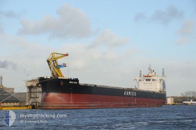
MEDI OITA
Cargo
Current Trip
CH FAN
| Time Travelled | 3 days |
|---|---|
| Remaining Time | --- |
| Distance Travelled | 1009.77 nm |
| Remaining Distance | --- |
| AVG Speed | 12 Knots |
| MAX Speed | 15 Knots |
| AVG Wind | 11.2 knots |
| MAX Wind | 24 knots |
| MIN Temp | 6°C / 42.8°F |
| MAX Temp | 14.7°C / 58.46°F |
| Draught | 13 m |
| Position Received | 2 d ago |
Current Position
| Longitude | -127.10480° |
|---|---|
| Latitude | 48.72991° |
| Status | Under way using engine |
| Speed | 11.1 Knots |
| Course | 285.1° |
| Area | North Pacific Ocean |
| Station | T-AIS |
| Position Received | 2 d ago |
Info
Information
The current position of MEDI OITA is in North Pacific Ocean with coordinates 48.72991° / -127.10480° as reported on 2024-05-20 12:23 by AIS to our vessel tracker app. The vessel's current speed is 11.1 Knots
The vessel MEDI OITA (IMO: 9836713, MMSI: 374155000) is a Cargo It's sailing under the flag of [PA] Panama.
In this page you can find informations about the vessels current position, last detected port calls, and current voyage information. If the vessels is not in coverage by AIS you will find the latest position.
The current position of MEDI OITA is detected by our AIS receivers and we are not responsible for the reliability of the data. The last position was recorded while the vessel was in Coverage by the Ais receivers of our vessel tracking app.
The current draught of MEDI OITA as reported by AIS is 13 meters
Weather
| Temperature | 6.7°C / 44.06°F |
|---|---|
| Wind Speed | 18 knots |
| Direction | 309° NW |
| Pressure | 1020.7 hPa |
| Humidity | 70.3 % |
| Cloud Coverage | 70 % |
Featured Company
Events
| Time | Event | Details | Position / Dest | Info |
|---|---|---|---|---|
| 2024-05-20 12:27 | Status Changed | Default Under way using engine |
48.73333 / -127.12334
CH FAN
|
Speed: 11.1 kn Course: 285.1° |
| 2024-05-20 12:23 | OUT of Coverage |
48.72991 / -127.10480
North Pacific Ocean
CH FAN
|
Speed: 11.1 kn Course: 285.1° |
|
| 2024-05-20 04:45 | Change Sea Area | Canadian part of the North Pacific Ocean Canadian part of the The Coastal Waters of Southeast Alaska and British Columbia |
48.51733 / -125.06940
North Pacific Ocean
CH FAN
|
Speed: 11.6 kn Course: 271.3° |
| 2024-05-20 04:45 | Status Changed | Under way using engine Default |
48.51733 / -125.06940
CH FAN
|
Speed: 11.6 kn Course: 271° |
| 2024-05-20 04:42 | IN Coverage |
48.51733 / -125.06940
North Pacific Ocean
CH FAN
|
Speed: 11.6 kn Course: 271.3° |
|
| 2024-05-20 03:37 | Status Changed | Default Under way using engine |
48.51262 / -124.72728
CH FAN
|
Speed: 12.6 kn Course: 292.7° |
| 2024-05-20 03:30 | OUT of Coverage |
48.50434 / -124.69583
The Coastal Waters of Southeast Alaska and British Columbia
CH FAN
|
Speed: 12.6 kn Course: 292.7° |
|
| 2024-05-20 03:24 | Status Changed | Under way using engine Default |
48.49610 / -124.66516
CH FAN
|
Speed: 12.5 kn Course: 292° |
| 2024-05-20 03:09 | Status Changed | Default Under way using engine |
48.47666 / -124.59167
CH FAN
|
Speed: 12.6 kn Course: 291.9° |
| 2024-05-20 02:57 | Status Changed | Under way using engine Default |
48.46131 / -124.53179
CH FAN
|
Speed: 12.5 kn Course: 294° |