
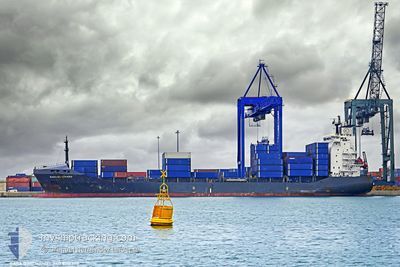
MAYFIELD
Container Ship
Current Trip
| Time Travelled | 3 days |
|---|---|
| Remaining Time | --- |
| Distance Travelled | 415.10 nm |
| Remaining Distance | --- |
| AVG Speed | 11 Knots |
| MAX Speed | 12.8 Knots |
| AVG Wind | 7.4 knots |
| MAX Wind | 18.9 knots |
| MIN Temp | 11.5°C / 52.7°F |
| MAX Temp | 16.4°C / 61.52°F |
| Draught | 8.1 m |
| Position Received | 3 d ago |
Current Position
| Longitude | --- |
|---|---|
| Latitude | --- |
| Status | Under way using engine |
| Speed | 12 Knots |
| Course | 205.6° |
| Area | Aegean Sea |
| Station | T-AIS |
| Position Received | 3 d ago |
Information
The current position of MAYFIELD is in Aegean Sea with coordinates 37.31704° / 23.62107° as reported on 2025-02-18 09:38 by AIS to our vessel tracker app. The vessel's current speed is 12 Knots
The vessel MAYFIELD (IMO: 9216353, MMSI: 538009458) is a Container Ship that was built in 2001 ( 24 years old ). It's sailing under the flag of [MH] Marshall Is.
In this page you can find informations about the vessels current position, last detected port calls, and current voyage information. If the vessels is not in coverage by AIS you will find the latest position.
The current position of MAYFIELD is detected by our AIS receivers and we are not responsible for the reliability of the data. The last position was recorded while the vessel was in Coverage by the Ais receivers of our vessel tracking app.
The current draught of MAYFIELD as reported by AIS is 8.1 meters
Weather
| Temperature | 13°C / 55.4°F |
|---|---|
| Wind Speed | 24 knots |
| Direction | 58° ENE |
| Pressure | 1026.5 hPa |
| Humidity | 60.9 % |
| Cloud Coverage | 50 % |
Featured Company
Last Port Calls
| Port | Arrival | Departure | Time In Port |
|---|---|---|---|
| 2025-02-16 18:25 | 2025-02-18 06:05 | 1 d | |
| 2025-02-11 08:08 | 2025-02-12 21:39 | 1 d | |
| 2025-02-06 14:51 | 2025-02-08 20:35 | 2 d | |
| 2025-01-26 17:03 | 2025-01-28 18:51 | 2 d | |
| 2025-01-23 01:30 | 2025-01-24 13:36 | 1 d | |
| 2025-01-13 22:50 | 2025-01-18 14:56 | 4 d | |
| 2025-01-09 23:19 | 2025-01-11 20:20 | 1 d | |
| 2025-01-01 12:45 | 2025-01-03 23:36 | 2 d | |
| 2024-12-28 16:34 | 2024-12-30 09:49 | 1 d | |
| 2024-12-20 07:47 | 2024-12-21 23:51 | 1 d |
Last Trips
| Origin | Departure | Destination | Arrival | Distance | |
|---|---|---|---|---|---|
| 2025-02-12 23:39 | 2025-02-16 20:25 | 584.05 nm | |||
| 2025-02-08 22:35 | 2025-02-11 10:08 | 579.01 nm | |||
| 2025-01-28 20:51 | 2025-02-06 16:51 | 603.26 nm | |||
| 2025-01-24 15:36 | 2025-01-26 19:03 | 576.60 nm | |||
| 2025-01-18 16:56 | 2025-01-23 03:30 | 583.86 nm | |||
| 2025-01-11 22:20 | 2025-01-14 00:50 | 571.42 nm | |||
| 2025-01-04 01:36 | 2025-01-10 01:19 | 583.51 nm | |||
| 2024-12-30 11:49 | 2025-01-01 14:45 | 571.61 nm | |||
| 2024-12-22 01:51 | 2024-12-28 18:34 | 631.91 nm | |||
| 2024-12-18 07:18 | 2024-12-20 09:47 | 571.50 nm |
Events
| Time | Event | Details | Position / Dest | Info |
|---|---|---|---|---|
| 2025-02-19 18:17 | STOP Moving | 5.23 nm, North West of BENGHAZI |
32.17153 / 19.97803
LYBEN
|
Speed: 0.2 kn Course: 11° |
| 2025-02-18 09:41 | Status Changed | Default Under way using engine |
37.30695 / 23.61493
LYBEN
|
Speed: 12 kn Course: 205.6° |
| 2025-02-18 09:38 | OUT of Coverage |
37.31704 / 23.62107
Aegean Sea
LYBEN
|
Speed: 12 kn Course: 205.6° |
|
| 2025-02-18 08:03 | ETA Changed | 2025/02/19 21:00 2026/01/01 21:00 |
37.62723 / 23.69432
LYBEN
|
Speed: 11.5 kn Course: 188.2° |
| 2025-02-18 07:51 | ETA Changed | 2026/01/01 21:00 2025/02/19 21:00 |
37.66586 / 23.69597
LYBEN
|
Speed: 11.4 kn Course: 158.5° |
| 2025-02-18 07:27 | ETA Changed | 2025/02/19 21:00 2026/01/01 21:00 |
37.73749 / 23.65948
LYBEN
|
Speed: 11.6 kn Course: 157.1° |
| 2025-02-18 07:03 | ETA Changed | 2026/01/01 21:00 2025/02/19 21:00 |
37.81019 / 23.62226
LYBEN
|
Speed: 11.5 kn Course: 157.5° |
| 2025-02-18 06:10 | START Moving | 0.44 nm, North of PSYTTALEIA |
37.95036 / 23.58808
LYBEN
|
Speed: 4.3 kn Course: 113° |
| 2025-02-18 06:07 | STOP Moving | 0.45 nm, North of PSYTTALEIA |
37.95027 / 23.58573
LYBEN
|
Speed: 0.3 kn Course: 63° |
| 2025-02-18 06:05 | PORT DEPARTURE |
|
37.95063 / 23.58645
LYBEN
|
Speed: 3.4 kn Course: 24° |