

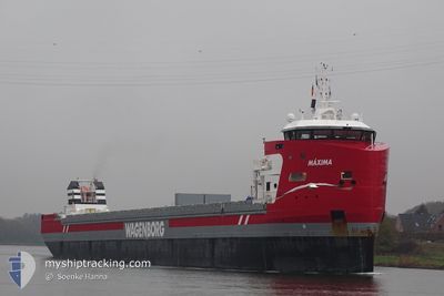
MAXIMA
Cargo

Current Trip
| Trip Time | 1 day |
|---|---|
| Trip Distance | 423.04 nm |
| AVG Speed | 9.3 Knots |
| MAX Speed | 13.1 Knots |
| Draught | 8.9 m |
| AVG Wind | 9.8 knots |
| MAX Wind | 25 knots |
| MIN Temp | -1°C / 30.2°F |
| MAX Temp | 7.6°C / 45.68°F |
| Position Received | Now |
Current Position
| Longitude | --- |
|---|---|
| Latitude | --- |
| Status | Moored |
| Speed | |
| Course | 45° |
| Area | Skaggerak |
| Station | T-AIS |
| Position Received | Now |
Information
The current position of MAXIMA is in Skaggerak with coordinates 59.12653° / 9.61778° as reported on 2025-03-21 02:33 by AIS to our vessel tracker app. The vessel's current speed is 0 Knots and is currently inside the port of PORSGRUNN.
The vessel MAXIMA (IMO: 9882061, MMSI: 246539000) is a Cargo It's sailing under the flag of [NL] Netherlands.
In this page you can find informations about the vessels current position, last detected port calls, and current voyage information. If the vessels is not in coverage by AIS you will find the latest position.
The current position of MAXIMA is detected by our AIS receivers and we are not responsible for the reliability of the data. The last position was recorded while the vessel was in Coverage by the Ais receivers of our vessel tracking app.
The current draught of MAXIMA as reported by AIS is 8.9 meters
Weather
| Temperature | -0.5°C / 31.1°F |
|---|---|
| Wind Speed | 3 knots |
| Direction | 346° NNW |
| Pressure | 1024.3 hPa |
| Humidity | 84.4 % |
| Cloud Coverage | 8 % |


Featured Company
Last Port Calls
| Port | Arrival | Departure | Time In Port |
|---|---|---|---|
| 2025-03-20 06:24 | |||
| 2025-03-16 16:42 | 2025-03-18 09:53 | 1 d | |
| 2025-02-27 23:06 | 2025-03-02 14:17 | 2 d | |
| 2025-02-23 19:30 | 2025-02-26 22:15 | 3 d | |
| 2025-02-09 14:55 | 2025-02-14 14:10 | 4 d | |
| 2025-01-19 12:30 | 2025-01-23 16:51 | 4 d | |
| 2025-01-10 12:05 | 2025-01-12 14:35 | 2 d |
Most Visited Ports (Last year)
| Port | Arrivals | |
|---|---|---|
| 5 | ||
| 4 | ||
| 3 | ||
| 3 | ||
| 3 | ||
| 3 |
Last Trips
| Origin | Departure | Destination | Arrival | Distance | |
|---|---|---|---|---|---|
| 2025-03-18 09:53 | 2025-03-20 06:24 | 423.04 nm | |||
| 2025-03-02 14:17 | 2025-03-16 16:42 | 2205.26 nm | |||
| 2025-02-26 22:15 | 2025-02-27 23:06 | 231.57 nm | |||
| 2025-02-14 14:10 | 2025-02-23 19:30 | 1028.62 nm | |||
| 2025-01-23 16:51 | 2025-02-09 14:55 | 3417.72 nm | |||
| 2025-01-12 14:35 | 2025-01-19 12:30 | 274.31 nm | |||
| 2024-12-30 21:25 | 2025-01-10 12:05 | 2137.19 nm |
Events
| Time | Event | Details | Position / Dest | Info |
|---|---|---|---|---|
| 2025-03-20 06:00 | Status Changed | Moored Under way using engine |
59.12649 / 9.61776
[NO] PORSGRUNN
|
Speed: Course: 45° |
| 2025-03-20 05:46 | STOP Moving |
59.12640 / 9.61741
[NO] PORSGRUNN
|
Speed: 0.3 kn Course: 56° |
|
| 2025-03-20 05:24 | PORT ARRIVAL |
|
59.12126 / 9.60516
[NO] PORSGRUNN
|
Speed: 3.6 kn Course: 44° |
| 2025-03-19 16:43 | Change Sea Area | Norwegian part of the Skaggerak Danish part of the Skaggerak |
57.67232 / 8.74447
Skaggerak
NOHRY
|
Speed: 9 kn Course: 30.7° |
| 2025-03-19 13:43 | Detected in Sea | Danish part of the Skaggerak |
57.30011 / 8.29523
Skaggerak
NOHRY
|
Speed: 9.6 kn Course: 29.7° |
| 2025-03-19 00:13 | Change Sea Area | Danish part of the North Sea German part of the North Sea |
55.19812 / 7.39305
North Sea
NOHRY
|
Speed: 9.3 kn Course: 353.3° |
| 2025-03-18 15:49 | Status Changed | Under way using engine Default |
54.00362 / 8.22170
NOHRY
|
Speed: 12.4 kn Course: 276° |
| 2025-03-18 15:46 | Status Changed | Default Under way using engine |
54.00220 / 8.24216
NOHRY
|
Speed: 12.3 kn Course: 276.8° |
| 2025-03-18 08:53 | PORT DEPARTURE |
|
53.54552 / 9.85634
NOHRY
|
Speed: 8.2 kn Course: 287° |
| 2025-03-18 08:15 | Status Changed | Under way using engine Moored |
53.50977 / 9.95074
[DE] HAMBURG
|
Speed: 3.8 kn Course: 325° |