
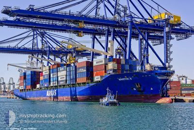
MARTHA A
Container Ship
Current Trip
SUEZ
| Time Travelled | 5 days |
|---|---|
| Remaining Time | --- |
| Distance Travelled | 603.33 nm |
| Remaining Distance | --- |
| AVG Speed | 9.9 Knots |
| MAX Speed | 16.3 Knots |
| AVG Wind | 15 knots |
| MAX Wind | 28.3 knots |
| MIN Temp | 11.3°C / 52.34°F |
| MAX Temp | 27.8°C / 82.04°F |
| Draught | 11.4 m |
| Position Received | 2 d ago |
Current Position
| Longitude | --- |
|---|---|
| Latitude | --- |
| Status | Under way using engine |
| Speed | 11.2 Knots |
| Course | 318° |
| Area | Gulf of Suez |
| Station | T-AIS |
| Position Received | 2 d ago |
Information
The current position of MARTHA A is in Gulf of Suez with coordinates 30.31631° / 32.41116° as reported on 2025-03-20 07:47 by AIS to our vessel tracker app. The vessel's current speed is 11.2 Knots
The vessel MARTHA A (IMO: 9299484, MMSI: 271044070) is a Container Ship that was built in 2005 ( 20 years old ). It's sailing under the flag of [TR] Turkey.
In this page you can find informations about the vessels current position, last detected port calls, and current voyage information. If the vessels is not in coverage by AIS you will find the latest position.
The current position of MARTHA A is detected by our AIS receivers and we are not responsible for the reliability of the data. The last position was recorded while the vessel was in Coverage by the Ais receivers of our vessel tracking app.
The current draught of MARTHA A as reported by AIS is 11.4 meters
Weather
| Temperature | 13.8°C / 56.84°F |
|---|---|
| Wind Speed | 5 knots |
| Direction | 141° SE |
| Pressure | 1026 hPa |
| Humidity | 63.1 % |
| Cloud Coverage | 7 % |
Featured Company
Last Port Calls
| Port | Arrival | Departure | Time In Port |
|---|---|---|---|
| 2025-03-20 04:47 | 2025-03-20 13:18 | 8 h | |
| 2025-03-17 21:57 | 2025-03-18 05:10 | 7 h | |
| 2025-03-15 13:24 | 2025-03-16 00:02 | 10 h | |
| 2025-03-08 03:17 | 2025-03-09 07:26 | 1 d | |
| 2025-03-04 14:17 | 2025-03-05 12:30 | 22 h | |
| 2025-02-24 23:53 | 2025-02-25 12:09 | 12 h | |
| 2025-02-22 12:24 | 2025-02-23 05:33 | 17 h | |
| 2025-02-21 03:53 | 2025-02-21 13:20 | 9 h | |
| 2025-02-17 12:27 | 2025-02-19 09:52 | 1 d | |
| 2025-02-14 16:22 | 2025-02-15 03:50 | 11 h |
Last Trips
| Origin | Departure | Destination | Arrival | Distance | |
|---|---|---|---|---|---|
| 2025-03-18 08:10 | 2025-03-20 06:47 | 317.53 nm | |||
| 2025-03-16 03:02 | 2025-03-18 00:57 | 562.06 nm | |||
| 2025-03-09 12:56 | 2025-03-15 16:24 | 2354.12 nm | |||
| 2025-03-05 18:00 | 2025-03-08 08:47 | 502.54 nm | |||
| 2025-02-25 15:09 | 2025-03-04 19:47 | 2445.56 nm | |||
| 2025-02-23 07:33 | 2025-02-25 02:53 | 575.26 nm | |||
| 2025-02-19 12:52 | 2025-02-22 14:24 | 770.55 nm | |||
| 2025-02-19 12:52 | 2025-02-21 05:53 | 376.16 nm | |||
| 2025-02-15 06:50 | 2025-02-17 15:27 | 623.66 nm | |||
| 2025-02-13 19:28 | 2025-02-14 19:22 | 315.31 nm |
Events
| Time | Event | Details | Position / Dest | Info |
|---|---|---|---|---|
| 2025-03-21 07:49 | STOP Moving | 8.34 nm, North West of EL DEKHEILA |
31.21967 / 29.66828
SUEZ
|
Speed: 0.1 kn Course: 325° |
| 2025-03-20 13:18 | PORT DEPARTURE |
|
31.23401 / 32.34754
SUEZ
|
Speed: 11.6 kn Course: 13° |
| 2025-03-20 07:48 | Status Changed | Default Under way using engine |
30.32000 / 32.40787
[EG] SUEZ CANAL
|
Speed: 11.2 kn Course: 318° |
| 2025-03-20 07:47 | OUT of Coverage |
30.31631 / 32.41116
Gulf of Suez
[EG] SUEZ CANAL
|
Speed: 11.2 kn Course: 322.3° |
|
| 2025-03-20 07:36 | Status Changed | Under way using engine Default |
30.28774 / 32.43707
[EG] SUEZ CANAL
|
Speed: 10.6 kn Course: 290° |
| 2025-03-20 07:06 | Status Changed | Default Under way using engine |
30.25185 / 32.53035
[EG] SUEZ CANAL
|
Speed: 10.4 kn Course: 315° |
| 2025-03-20 05:09 | Status Changed | Under way using engine At anchor |
29.98347 / 32.58640
[EG] SUEZ CANAL
|
Speed: 5.9 kn Course: 352° |
| 2025-03-20 04:47 | PORT ARRIVAL |
|
29.94693 / 32.57886
[EG] SUEZ CANAL
|
Speed: 6.8 kn Course: 30° |
| 2025-03-20 04:10 | Change Sea Area | Egyptian part of the Gulf of Suez Egyptian part of the Red Sea |
29.87315 / 32.55087
Gulf of Suez
|
Speed: 7.6 kn Course: 355.4° |
| 2025-03-20 04:08 | Status Changed | At anchor Default |
29.86984 / 32.55128
SUEZ
|
Speed: 5.7 kn Course: 313° |