
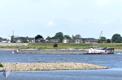
MARIS
Cargo
Current Trip
MAGDEBURG
| Time Travelled | 1 day |
|---|---|
| Remaining Time | --- |
| Distance Travelled | 88.86 nm |
| Remaining Distance | --- |
| AVG Speed | 5.4 Knots |
| MAX Speed | 8 Knots |
| AVG Wind | 15.4 knots |
| MAX Wind | 19.8 knots |
| MIN Temp | -4.3°C / 24.26°F |
| MAX Temp | -1.2°C / 29.84°F |
| Draught | 2.4 m |
| Position Received | 1 h, 9 m ago |
Current Position
| Longitude | --- |
|---|---|
| Latitude | --- |
| Status | Moored |
| Speed | |
| Course | 262° |
| Area | North Sea |
| Station | T-AIS |
| Position Received | 1 h, 9 m ago |
Info
Information
The current position of MARIS is in North Sea with coordinates 52.38250° / 9.25910° as reported on 2026-01-09 19:36 by AIS to our vessel tracker app. The vessel's current speed is 0 Knots
The vessel MARIS (MMSI: 244660016) is a Cargo It's sailing under the flag of [NL] Netherlands.
In this page you can find informations about the vessels current position, last detected port calls, and current voyage information. If the vessels is not in coverage by AIS you will find the latest position.
The current position of MARIS is detected by our AIS receivers and we are not responsible for the reliability of the data. The last position was recorded while the vessel was in Coverage by the Ais receivers of our vessel tracking app.
The current draught of MARIS as reported by AIS is 2.4 meters
Weather
| Temperature | -4°C / 24.8°F |
|---|---|
| Wind Speed | 18 knots |
| Direction | 81° E |
| Pressure | 994.5 hPa |
| Humidity | 94.6 % |
| Cloud Coverage | 100 % |
Featured Company
Last Port Calls
| Port | Arrival | Departure | Time In Port |
|---|---|---|---|
| 2026-01-08 12:46 | 2026-01-08 14:26 | 1 h | |
| 2026-01-04 13:21 | 2026-01-04 13:58 | 36 m | |
| 2026-01-02 17:09 | 2026-01-03 07:12 | 14 h | |
| 2025-12-20 13:47 | 2026-01-02 06:27 | 12 d | |
| 2025-12-20 09:57 | 2025-12-20 10:20 | 22 m | |
| 2025-12-19 11:47 | 2025-12-19 12:36 | 49 m | |
| 2025-12-17 13:15 | 2025-12-18 15:47 | 1 d | |
| 2025-12-16 15:14 | 2025-12-16 18:06 | 2 h | |
| 2025-12-13 03:13 | 2025-12-13 09:02 | 5 h | |
| 2025-12-08 19:23 | 2025-12-09 07:22 | 11 h |
Last Trips
| Origin | Departure | Destination | Arrival | Distance | |
|---|---|---|---|---|---|
| 2026-01-04 13:58 | 2026-01-08 12:46 | 194.74 nm | |||
| 2026-01-03 07:12 | 2026-01-04 13:21 | 83.23 nm | |||
| 2026-01-02 06:27 | 2026-01-02 17:09 | 71.21 nm | |||
| 2025-12-20 10:20 | 2025-12-20 13:47 | 29.20 nm | |||
| 2025-12-19 12:36 | 2025-12-20 09:57 | 112.98 nm | |||
| 2025-12-18 15:47 | 2025-12-19 11:47 | 18.45 nm | |||
| 2025-12-16 18:06 | 2025-12-17 13:15 | 2.57 nm | |||
| 2025-12-13 09:02 | 2025-12-16 15:14 | 173.86 nm | |||
| 2025-12-09 07:22 | 2025-12-13 03:13 | 232.98 nm | |||
| 2025-12-08 11:34 | 2025-12-08 19:23 | 38.25 nm |
Events
| Time | Event | Details | Position / Dest | Info |
|---|---|---|---|---|
| 2026-01-09 19:45 | Status Changed | Default Moored |
52.38250 / 9.25909
MAGDEBURG
|
Speed: Course: 262° |
| 2026-01-09 19:36 | Status Changed | Moored Default |
52.38250 / 9.25910
MAGDEBURG
|
Speed: Course: 261° |
| 2026-01-09 19:36 | OUT of Coverage |
52.38250 / 9.25910
North Sea
|
Speed: Course: 358° |
|
| 2026-01-09 19:01 | Status Changed | Default Moored |
52.38167 / 9.25833
MAGDEBURG
|
Speed: 0.1 kn Course: 266° |
| 2026-01-09 18:50 | STOP Moving | 7.66 nm, West of KOLENFELD |
52.38248 / 9.25917
MAGDEBURG
|
Speed: 0.2 kn Course: 262° |
| 2026-01-09 18:50 | Status Changed | Moored Default |
52.38245 / 9.25921
MAGDEBURG
|
Speed: 4 kn Course: -1° |
| 2026-01-09 18:40 | Status Changed | Default Under way using engine |
52.38334 / 9.27500
MAGDEBURG
|
Speed: 5.4 kn Course: 261° |
| 2026-01-09 17:03 | Status Changed | Under way using engine Default |
52.40813 / 9.50191
MAGDEBURG
|
Speed: 5 kn Course: 240° |
| 2026-01-09 17:03 | IN Coverage |
52.40816 / 9.49951
North Sea
|
Speed: 5.3 kn Course: 267° |
|
| 2026-01-09 15:26 | OUT of Coverage |
52.41383 / 9.72167
North Sea
|
Speed: 5.6 kn Course: 299° |