

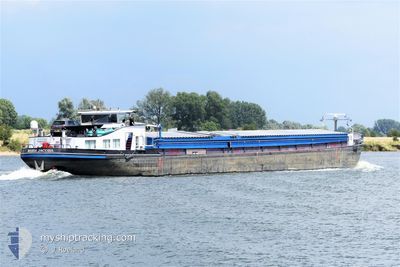
MARIA JACOBA
Cargo

Current Trip
| Time Travelled | 2 days |
|---|---|
| Remaining Time | --- |
| Distance Travelled | 59.55 nm |
| Remaining Distance | --- |
| AVG Speed | 6 Knots |
| MAX Speed | 8.1 Knots |
| AVG Wind | 11.5 knots |
| MAX Wind | 16.8 knots |
| MIN Temp | 1.8°C / 35.24°F |
| MAX Temp | 3.9°C / 39.02°F |
| Draught | 0 m |
| Position Received | 1 d ago |
Current Position
| Longitude | --- |
|---|---|
| Latitude | --- |
| Status | Under way using engine |
| Speed | 4.7 Knots |
| Course | 133.6° |
| Area | North Sea |
| Station | T-AIS |
| Position Received | 1 d ago |
Information
The current position of MARIA JACOBA is in North Sea with coordinates 52.36287° / 6.07941° as reported on 2025-02-11 16:46 by AIS to our vessel tracker app. The vessel's current speed is 4.7 Knots
The vessel MARIA JACOBA (MMSI: 244210525) is a Cargo It's sailing under the flag of [NL] Netherlands.
In this page you can find informations about the vessels current position, last detected port calls, and current voyage information. If the vessels is not in coverage by AIS you will find the latest position.
The current position of MARIA JACOBA is detected by our AIS receivers and we are not responsible for the reliability of the data. The last position was recorded while the vessel was in Coverage by the Ais receivers of our vessel tracking app.
Weather
| Temperature | 3.9°C / 39.02°F |
|---|---|
| Wind Speed | 8 knots |
| Direction | 154° SSE |
| Pressure | 1018.6 hPa |
| Humidity | 95.8 % |
| Cloud Coverage | 100 % |


Featured Company
Last Port Calls
| Port | Arrival | Departure | Time In Port |
|---|---|---|---|
| 2025-02-10 15:58 | 2025-02-11 01:15 | 9 h | |
| 2025-02-06 08:11 | 2025-02-07 09:19 | 1 d | |
| 2025-02-05 11:44 | 2025-02-06 01:01 | 13 h | |
| 2025-02-05 10:57 | 2025-02-05 11:31 | 33 m | |
| 2025-02-04 11:53 | 2025-02-04 12:51 | 58 m | |
| 2025-02-03 14:26 | 2025-02-04 08:39 | 18 h | |
| 2025-02-03 09:54 | 2025-02-03 10:43 | 48 m | |
| 2025-01-29 22:11 | 2025-01-30 13:46 | 15 h | |
| 2025-01-29 17:21 | 2025-01-29 17:59 | 38 m | |
| 2025-01-28 19:06 | 2025-01-29 13:58 | 18 h |
Last Trips
| Origin | Departure | Destination | Arrival | Distance | |
|---|---|---|---|---|---|
| 2025-02-07 10:19 | 2025-02-10 16:58 | 54.41 nm | |||
| 2025-02-06 02:01 | 2025-02-06 09:11 | 46.67 nm | |||
| 2025-02-05 12:31 | 2025-02-05 12:44 | 2.22 nm | |||
| 2025-02-04 13:51 | 2025-02-05 11:57 | 87.45 nm | |||
| 2025-02-04 09:39 | 2025-02-04 12:53 | 14.15 nm | |||
| 2025-02-03 11:43 | 2025-02-03 15:26 | 14.07 nm | |||
| 2025-01-30 14:46 | 2025-02-03 10:54 | 104.68 nm | |||
| 2025-01-29 18:59 | 2025-01-29 23:11 | 36.27 nm | |||
| 2025-01-29 14:58 | 2025-01-29 18:21 | 33.37 nm | |||
| 2025-01-28 11:23 | 2025-01-28 20:06 | 55.79 nm |
Events
| Time | Event | Details | Position / Dest | Info |
|---|---|---|---|---|
| 2025-02-11 16:46 | OUT of Coverage |
52.36287 / 6.07941
North Sea
|
Speed: 4.7 kn Course: 133.6° |
|
| 2025-02-11 16:46 | IN Coverage |
52.36287 / 6.07941
North Sea
|
Speed: 4.7 kn Course: 133.6° |
|
| 2025-02-11 15:38 | OUT of Coverage |
52.43739 / 6.11436
North Sea
|
Speed: 5.3 kn Course: 142.7° |
|
| 2025-02-11 10:21 | START Moving | 0.21 nm, North West of LELYSTAD |
52.52877 / 5.43487
GENEMUIDEN
|
Speed: 4.1 kn Course: 4.1° |
| 2025-02-11 10:19 | Status Changed | Under way using engine Moored |
52.52729 / 5.43476
GENEMUIDEN
|
Speed: 1.9 kn Course: 511° |
| 2025-02-11 10:15 | Status Changed | Moored Under way using engine |
52.52692 / 5.43471
GENEMUIDEN
|
Speed: 0.1 kn Course: 511° |
| 2025-02-11 10:13 | STOP Moving | 0.16 nm, West of LELYSTAD |
52.52690 / 5.43468
GENEMUIDEN
|
Speed: 0.2 kn Course: 511° |
| 2025-02-11 07:26 | START Moving | 0.08 nm, West of SCHELLINGWOUDE |
52.38067 / 4.96253
GENEMUIDEN
|
Speed: 4.9 kn Course: 135.3° |
| 2025-02-11 07:24 | Status Changed | Under way using engine Moored |
52.38166 / 4.96059
GENEMUIDEN
|
Speed: 1.5 kn Course: 511° |
| 2025-02-11 07:19 | Status Changed | Moored Under way using engine |
52.38179 / 4.96020
GENEMUIDEN
|
Speed: Course: 511° |