

MARI
Cargo

Current Trip
MUSHOLM
| Time Travelled | 2 days |
|---|---|
| Remaining Time | --- |
| Distance Travelled | 32.69 nm |
| Remaining Distance | --- |
| AVG Speed | 5 Knots |
| MAX Speed | 7 Knots |
| AVG Wind | 4.8 knots |
| MAX Wind | 7 knots |
| MIN Temp | 5.9°C / 42.62°F |
| MAX Temp | 10.6°C / 51.08°F |
| Draught | 2.2 m |
| Position Received | Now |
Current Position
| Longitude | --- |
|---|---|
| Latitude | --- |
| Status | Moored |
| Speed | 0.1 Knots |
| Course | 205° |
| Area | Kattegat |
| Station | T-AIS |
| Position Received | Now |
Information
The current position of MARI is in Kattegat with coordinates 55.51718° / 11.11928° as reported on 2025-04-23 18:05 by AIS to our vessel tracker app. The vessel's current speed is 0.1 Knots
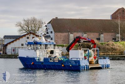
The vessel MARI (MMSI: 219019354) is a Cargo It's sailing under the flag of [DK] Denmark.
In this page you can find informations about the vessels current position, last detected port calls, and current voyage information. If the vessels is not in coverage by AIS you will find the latest position.
The current position of MARI is detected by our AIS receivers and we are not responsible for the reliability of the data. The last position was recorded while the vessel was in Coverage by the Ais receivers of our vessel tracking app.
The current draught of MARI as reported by AIS is 2.2 meters
Weather
| Temperature | 9.4°C / 48.92°F |
|---|---|
| Wind Speed | 10 knots |
| Direction | 41° NE |
| Pressure | 1017.6 hPa |
| Humidity | 83.5 % |
| Cloud Coverage | 88 % |


Featured Company
Last Port Calls
| Port | Arrival | Departure | Time In Port |
|---|---|---|---|
| 2025-04-20 20:25 | 2025-04-21 10:34 | 14 h | |
| 2025-04-13 01:59 | 2025-04-13 11:32 | 9 h | |
| 2025-04-06 22:00 | 2025-04-07 16:14 | 18 h | |
| 2025-04-01 10:26 | 2025-04-01 15:42 | 5 h | |
| 2025-03-23 22:33 | 2025-03-24 17:20 | 18 h | |
| 2025-03-17 08:56 | 2025-03-17 10:36 | 1 h | |
| 2025-03-13 17:54 | 2025-03-13 20:19 | 2 h | |
| 2025-03-12 15:24 | 2025-03-12 16:59 | 1 h | |
| 2025-02-26 15:26 | 2025-02-26 17:31 | 2 h | |
| 2025-02-25 09:05 | 2025-02-25 13:00 | 3 h |
Last Trips
| Origin | Departure | Destination | Arrival | Distance | |
|---|---|---|---|---|---|
| 2025-04-13 11:32 | 2025-04-20 20:25 | 40.14 nm | |||
| 2025-04-07 16:14 | 2025-04-13 01:59 | 46.55 nm | |||
| 2025-04-01 15:42 | 2025-04-06 22:00 | 59.58 nm | |||
| 2025-03-24 17:20 | 2025-04-01 10:26 | 69.86 nm | |||
| 2025-03-17 10:36 | 2025-03-23 22:33 | 65.44 nm | |||
| 2025-03-13 20:19 | 2025-03-17 08:56 | 41.66 nm | |||
| 2025-03-12 16:59 | 2025-03-13 17:54 | 53.90 nm | |||
| 2025-02-26 17:31 | 2025-03-12 15:24 | 124.99 nm | |||
| 2025-02-25 13:00 | 2025-02-26 15:26 | 54.72 nm | |||
| 2025-02-13 14:21 | 2025-02-25 09:05 | 90.97 nm |
Events
| Time | Event | Details | Position / Dest | Info |
|---|---|---|---|---|
| 2025-04-23 15:03 | Status Changed | Moored Default |
55.51718 / 11.11930
MUSHOLM
|
Speed: Course: 205° |
| 2025-04-23 15:00 | Status Changed | Default Moored |
55.51718 / 11.11930
MUSHOLM
|
Speed: Course: 200° |
| 2025-04-23 13:21 | Status Changed | Moored Under way using engine |
55.51720 / 11.11928
MUSHOLM
|
Speed: 0.1 kn Course: 210° |
| 2025-04-23 13:14 | STOP Moving | 9.29 nm, South of KALUNDBORG |
55.51702 / 11.11938
MUSHOLM
|
Speed: 0.3 kn Course: 212° |
| 2025-04-23 12:51 | START Moving | 9.19 nm, North of KORSOR |
55.48448 / 11.11013
MUSHOLM
|
Speed: 6.3 kn Course: 22° |
| 2025-04-23 12:42 | STOP Moving | 9.13 nm, North of KORSOR |
55.48337 / 11.10742
MUSHOLM
|
Speed: 0.2 kn Course: 171° |
| 2025-04-23 12:19 | START Moving | 9.42 nm, North of KORSOR |
55.48432 / 11.07083
MUSHOLM
|
Speed: 4.8 kn Course: 38° |
| 2025-04-23 12:14 | STOP Moving | 9.35 nm, North of KORSOR |
55.48288 / 11.06857
MUSHOLM
|
Speed: 0.3 kn Course: 107° |
| 2025-04-23 12:06 | START Moving | 9.23 nm, North of KORSOR |
55.47948 / 11.06100
MUSHOLM
|
Speed: 3.2 kn Course: 28° |
| 2025-04-23 11:56 | STOP Moving | 9.17 nm, North of KORSOR |
55.47782 / 11.05697
MUSHOLM
|
Speed: 0.3 kn Course: 196° |