
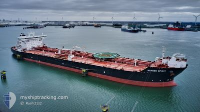
MARAN NANSEN
Oil Products Tanker
Current Trip
| Time Travelled | 2 days |
|---|---|
| Remaining Time | --- |
| Distance Travelled | 273.64 nm |
| Remaining Distance | 3.75 nm |
| AVG Speed | 11.6 Knots |
| MAX Speed | 14.6 Knots |
| AVG Wind | 20.9 knots |
| MAX Wind | 40 knots |
| MIN Temp | 6.8°C / 44.24°F |
| MAX Temp | 10.2°C / 50.36°F |
| Draught | 9.3 m |
| Position Received | 3 m ago |
Current Position
| Longitude | --- |
|---|---|
| Latitude | --- |
| Status | At anchor |
| Speed | |
| Course | 224° |
| Area | Kattegat |
| Station | T-AIS |
| Position Received | 3 m ago |
Info
Information
The current position of MARAN NANSEN is in Kattegat with coordinates 57.66040° / 10.64871° as reported on 2025-12-10 08:48 by AIS to our vessel tracker app. The vessel's current speed is 0 Knots and is heading at the port of SKAGEN. The estimated time of arrival as calculated by MyShipTracking vessel tracking app is 2025-12-08 19:30 LT
The vessel MARAN NANSEN (IMO: 9438860, MMSI: 311027500) is a Oil Products Tanker that was built in 2010 ( 15 years old ). It's sailing under the flag of [BS] Bahamas.
In this page you can find informations about the vessels current position, last detected port calls, and current voyage information. If the vessels is not in coverage by AIS you will find the latest position.
The current position of MARAN NANSEN is detected by our AIS receivers and we are not responsible for the reliability of the data. The last position was recorded while the vessel was in Coverage by the Ais receivers of our vessel tracking app.
The current draught of MARAN NANSEN as reported by AIS is 9.3 meters
Weather
| Temperature | 9.5°C / 49.1°F |
|---|---|
| Wind Speed | 23 knots |
| Direction | 235° SW |
| Pressure | 1003.5 hPa |
| Humidity | 85.9 % |
| Cloud Coverage | 100 % |
Featured Company
Most Visited Ports (Last year)
| Port | Arrivals | |
|---|---|---|
| 11 | ||
| 3 | ||
| 2 | ||
| 2 | ||
| 1 | ||
| 1 |
Last Trips
| Origin | Departure | Destination | Arrival | Distance | |
|---|---|---|---|---|---|
| 2025-11-26 14:58 | 2025-12-06 12:06 | 1368.81 nm | |||
| 2025-11-13 19:28 | 2025-11-25 09:15 | 2161.53 nm | |||
| 2025-11-03 17:23 | 2025-11-12 14:50 | 2369.35 nm | |||
| 2025-10-06 19:16 | 2025-10-30 17:01 | 2482.77 nm | |||
| 2025-09-15 23:45 | 2025-10-04 12:41 | 1638.23 nm |
Events
| Time | Event | Details | Position / Dest | Info |
|---|---|---|---|---|
| 2025-12-10 07:42 | Status Changed | At anchor Default |
57.66020 / 10.64899
DKSKA
|
Speed: Course: 235° |
| 2025-12-10 07:39 | Status Changed | Default At anchor |
57.66015 / 10.64904
DKSKA
|
Speed: Course: 234° |
| 2025-12-10 07:21 | Status Changed | At anchor Default |
57.66010 / 10.64907
DKSKA
|
Speed: Course: 240° |
| 2025-12-10 07:15 | Status Changed | Default At anchor |
57.66004 / 10.64921
DKSKA
|
Speed: Course: 239° |
| 2025-12-10 06:48 | Status Changed | At anchor Default |
57.65998 / 10.64929
DKSKA
|
Speed: Course: 236° |
| 2025-12-10 06:42 | Status Changed | Default At anchor |
57.66006 / 10.64925
DKSKA
|
Speed: Course: 236° |
| 2025-12-10 04:30 | Status Changed | At anchor Default |
57.66029 / 10.64894
DKSKA
|
Speed: Course: 226° |
| 2025-12-10 04:27 | Status Changed | Default At anchor |
57.66032 / 10.64891
DKSKA
|
Speed: Course: 225° |
| 2025-12-10 00:24 | Status Changed | At anchor Default |
57.66127 / 10.64600
DKSKA
|
Speed: Course: 189° |
| 2025-12-10 00:18 | Status Changed | Default At anchor |
57.66125 / 10.64591
DKSKA
|
Speed: Course: 190° |