
MANTA PENYEZ
General Cargo
Current Trip
| Trip Time | 23 days |
|---|---|
| Trip Distance | 38.99 nm |
| AVG Speed | 4.5 Knots |
| MAX Speed | 6.9 Knots |
| Draught | 9.9 m |
| AVG Wind | 8.1 knots |
| MAX Wind | 12 knots |
| MIN Temp | 24.5°C / 76.1°F |
| MAX Temp | 29.6°C / 85.28°F |
| Position Received | 2024-05-28 19:20 |
Current Position
| Longitude | --- |
|---|---|
| Latitude | --- |
| Status | Under way using engine |
| Speed | 13.3 Knots |
| Course | 153.9° |
| Area | Red Sea |
| Station | T-AIS |
| Position Received | 2024-05-28 19:20 |
Info
Information
The current position of MANTA PENYEZ is in Red Sea with coordinates 19.46360° / 39.06471° as reported on 2024-05-28 19:20 by AIS to our vessel tracker app. The vessel's current speed is 13.3 Knots and is currently inside the port of DJIBOUTI.
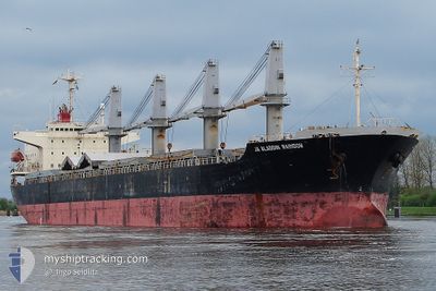
The vessel MANTA PENYEZ (IMO: 9196307, MMSI: 636015600) is a General Cargo that was built in 1999 ( 25 years old ). It's sailing under the flag of [LR] Liberia.
In this page you can find informations about the vessels current position, last detected port calls, and current voyage information. If the vessels is not in coverage by AIS you will find the latest position.
The current position of MANTA PENYEZ is detected by our AIS receivers and we are not responsible for the reliability of the data. The last position was recorded while the vessel was in Coverage by the Ais receivers of our vessel tracking app.
The current draught of MANTA PENYEZ as reported by AIS is 9.9 meters
Weather
| Temperature | 25.4°C / 77.72°F |
|---|---|
| Wind Speed | 9 knots |
| Direction | 90° E |
| Pressure | 1012.9 hPa |
| Humidity | 62.3 % |
| Cloud Coverage | 100 % |
Featured Company
Most Visited Ports (Last year)
| Port | Arrivals | |
|---|---|---|
| 3 | ||
| 2 | ||
| 1 | ||
| 1 | ||
| 1 | ||
| 1 |
Events
| Time | Event | Details | Position / Dest | Info |
|---|---|---|---|---|
| 2024-11-26 22:30 | STOP Moving |
11.60091 / 43.06559
[DJ] DJIBOUTI
|
Speed: Course: 83° |
|
| 2024-11-26 22:29 | PORT ARRIVAL |
|
11.60091 / 43.06559
[DJ] DJIBOUTI
|
Speed: 1.2 kn Course: 105° |
| 2024-11-26 21:13 | START Moving | 5.6 nm, North West of DJIBOUTI |
11.65432 / 43.04162
DJ JIB
|
Speed: 3.1 kn Course: 155° |
| 2024-11-26 18:26 | STOP Moving | 4.42 nm, North West of DJIBOUTI |
11.65248 / 43.06366
DJ JIB
|
Speed: 0.3 kn Course: 122° |
| 2024-11-26 16:44 | START Moving | 3.32 nm, North East of DJIBOUTI |
11.65340 / 43.16351
DJ JIB
|
Speed: 3.2 kn Course: 281° |
| 2024-11-19 20:51 | STOP Moving | 3.49 nm, North East of DJIBOUTI |
11.65667 / 43.16410
DJ JIB
|
Speed: 0.1 kn Course: 146° |
| 2024-11-19 20:13 | START Moving | 3.77 nm, North of DJIBOUTI |
11.67422 / 43.11766
DJ JIB
|
Speed: 4.8 kn Course: 110° |
| 2024-11-19 10:04 | STOP Moving | 4.04 nm, North of DJIBOUTI |
11.67718 / 43.10908
DJ JIB
|
Speed: 0.2 kn Course: 110° |
| 2024-11-19 09:09 | START Moving | 3.33 nm, North East of DJIBOUTI |
11.65433 / 43.16281
DJ JIB
|
Speed: 3.1 kn Course: 277° |