

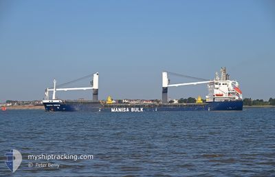
MANISA GRETA
General Cargo

Current Trip
| Time Travelled | 1 day |
|---|---|
| Remaining Time | 1 day |
| Distance Travelled | 374.31 nm |
| Remaining Distance | 450.93 nm |
| AVG Speed | 9.8 Knots |
| MAX Speed | 12.2 Knots |
| AVG Wind | 9 knots |
| MAX Wind | 16 knots |
| MIN Temp | 12.6°C / 54.68°F |
| MAX Temp | 16.6°C / 61.88°F |
| Draught | 7.2 m |
| Position Received | 50 m ago |
Current Position
| Longitude | --- |
|---|---|
| Latitude | --- |
| Status | Under way using engine |
| Speed | 10 Knots |
| Course | 82.9° |
| Area | Alboran Sea |
| Station | T-AIS |
| Position Received | 50 m ago |
Information
The current position of MANISA GRETA is in Alboran Sea with coordinates 36.28647° / -2.88367° as reported on 2025-03-27 10:13 by AIS to our vessel tracker app. The vessel's current speed is 10 Knots and is heading at the port of PALAMOS. The estimated time of arrival as calculated by MyShipTracking vessel tracking app is 2025-03-29 07:32 LT
The vessel MANISA GRETA (IMO: 9391024, MMSI: 255806248) is a General Cargo that was built in 2007 ( 18 years old ). It's sailing under the flag of [PT] Portugal.
In this page you can find informations about the vessels current position, last detected port calls, and current voyage information. If the vessels is not in coverage by AIS you will find the latest position.
The current position of MANISA GRETA is detected by our AIS receivers and we are not responsible for the reliability of the data. The last position was recorded while the vessel was in Coverage by the Ais receivers of our vessel tracking app.
The current draught of MANISA GRETA as reported by AIS is 7.2 meters
Weather
| Temperature | 16.1°C / 60.98°F |
|---|---|
| Wind Speed | 10 knots |
| Direction | 265° W |
| Pressure | 1016.8 hPa |
| Humidity | 79.6 % |
| Cloud Coverage | --- |


Featured Company
Last Port Calls
| Port | Arrival | Departure | Time In Port |
|---|---|---|---|
| 2025-03-23 22:47 | 2025-03-25 18:09 | 1 d | |
| 2025-03-19 16:44 | 2025-03-23 11:34 | 3 d | |
| 2025-03-12 09:31 | 2025-03-14 10:53 | 2 d | |
| 2025-02-26 06:16 | 2025-03-03 11:01 | 5 d | |
| 2025-02-17 08:24 | 2025-02-18 17:32 | 1 d | |
| 2025-02-15 11:58 | 2025-02-16 17:59 | 1 d | |
| 2025-02-09 01:59 | 2025-02-09 23:15 | 21 h | |
| 2025-02-05 09:13 | 2025-02-07 15:08 | 2 d | |
| 2025-01-31 18:46 | 2025-02-01 14:51 | 20 h | |
| 2025-01-22 19:24 | 2025-01-26 10:17 | 3 d |
Most Visited Ports (Last year)
| Port | Arrivals | |
|---|---|---|
| 5 | ||
| 4 | ||
| 4 | ||
| 3 | ||
| 3 | ||
| 3 |
Last Trips
| Origin | Departure | Destination | Arrival | Distance | |
|---|---|---|---|---|---|
| 2025-03-23 11:34 | 2025-03-23 22:47 | 9.57 nm | |||
| 2025-03-14 10:53 | 2025-03-19 16:44 | 558.85 nm | |||
| 2025-03-03 11:01 | 2025-03-12 09:31 | 1230.30 nm | |||
| 2025-02-18 17:32 | 2025-02-26 06:16 | 1487.83 nm | |||
| 2025-02-16 17:59 | 2025-02-17 08:24 | 122.07 nm | |||
| 2025-02-09 23:15 | 2025-02-15 11:58 | 1138.25 nm | |||
| 2025-02-07 15:08 | 2025-02-09 01:59 | 331.92 nm | |||
| 2025-02-01 14:51 | 2025-02-05 09:13 | 826.61 nm | |||
| 2025-01-26 10:17 | 2025-01-31 18:46 | 814.14 nm | |||
| 2025-01-18 03:49 | 2025-01-22 19:24 | 802.75 nm |
Events
| Time | Event | Details | Position / Dest | Info |
|---|---|---|---|---|
| 2025-03-27 10:17 | Status Changed | Default Under way using engine |
36.28768 / -2.86987
ESPAL
|
Speed: 10 kn Course: 82.9° |
| 2025-03-27 09:45 | Status Changed | Under way using engine Default |
36.27714 / -2.97975
ESPAL
|
Speed: 10.3 kn Course: 80° |
| 2025-03-27 09:27 | IN Coverage |
36.27748 / -2.97630
Alboran Sea
ESPAL
|
Speed: 10.1 kn Course: 82.6° |
|
| 2025-03-27 08:39 | Status Changed | Default Under way using engine |
36.25575 / -3.21406
ESPAL
|
Speed: 10.4 kn Course: 86.5° |
| 2025-03-27 08:36 | OUT of Coverage |
36.25521 / -3.22347
Alboran Sea
ESPAL
|
Speed: 10.4 kn Course: 86.5° |
|
| 2025-03-27 07:57 | Status Changed | Under way using engine Default |
36.24347 / -3.36063
ESPAL
|
Speed: 10.2 kn Course: 81° |
| 2025-03-27 07:51 | Status Changed | Default Under way using engine |
36.24077 / -3.38297
ESPAL
|
Speed: 10.2 kn Course: 81.3° |
| 2025-03-27 06:53 | Status Changed | Under way using engine Default |
36.21138 / -3.57903
ESPAL
|
Speed: 10 kn Course: 82° |
| 2025-03-27 06:44 | Status Changed | Default Under way using engine |
36.20737 / -3.61070
ESPAL
|
Speed: 9.8 kn Course: 80.2° |
| 2025-03-27 04:18 | Status Changed | Under way using engine Default |
36.14068 / -4.13035
ESPAL
|
Speed: 10.6 kn Course: 82° |