

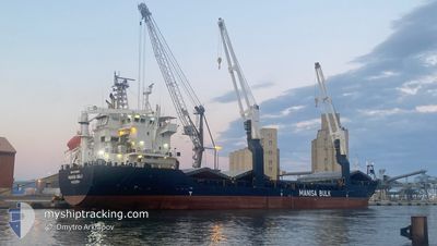
MANISA BALU
General Cargo

Current Trip
| Time Travelled | 20 h, 35 mins |
|---|---|
| Remaining Time | --- |
| Distance Travelled | 116.95 nm |
| Remaining Distance | --- |
| AVG Speed | 10.1 Knots |
| MAX Speed | 11.1 Knots |
| AVG Wind | 12.3 knots |
| MAX Wind | 19.7 knots |
| MIN Temp | 14.5°C / 58.1°F |
| MAX Temp | 15.4°C / 59.72°F |
| Draught | 4.5 m |
| Position Received | 9 h, 10 m ago |
Current Position
| Longitude | --- |
|---|---|
| Latitude | --- |
| Status | Under way using engine |
| Speed | 9.9 Knots |
| Course | 192.1° |
| Area | Mediterranean Sea - Western Basin |
| Station | T-AIS |
| Position Received | 9 h, 10 m ago |
Information
The current position of MANISA BALU is in Mediterranean Sea - Western Basin with coordinates 42.38646° / 8.37361° as reported on 2025-03-30 00:04 by AIS to our vessel tracker app. The vessel's current speed is 9.9 Knots and is heading at the port of ORISTANO. The estimated time of arrival as calculated by MyShipTracking vessel tracking app is 2025-03-30 22:00 LT
The vessel MANISA BALU (IMO: 9391036, MMSI: 255899000) is a General Cargo that was built in 2008 ( 17 years old ). It's sailing under the flag of [PT] Portugal.
In this page you can find informations about the vessels current position, last detected port calls, and current voyage information. If the vessels is not in coverage by AIS you will find the latest position.
The current position of MANISA BALU is detected by our AIS receivers and we are not responsible for the reliability of the data. The last position was recorded while the vessel was in Coverage by the Ais receivers of our vessel tracking app.
The current draught of MANISA BALU as reported by AIS is 4.5 meters
Weather
| Temperature | 13.8°C / 56.84°F |
|---|---|
| Wind Speed | 5 knots |
| Direction | 46° NE |
| Pressure | 1007.4 hPa |
| Humidity | 75 % |
| Cloud Coverage | 28 % |


Featured Company
Last Port Calls
| Port | Arrival | Departure | Time In Port |
|---|---|---|---|
| 2025-03-24 16:59 | 2025-03-29 13:39 | 4 d | |
| 2025-03-17 12:57 | 2025-03-20 11:55 | 2 d | |
| 2025-03-06 06:46 | 2025-03-07 16:19 | 1 d | |
| 2025-02-26 15:43 | 2025-02-27 08:11 | 16 h | |
| 2025-02-20 20:38 | 2025-02-24 13:10 | 3 d | |
| 2025-02-17 06:10 | 2025-02-18 18:23 | 1 d | |
| 2025-02-15 09:43 | 2025-02-16 13:21 | 1 d | |
| 2025-02-12 14:42 | 2025-02-13 16:11 | 1 d | |
| 2025-02-07 20:54 | 2025-02-11 11:47 | 3 d | |
| 2025-02-01 11:51 | 2025-02-06 02:23 | 4 d |
Most Visited Ports (Last year)
| Port | Arrivals | |
|---|---|---|
| 3 | ||
| 3 | ||
| 3 | ||
| 3 | ||
| 2 | ||
| 2 |
Last Trips
| Origin | Departure | Destination | Arrival | Distance | |
|---|---|---|---|---|---|
| 2025-03-20 11:55 | 2025-03-24 16:59 | 969.74 nm | |||
| 2025-03-07 16:19 | 2025-03-17 12:57 | 812.09 nm | |||
| 2025-02-27 08:11 | 2025-03-06 06:46 | 1416.54 nm | |||
| 2025-02-24 13:10 | 2025-02-26 15:43 | 488.14 nm | |||
| 2025-02-18 18:23 | 2025-02-20 20:38 | 478.22 nm | |||
| 2025-02-16 13:21 | 2025-02-17 06:10 | 182.02 nm | |||
| 2025-02-13 16:11 | 2025-02-15 09:43 | 381.80 nm | |||
| 2025-02-11 11:47 | 2025-02-12 14:42 | 241.20 nm | |||
| 2025-02-06 02:23 | 2025-02-07 20:54 | 424.41 nm | |||
| 2025-01-27 23:14 | 2025-02-01 11:51 | 225.01 nm |
Events
| Time | Event | Details | Position / Dest | Info |
|---|---|---|---|---|
| 2025-03-30 00:56 | Status Changed | Default Under way using engine |
42.24453 / 8.34054
ITQOS
|
Speed: 9.9 kn Course: 192.1° |
| 2025-03-30 00:04 | OUT of Coverage |
42.38646 / 8.37361
Mediterranean Sea - Western Basin
ITQOS
|
Speed: 9.9 kn Course: 192.1° |
|
| 2025-03-29 21:58 | IN Coverage |
42.72990 / 8.43144
Mediterranean Sea - Western Basin
ITQOS
|
Speed: 9.8 kn Course: 185.5° |
|
| 2025-03-29 20:12 | Status Changed | Default Under way using engine |
43.02639 / 8.46826
ITQOS
|
Speed: 10 kn Course: 183.5° |
| 2025-03-29 20:10 | Detected in Sea | French part of the Mediterranean Sea - Western Basin |
43.03225 / 8.46889
Mediterranean Sea - Western Basin
ITQOS
|
Speed: 10 kn Course: 183.5° |
| 2025-03-29 20:10 | Status Changed | Under way using engine Default |
43.03225 / 8.46889
ITQOS
|
Speed: 9.9 kn Course: 187° |
| 2025-03-29 20:10 | IN Coverage |
43.03225 / 8.46889
Mediterranean Sea - Western Basin
ITQOS
|
Speed: 10 kn Course: 183.5° |
|
| 2025-03-29 20:10 | OUT of Coverage |
43.03225 / 8.46889
Mediterranean Sea - Western Basin
ITQOS
|
Speed: 10 kn Course: 183.5° |
|
| 2025-03-29 17:59 | Status Changed | Default Under way using engine |
43.39906 / 8.50085
ITQOS
|
Speed: 10.1 kn Course: 181.9° |
| 2025-03-29 17:58 | OUT of Coverage |
43.40211 / 8.50106
Ligurian Sea
ITQOS
|
Speed: 10.1 kn Course: 181.9° |