
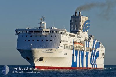
MAJESTIC
Ro-Ro/Passenger Ship
Current Trip
| Time Travelled | 4 h, 41 mins |
|---|---|
| Remaining Time | 1 day |
| Distance Travelled | 95.33 nm |
| Remaining Distance | 783.01 nm |
| AVG Speed | 21.2 Knots |
| MAX Speed | 21.9 Knots |
| AVG Wind | 8.2 knots |
| MAX Wind | 11 knots |
| MIN Temp | 18.7°C / 65.66°F |
| MAX Temp | 19.2°C / 66.56°F |
| Draught | 6.8 m |
| Position Received | 9 m ago |
Current Position
| Longitude | -3.63939° |
|---|---|
| Latitude | 36.16820° |
| Status | Under way using engine |
| Speed | 19.9 Knots |
| Course | 83° |
| Area | Alboran Sea |
| Station | T-AIS |
| Position Received | 9 m ago |
Info
Information
The current position of MAJESTIC is in Alboran Sea with coordinates 36.16820° / -3.63939° as reported on 2024-05-23 20:46 by AIS to our vessel tracker app. The vessel's current speed is 19.9 Knots and is heading at the port of GENOVA. The estimated time of arrival as calculated by MyShipTracking vessel tracking app is 2024-05-25 10:45 LT
The vessel MAJESTIC (IMO: 9015735, MMSI: 247142000) is a Ro-Ro/Passenger Ship that was built in 1993 ( 31 years old ). It's sailing under the flag of [IT] Italy.
In this page you can find informations about the vessels current position, last detected port calls, and current voyage information. If the vessels is not in coverage by AIS you will find the latest position.
The current position of MAJESTIC is detected by our AIS receivers and we are not responsible for the reliability of the data. The last position was recorded while the vessel was in Coverage by the Ais receivers of our vessel tracking app.
The current draught of MAJESTIC as reported by AIS is 6.8 meters
Weather
| Temperature | 18.9°C / 66.02°F |
|---|---|
| Wind Speed | 7 knots |
| Direction | 82° E |
| Pressure | 1014.1 hPa |
| Humidity | 79.7 % |
| Cloud Coverage | 59 % |
Featured Company
Last Port Calls
| Port | Arrival | Departure | Time In Port |
|---|---|---|---|
| 2024-05-23 12:15 | 2024-05-23 17:14 | 4 h | |
| 2024-05-20 21:53 | 2024-05-21 13:24 | 15 h | |
| 2024-05-19 14:42 | 2024-05-19 20:19 | 5 h | |
| 2024-05-17 23:31 | 2024-05-18 15:42 | 16 h | |
| 2024-05-16 17:36 | 2024-05-16 22:50 | 5 h | |
| 2024-05-13 19:53 | 2024-05-15 18:32 | 1 d | |
| 2024-05-12 13:49 | 2024-05-12 19:29 | 5 h | |
| 2024-04-20 07:40 | 2024-05-11 15:30 | 21 d | |
| 2024-04-17 07:48 | 2024-04-17 22:58 | 15 h | |
| 2024-04-14 19:30 | 2024-04-16 18:58 | 1 d |
Most Visited Ports (Last year)
| Port | Arrivals | |
|---|---|---|
| 53 | ||
| 33 | ||
| 28 | ||
| 27 | ||
| 24 | ||
| 19 |
Last Trips
| Origin | Departure | Destination | Arrival | Distance | |
|---|---|---|---|---|---|
| 2024-05-21 13:24 | 2024-05-23 12:15 | 889.65 nm | |||
| 2024-05-19 20:19 | 2024-05-20 21:53 | 465.94 nm | |||
| 2024-05-18 15:42 | 2024-05-19 14:42 | 467.48 nm | |||
| 2024-05-16 22:50 | 2024-05-17 23:31 | 467.41 nm | |||
| 2024-05-15 18:32 | 2024-05-16 17:36 | 466.96 nm | |||
| 2024-05-12 19:29 | 2024-05-13 19:53 | 463.07 nm | |||
| 2024-05-11 15:30 | 2024-05-12 13:49 | 466.42 nm | |||
| 2024-04-17 22:58 | 2024-04-20 07:40 | 628.10 nm | |||
| 2024-04-16 18:58 | 2024-04-17 07:48 | 215.10 nm | |||
| 2024-04-14 15:16 | 2024-04-14 19:30 | 34.34 nm |
Events
| Time | Event | Details | Position / Dest | Info |
|---|---|---|---|---|
| 2024-05-23 20:46 | Status Changed | Default Under way using engine |
36.16867 / -3.63533
ITGOA
|
Speed: 19.9 kn Course: 83° |
| 2024-05-23 20:46 | Status Changed | Under way using engine Default |
36.16820 / -3.63939
ITGOA
|
Speed: 20.2 kn Course: 87° |
| 2024-05-23 20:39 | Status Changed | Default Under way using engine |
36.16463 / -3.68278
ITGOA
|
Speed: 20.1 kn Course: 86.7° |
| 2024-05-23 20:36 | Status Changed | Under way using engine Default |
36.16337 / -3.70826
ITGOA
|
Speed: 20.1 kn Course: 84° |
| 2024-05-23 20:28 | Status Changed | Default Under way using engine |
36.16023 / -3.76014
ITGOA
|
Speed: 20.1 kn Course: 80.1° |
| 2024-05-23 20:05 | Status Changed | Under way using engine Default |
36.14413 / -3.92442
ITGOA
|
Speed: 21.6 kn Course: 84° |
| 2024-05-23 20:03 | Status Changed | Default Under way using engine |
36.14252 / -3.94419
ITGOA
|
Speed: 21.6 kn Course: 83.4° |
| 2024-05-23 17:40 | Destination Changed | ITGOA MA PTM |
36.01545 / -4.98039
ITGOA
|
Speed: 21.5 kn Course: 83° |
| 2024-05-23 17:40 | ETA Changed | 2024/05/25 14:10 2024/05/23 10:50 |
36.01545 / -4.98039
ITGOA
|
Speed: 21.5 kn Course: 83° |
| 2024-05-23 16:56 | Change Sea Area | Spanish part of the Alboran Sea Spanish part of the Strait of Gibraltar |
35.98086 / -5.29881
Alboran Sea
|
Speed: 21.9 kn Course: 82.7° |