
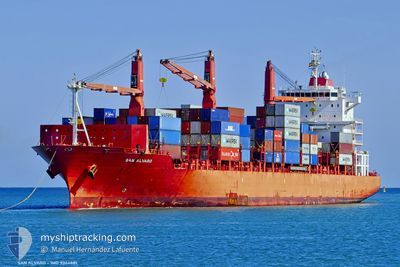
MAERSK VENEZIA
Container Ship
Current Trip
HNPCZ
| Time Travelled | 12 h, 31 mins |
|---|---|
| Remaining Time | --- |
| Distance Travelled | 157.81 nm |
| Remaining Distance | --- |
| AVG Speed | 13.6 Knots |
| MAX Speed | 14.6 Knots |
| AVG Wind | 18.1 knots |
| MAX Wind | 20 knots |
| MIN Temp | 26.3°C / 79.34°F |
| MAX Temp | 29.4°C / 84.92°F |
| Draught | 9 m |
| Position Received | 9 h, 34 m ago |
Current Position
| Longitude | --- |
|---|---|
| Latitude | --- |
| Status | Under way using engine |
| Speed | 13.9 Knots |
| Course | 304.8° |
| Area | Caribbean Sea |
| Station | T-AIS |
| Position Received | 9 h, 34 m ago |
Info
Information
The current position of MAERSK VENEZIA is in Caribbean Sea with coordinates 10.57617° / -76.08814° as reported on 2025-03-01 22:55 by AIS to our vessel tracker app. The vessel's current speed is 13.9 Knots
The vessel MAERSK VENEZIA (IMO: 9344681, MMSI: 477754600) is a Container Ship that was built in 2007 ( 18 years old ). It's sailing under the flag of [HK] Hong Kong.
In this page you can find informations about the vessels current position, last detected port calls, and current voyage information. If the vessels is not in coverage by AIS you will find the latest position.
The current position of MAERSK VENEZIA is detected by our AIS receivers and we are not responsible for the reliability of the data. The last position was recorded while the vessel was in Coverage by the Ais receivers of our vessel tracking app.
The current draught of MAERSK VENEZIA as reported by AIS is 9 meters
Weather
| Temperature | 26.5°C / 79.7°F |
|---|---|
| Wind Speed | 17 knots |
| Direction | 43° NE |
| Pressure | 1010.1 hPa |
| Humidity | 79.8 % |
| Cloud Coverage | 21 % |
Featured Company
Last Port Calls
| Port | Arrival | Departure | Time In Port |
|---|---|---|---|
| 2025-02-28 21:51 | 2025-03-01 19:58 | 22 h | |
| 2025-02-23 13:54 | 2025-02-25 08:01 | 1 d | |
| 2025-02-20 04:31 | 2025-02-21 16:27 | 1 d | |
| 2025-02-16 13:08 | 2025-02-17 06:02 | 16 h | |
| 2025-02-13 15:35 | 2025-02-14 08:03 | 16 h | |
| 2025-02-12 18:38 | 2025-02-13 10:55 | 16 h | |
| 2025-02-08 20:23 | 2025-02-10 04:36 | 1 d | |
| 2025-01-31 14:28 | 2025-02-01 23:20 | 1 d | |
| 2025-01-29 23:55 | 2025-01-30 22:47 | 22 h | |
| 2025-01-26 13:07 | 2025-01-28 02:19 | 1 d |
Most Visited Ports (Last year)
| Port | Arrivals | |
|---|---|---|
| 17 | ||
| 13 | ||
| 11 | ||
| 11 | ||
| 10 | ||
| 10 |
Last Trips
| Origin | Departure | Destination | Arrival | Distance | |
|---|---|---|---|---|---|
| 2025-02-25 04:01 | 2025-02-28 16:51 | 708.10 nm | |||
| 2025-02-21 11:27 | 2025-02-23 09:54 | 731.83 nm | |||
| 2025-02-17 01:02 | 2025-02-19 23:31 | 827.71 nm | |||
| 2025-02-14 02:03 | 2025-02-16 08:08 | 900.67 nm | |||
| 2025-02-13 04:55 | 2025-02-13 09:35 | 64.46 nm | |||
| 2025-02-09 23:36 | 2025-02-12 12:38 | 862.47 nm | |||
| 2025-02-01 19:20 | 2025-02-08 15:23 | 821.65 nm | |||
| 2025-01-30 18:47 | 2025-01-31 10:28 | 104.88 nm | |||
| 2025-01-27 21:19 | 2025-01-29 19:55 | 731.91 nm | |||
| 2025-01-24 07:28 | 2025-01-26 08:07 | 776.95 nm |
Events
| Time | Event | Details | Position / Dest | Info |
|---|---|---|---|---|
| 2025-03-01 22:58 | Status Changed | Default Under way using engine |
10.58426 / -76.09961
HNPCZ
|
Speed: 13.9 kn Course: 304.8° |
| 2025-03-01 22:55 | Status Changed | Under way using engine Default |
10.57617 / -76.08814
HNPCZ
|
Speed: 13.8 kn Course: 305° |
| 2025-03-01 22:55 | OUT of Coverage |
10.57617 / -76.08814
Caribbean Sea
HNPCZ
|
Speed: 13.9 kn Course: 304.8° |
|
| 2025-03-01 22:29 | Status Changed | Default Under way using engine |
10.51673 / -76.00524
HNPCZ
|
Speed: 14.5 kn Course: 306.4° |
| 2025-03-01 22:07 | Status Changed | Under way using engine Default |
10.46598 / -75.93386
HNPCZ
|
Speed: 14.1 kn Course: 304° |
| 2025-03-01 22:00 | Status Changed | Default Under way using engine |
10.45006 / -75.91019
HNPCZ
|
Speed: 14.2 kn Course: 300.9° |
| 2025-03-01 21:11 | Destination Changed | HNPCZ COCTG |
10.35580 / -75.73598
HNPCZ
|
Speed: 14.4 kn Course: 295.6° |
| 2025-03-01 21:11 | ETA Changed | 2025/03/04 16:00 2026/01/27 17:00 |
10.35580 / -75.73598
HNPCZ
|
Speed: 14.4 kn Course: 295.6° |
| 2025-03-01 20:53 | Status Changed | Under way using engine Default |
10.32574 / -75.67140
COCTG
|
Speed: 14 kn Course: 275° |
| 2025-03-01 20:53 | IN Coverage |
10.32665 / -75.67360
Caribbean Sea
|
Speed: 14 kn Course: 293° |