
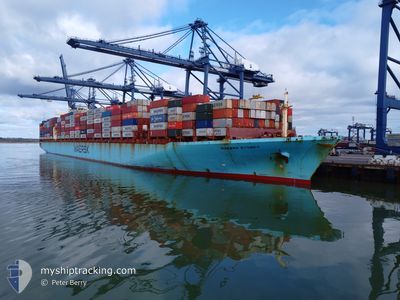
MAERSK SYDNEY
Container Ship
Current Trip
| Time Travelled | 8 days |
|---|---|
| Remaining Time | --- |
| Distance Travelled | 2152.16 nm |
| Remaining Distance | --- |
| AVG Speed | 12.8 Knots |
| MAX Speed | 17.1 Knots |
| AVG Wind | 11.4 knots |
| MAX Wind | 26.6 knots |
| MIN Temp | 17.7°C / 63.86°F |
| MAX Temp | 26.5°C / 79.7°F |
| Draught | 10.6 m |
| Position Received | 1 d ago |
Current Position
| Longitude | --- |
|---|---|
| Latitude | --- |
| Status | Under way using engine |
| Speed | 7 Knots |
| Course | 218.6° |
| Area | South China Sea |
| Station | T-AIS |
| Position Received | 1 d ago |
Info
Information
The current position of MAERSK SYDNEY is in South China Sea with coordinates 20.62640° / 106.90201° as reported on 2025-02-15 22:28 by AIS to our vessel tracker app. The vessel's current speed is 7 Knots and is heading at the port of NINGBO. The estimated time of arrival as calculated by MyShipTracking vessel tracking app is 2025-02-20 12:00 LT
The vessel MAERSK SYDNEY (IMO: 9289958, MMSI: 563000500) is a Container Ship that was built in 2005 ( 20 years old ). It's sailing under the flag of [SG] Singapore.
In this page you can find informations about the vessels current position, last detected port calls, and current voyage information. If the vessels is not in coverage by AIS you will find the latest position.
The current position of MAERSK SYDNEY is detected by our AIS receivers and we are not responsible for the reliability of the data. The last position was recorded while the vessel was in Coverage by the Ais receivers of our vessel tracking app.
The current draught of MAERSK SYDNEY as reported by AIS is 10.6 meters
Weather
| Temperature | 18.8°C / 65.84°F |
|---|---|
| Wind Speed | 20 knots |
| Direction | 61° ENE |
| Pressure | 1020.5 hPa |
| Humidity | 75.3 % |
| Cloud Coverage | 85 % |
Featured Company
Last Port Calls
| Port | Arrival | Departure | Time In Port |
|---|---|---|---|
| 2025-02-07 23:57 | 2025-02-09 18:57 | 1 d | |
| 2025-02-01 12:31 | 2025-02-02 08:21 | 19 h | |
| 2024-12-30 22:06 | 2025-01-03 13:50 | 3 d | |
| 2024-12-26 09:23 | 2024-12-27 12:00 | 1 d | |
| 2024-12-22 20:44 | 2024-12-24 14:07 | 1 d | |
| 2024-12-20 09:30 | 2024-12-21 15:40 | 1 d |
Most Visited Ports (Last year)
| Port | Arrivals | |
|---|---|---|
| 6 | ||
| 4 | ||
| 3 | ||
| 3 | ||
| 3 | ||
| 3 |
Last Trips
| Origin | Departure | Destination | Arrival | Distance | |
|---|---|---|---|---|---|
| 2025-02-02 16:21 | 2025-02-08 06:57 | 892.22 nm | |||
| 2025-01-03 08:50 | 2025-02-01 20:31 | 12495.78 nm | |||
| 2024-12-27 07:00 | 2024-12-30 17:06 | 589.85 nm | |||
| 2024-12-24 09:07 | 2024-12-26 04:23 | 368.41 nm | |||
| 2024-12-21 10:40 | 2024-12-22 15:44 | 51.02 nm | |||
| 2024-11-23 19:41 | 2024-12-20 04:30 | 11187.83 nm |
Events
| Time | Event | Details | Position / Dest | Info |
|---|---|---|---|---|
| 2025-02-15 22:29 | Status Changed | Default Under way using engine |
20.62361 / 106.90092
NINGBO
|
Speed: 7 kn Course: 218.6° |
| 2025-02-15 22:28 | OUT of Coverage |
20.62640 / 106.90201
South China Sea
NINGBO
|
Speed: 7 kn Course: 218.6° |
|
| 2025-02-15 21:55 | Status Changed | Under way using engine Default |
20.65793 / 107.01205
NINGBO
|
Speed: 15.7 kn Course: 144° |
| 2025-02-15 21:05 | Status Changed | Default Under way using engine |
20.79906 / 106.91084
NINGBO
|
Speed: 1 kn Course: 13° |
| 2025-02-15 20:51 | START Moving | 10.88 nm, East of HAI PHONG |
20.78964 / 106.91637
NINGBO
|
Speed: 3.4 kn Course: 343° |
| 2025-02-15 20:39 | Status Changed | Under way using engine Moored |
20.78760 / 106.91612
NINGBO
|
Speed: 0.1 kn Course: 332° |
| 2025-02-15 20:37 | Status Changed | Moored Default |
20.78747 / 106.91611
NINGBO
|
Speed: Course: 329° |
| 2025-02-15 20:31 | Status Changed | Default Moored |
20.78733 / 106.91599
NINGBO
|
Speed: Course: 329° |
| 2025-02-15 20:07 | Status Changed | Moored Default |
20.78745 / 106.91595
NINGBO
|
Speed: Course: 329° |
| 2025-02-15 20:01 | Status Changed | Default Moored |
20.78741 / 106.91593
NINGBO
|
Speed: Course: 330° |