
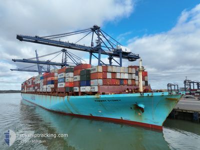
MAERSK SYDNEY
Container Ship
Current Trip
| Time Travelled | 1 day |
|---|---|
| Remaining Time | --- |
| Distance Travelled | 260.15 nm |
| Remaining Distance | --- |
| AVG Speed | 10.9 Knots |
| MAX Speed | 16 Knots |
| AVG Wind | 13.3 knots |
| MAX Wind | 17 knots |
| MIN Temp | 19.5°C / 67.1°F |
| MAX Temp | 21.4°C / 70.52°F |
| Draught | 12.4 m |
| Position Received | 20 h, 28 m ago |
Current Position
| Longitude | -74.10440° |
|---|---|
| Latitude | 38.90813° |
| Status | Under way using engine |
| Speed | 12.5 Knots |
| Course | 191° |
| Area | North Atlantic Ocean |
| Station | T-AIS |
| Position Received | 20 h, 28 m ago |
Info
Information
The current position of MAERSK SYDNEY is in North Atlantic Ocean with coordinates 38.90813° / -74.10440° as reported on 2024-09-21 11:04 by AIS to our vessel tracker app. The vessel's current speed is 12.5 Knots
The vessel MAERSK SYDNEY (IMO: 9289958, MMSI: 563000500) is a Container Ship that was built in 2005 ( 19 years old ). It's sailing under the flag of [SG] Singapore.
In this page you can find informations about the vessels current position, last detected port calls, and current voyage information. If the vessels is not in coverage by AIS you will find the latest position.
The current position of MAERSK SYDNEY is detected by our AIS receivers and we are not responsible for the reliability of the data. The last position was recorded while the vessel was in Coverage by the Ais receivers of our vessel tracking app.
The current draught of MAERSK SYDNEY as reported by AIS is 12.4 meters
Weather
| Temperature | 21°C / 69.8°F |
|---|---|
| Wind Speed | 3 knots |
| Direction | 74° ENE |
| Pressure | 1013.3 hPa |
| Humidity | 83.3 % |
| Cloud Coverage | 57 % |
Featured Company
Last Port Calls
| Port | Arrival | Departure | Time In Port |
|---|---|---|---|
| 2024-09-18 12:53 | 2024-09-21 02:01 | 2 d | |
| 2024-08-17 08:59 | 2024-08-18 06:46 | 21 h | |
| 2024-08-11 22:09 | 2024-08-13 00:12 | 1 d | |
| 2024-08-06 12:07 | 2024-08-07 18:46 | 1 d | |
| 2024-08-04 07:20 | 2024-08-05 22:26 | 1 d | |
| 2024-07-28 14:21 | 2024-07-31 11:45 | 2 d | |
| 2024-07-24 16:59 | 2024-07-26 05:00 | 1 d |
Most Visited Ports (Last year)
| Port | Arrivals | |
|---|---|---|
| 5 | ||
| 3 | ||
| 3 | ||
| 3 | ||
| 2 | ||
| 2 |
Last Trips
| Origin | Departure | Destination | Arrival | Distance | |
|---|---|---|---|---|---|
| 2024-08-18 10:46 | 2024-09-18 08:53 | 11326.04 nm | |||
| 2024-08-13 05:42 | 2024-08-17 12:59 | 1637.29 nm | |||
| 2024-08-08 02:46 | 2024-08-12 03:39 | 1593.09 nm | |||
| 2024-08-06 06:26 | 2024-08-06 20:07 | 35.48 nm | |||
| 2024-07-31 18:45 | 2024-08-04 15:20 | 820.94 nm | |||
| 2024-07-26 13:00 | 2024-07-28 21:21 | 851.84 nm | |||
| 2024-06-21 11:31 | 2024-07-25 00:59 | 12798.23 nm |
Events
| Time | Event | Details | Position / Dest | Info |
|---|---|---|---|---|
| 2024-09-21 11:11 | Status Changed | Default Under way using engine |
38.88515 / -74.11050
NORFOLK
|
Speed: 12.5 kn Course: 191° |
| 2024-09-21 11:04 | OUT of Coverage |
38.90813 / -74.10440
North Atlantic Ocean
NORFOLK
|
Speed: 12.5 kn Course: 191° |
|
| 2024-09-21 08:57 | Status Changed | Under way using engine Default |
39.33607 / -73.99123
NORFOLK
|
Speed: 12.3 kn Course: 193° |
| 2024-09-21 08:55 | Status Changed | Default Under way using engine |
39.34398 / -73.98885
NORFOLK
|
Speed: 12.3 kn Course: 192.8° |
| 2024-09-21 08:01 | Status Changed | Under way using engine Default |
39.52742 / -73.93600
NORFOLK
|
Speed: 12.2 kn Course: 193° |
| 2024-09-21 07:35 | Status Changed | Default Under way using engine |
39.61277 / -73.91218
NORFOLK
|
Speed: 12.1 kn Course: 191.7° |
| 2024-09-21 07:28 | Status Changed | Under way using engine Default |
39.63722 / -73.90541
NORFOLK
|
Speed: 12.2 kn Course: 191° |
| 2024-09-21 07:19 | IN Coverage |
39.63722 / -73.90541
North Atlantic Ocean
NORFOLK
|
Speed: 12.1 kn Course: 191.7° |
|
| 2024-09-21 06:19 | Status Changed | Default Under way using engine |
39.86923 / -73.86053
NORFOLK
|
Speed: 12.2 kn Course: 187.3° |
| 2024-09-21 06:19 | OUT of Coverage |
39.87036 / -73.86034
North Atlantic Ocean
NORFOLK
|
Speed: 12.2 kn Course: 187.3° |