
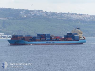
MAERSK NEWPORT
Container Ship
Current Trip
| Time Travelled | 8 days |
|---|---|
| Remaining Time | --- |
| Distance Travelled | 1913.92 nm |
| Remaining Distance | --- |
| AVG Speed | 12.8 Knots |
| MAX Speed | 18.6 Knots |
| AVG Wind | 16.1 knots |
| MAX Wind | 26.7 knots |
| MIN Temp | 1.9°C / 35.42°F |
| MAX Temp | 16.8°C / 62.24°F |
| Draught | 11 m |
| Position Received | 17 h, 31 m ago |
Current Position
| Longitude | --- |
|---|---|
| Latitude | --- |
| Status | Under way using engine |
| Speed | 11.6 Knots |
| Course | 354.6° |
| Area | Black Sea |
| Station | T-AIS |
| Position Received | 17 h, 31 m ago |
Info
Information
The current position of MAERSK NEWPORT is in Black Sea with coordinates 41.49215° / 29.19552° as reported on 2025-02-18 01:04 by AIS to our vessel tracker app. The vessel's current speed is 11.6 Knots
The vessel MAERSK NEWPORT (IMO: 9356127, MMSI: 219223000) is a Container Ship that was built in 2008 ( 17 years old ). It's sailing under the flag of [DK] Denmark.
In this page you can find informations about the vessels current position, last detected port calls, and current voyage information. If the vessels is not in coverage by AIS you will find the latest position.
The current position of MAERSK NEWPORT is detected by our AIS receivers and we are not responsible for the reliability of the data. The last position was recorded while the vessel was in Coverage by the Ais receivers of our vessel tracking app.
The current draught of MAERSK NEWPORT as reported by AIS is 11 meters
Weather
| Temperature | 2.7°C / 36.86°F |
|---|---|
| Wind Speed | 15 knots |
| Direction | 63° ENE |
| Pressure | 1026.5 hPa |
| Humidity | 62.1 % |
| Cloud Coverage | 100 % |
Featured Company
Last Port Calls
| Port | Arrival | Departure | Time In Port |
|---|---|---|---|
| 2025-02-14 14:29 | 2025-02-15 11:25 | 20 h | |
| 2025-02-09 17:53 | 2025-02-10 09:35 | 15 h | |
| 2025-02-06 12:09 | 2025-02-08 06:10 | 1 d | |
| 2025-01-31 07:29 | 2025-02-01 10:37 | 1 d | |
| 2025-01-23 20:45 | 2025-01-25 13:08 | 1 d | |
| 2025-01-17 09:17 | 2025-01-18 07:12 | 21 h | |
| 2025-01-11 12:41 | 2025-01-14 03:21 | 2 d | |
| 2025-01-07 05:29 | 2025-01-08 06:57 | 1 d | |
| 2025-01-02 11:12 | 2025-01-04 01:21 | 1 d | |
| 2024-12-24 10:49 | 2024-12-25 10:47 | 23 h |
Most Visited Ports (Last year)
| Port | Arrivals | |
|---|---|---|
| 25 | ||
| 20 | ||
| 11 | ||
| 4 | ||
| 2 | ||
| 2 |
Last Trips
| Origin | Departure | Destination | Arrival | Distance | |
|---|---|---|---|---|---|
| 2025-02-10 09:35 | 2025-02-14 14:29 | 879.83 nm | |||
| 2025-02-08 06:10 | 2025-02-09 17:53 | 264.52 nm | |||
| 2025-01-25 13:08 | 2025-02-06 12:09 | 2218.86 nm | |||
| 2025-01-25 13:08 | 2025-01-31 07:29 | 1091.52 nm | |||
| 2025-01-14 03:21 | 2025-01-23 20:45 | 2126.03 nm | |||
| 2025-01-14 03:21 | 2025-01-17 09:17 | 1029.86 nm | |||
| 2025-01-04 01:21 | 2025-01-11 12:41 | 2073.48 nm | |||
| 2025-01-04 01:21 | 2025-01-07 05:29 | 1028.20 nm | |||
| 2024-12-20 14:38 | 2025-01-02 11:12 | 2137.95 nm | |||
| 2024-12-20 14:38 | 2024-12-24 10:49 | 1063.03 nm |
Events
| Time | Event | Details | Position / Dest | Info |
|---|---|---|---|---|
| 2025-02-18 14:15 | STOP Moving | 15.09 nm, East of CONSTANTA |
44.03067 / 28.99597
EGPSD>ROCND
|
Speed: 0.3 kn Course: 64° |
| 2025-02-18 01:06 | Status Changed | Default Under way using engine |
41.49923 / 29.19440
EGPSD>ROCND
|
Speed: 11.6 kn Course: 354.6° |
| 2025-02-18 01:04 | OUT of Coverage |
41.49215 / 29.19552
Black Sea
EGPSD>ROCND
|
Speed: 11.6 kn Course: 354.6° |
|
| 2025-02-17 23:37 | Change Sea Area | Turkish part of the Black Sea Turkish part of the Sea of Marmara |
41.23197 / 29.14020
Black Sea
EGPSD>ROCND
|
Speed: 11.7 kn Course: 30.1° |
| 2025-02-17 19:31 | START Moving | 11.89 nm, South of AMBARLI |
40.76757 / 28.60990
EGPSD>ROCND
|
Speed: 3.6 kn Course: 141° |
| 2025-02-17 18:50 | Status Changed | Under way using engine Default |
40.76277 / 28.62483
EGPSD>ROCND
|
Speed: 1.1 kn Course: 174° |
| 2025-02-17 18:49 | Status Changed | Default Under way using engine |
40.76268 / 28.62508
EGPSD>ROCND
|
Speed: 1 kn Course: 179° |
| 2025-02-17 18:18 | Status Changed | Under way using engine Default |
40.75855 / 28.63665
EGPSD>ROCND
|
Speed: 1.1 kn Course: 164° |
| 2025-02-17 18:17 | Status Changed | Default Under way using engine |
40.75841 / 28.63718
EGPSD>ROCND
|
Speed: 1.2 kn Course: 163° |
| 2025-02-17 16:27 | STOP Moving | 12.42 nm, South of AMBARLI |
40.75263 / 28.67758
EGPSD>ROCND
|
Speed: 0.3 kn Course: 82° |