
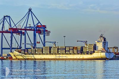
MAERSK NAMIBIA
Container Ship
Current Trip
| Trip Time | 17 days |
|---|---|
| Trip Distance | 1136.86 nm |
| AVG Speed | 12.2 Knots |
| MAX Speed | 16.9 Knots |
| Draught | 11 m |
| AVG Wind | 6.5 knots |
| MAX Wind | 13 knots |
| MIN Temp | 25.3°C / 77.54°F |
| MAX Temp | 28.4°C / 83.12°F |
| Position Received | 2024-07-31 09:20 |
Current Position
| Longitude | --- |
|---|---|
| Latitude | --- |
| Status | Under way using engine |
| Speed | 17.4 Knots |
| Course | 176.2° |
| Area | North Atlantic Ocean |
| Station | T-AIS |
| Position Received | 2024-07-31 09:20 |
Info
Information
The current position of MAERSK NAMIBIA is in North Atlantic Ocean with coordinates 19.70346° / -17.99829° as reported on 2024-07-31 09:20 by AIS to our vessel tracker app. The vessel's current speed is 17.4 Knots and is currently inside the port of MONROVIA.
The vessel MAERSK NAMIBIA (IMO: 9289180, MMSI: 566415000) is a Container Ship that was built in 2004 ( 22 years old ). It's sailing under the flag of [SG] Singapore.
In this page you can find informations about the vessels current position, last detected port calls, and current voyage information. If the vessels is not in coverage by AIS you will find the latest position.
The current position of MAERSK NAMIBIA is detected by our AIS receivers and we are not responsible for the reliability of the data. The last position was recorded while the vessel was in Coverage by the Ais receivers of our vessel tracking app.
The current draught of MAERSK NAMIBIA as reported by AIS is 11 meters
Weather
| Temperature | 28.9°C / 84.02°F |
|---|---|
| Wind Speed | 7 knots |
| Direction | 181° S |
| Pressure | 1012.2 hPa |
| Humidity | 67.2 % |
| Cloud Coverage | 20 % |
Featured Company
Last Port Calls
| Port | Arrival | Departure | Time In Port |
|---|---|---|---|
| 2026-01-03 07:33 | |||
| 2025-12-15 10:10 | 2025-12-16 21:43 | 1 d | |
| 2025-12-10 06:59 | 2025-12-13 07:23 | 3 d | |
| 2025-11-27 04:02 | 2025-11-28 18:43 | 1 d | |
| 2025-11-21 18:34 | 2025-11-22 23:06 | 1 d | |
| 2025-11-17 17:50 | 2025-11-20 13:26 | 2 d | |
| 2025-11-08 16:40 | 2025-11-13 01:24 | 4 d |
Last Trips
| Origin | Departure | Destination | Arrival | Distance | |
|---|---|---|---|---|---|
| 2025-12-16 21:43 | 2026-01-03 07:33 | 1136.86 nm | |||
| 2025-12-13 07:23 | 2025-12-15 10:10 | 541.85 nm | |||
| 2025-11-28 18:43 | 2025-12-10 06:59 | 1544.67 nm | |||
| 2025-11-22 23:06 | 2025-11-27 04:02 | 430.89 nm | |||
| 2025-11-20 13:26 | 2025-11-21 18:34 | 333.07 nm | |||
| 2025-11-13 01:24 | 2025-11-17 17:50 | 964.66 nm | |||
| 2025-10-31 12:22 | 2025-11-08 16:40 | 289.94 nm |
Events
| Time | Event | Details | Position / Dest | Info |
|---|---|---|---|---|
| 2026-01-03 07:45 | STOP Moving |
6.34167 / -10.79667
[LR] MONROVIA
|
Speed: Course: -1° |
|
| 2026-01-03 07:33 | PORT ARRIVAL |
|
6.34638 / -10.80633
[LR] MONROVIA
|
Speed: 5.8 kn Course: 123° |
| 2026-01-03 06:17 | START Moving | 6.6 nm, West of MONROVIA |
6.35513 / -10.91406
ES ALG > CG PNR
|
Speed: 8.6 kn Course: 77° |
| 2026-01-03 05:57 | STOP Moving | 7.24 nm, West of MONROVIA |
6.35167 / -10.92500
ES ALG > CG PNR
|
Speed: Course: -1° |
| 2026-01-03 03:25 | START Moving |
6.08626 / -11.19869
ES ALG > CG PNR
|
Speed: 3.1 kn Course: 50° |
|
| 2025-12-30 21:39 | STOP Moving |
5.88031 / -11.02764
ES ALG > CG PNR
|
Speed: 0.1 kn Course: 229° |
|
| 2025-12-30 08:11 | START Moving |
6.32520 / -11.17433
ES ALG > CG PNR
|
Speed: 4 kn Course: 233° |
|
| 2025-12-27 13:22 | STOP Moving |
6.03235 / -11.07623
ES ALG > CG PNR
|
Speed: 0.1 kn Course: 149° |
|
| 2025-12-27 10:30 | START Moving | 4.87 nm, West of MONROVIA |
6.34784 / -10.88552
ES ALG > CG PNR
|
Speed: 5.5 kn Course: 163° |
| 2025-12-27 09:50 | STOP Moving | 4.79 nm, West of MONROVIA |
6.35158 / -10.88406
ES ALG > CG PNR
|
Speed: 0.3 kn Course: 156° |