

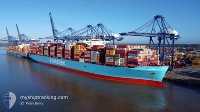
MAERSK HOUSTON
Cargo

Current Trip
| Trip Time | 2 days |
|---|---|
| Trip Distance | 442.23 nm |
| AVG Speed | 10.4 Knots |
| MAX Speed | 13.6 Knots |
| Draught | 12.8 m |
| AVG Wind | 11.7 knots |
| MAX Wind | 18 knots |
| MIN Temp | 24.1°C / 75.38°F |
| MAX Temp | 33.7°C / 92.66°F |
| Position Received | 6 d ago |
Current Position
| Longitude | --- |
|---|---|
| Latitude | --- |
| Status | Under way using engine |
| Speed | 12.1 Knots |
| Course | 117.2° |
| Area | Gulf of Oman |
| Station | T-AIS |
| Position Received | 6 d ago |
Information
The current position of MAERSK HOUSTON is in Gulf of Oman with coordinates 24.75783° / 57.26140° as reported on 2025-03-22 19:36 by AIS to our vessel tracker app. The vessel's current speed is 12.1 Knots and is currently inside the port of NHAVA SHEVA.
The vessel MAERSK HOUSTON (IMO: 9848950, MMSI: 563078300) is a Cargo It's sailing under the flag of [SG] Singapore.
In this page you can find informations about the vessels current position, last detected port calls, and current voyage information. If the vessels is not in coverage by AIS you will find the latest position.
The current position of MAERSK HOUSTON is detected by our AIS receivers and we are not responsible for the reliability of the data. The last position was recorded while the vessel was in Coverage by the Ais receivers of our vessel tracking app.
The current draught of MAERSK HOUSTON as reported by AIS is 12.8 meters
Weather
| Temperature | 30.9°C / 87.62°F |
|---|---|
| Wind Speed | 5 knots |
| Direction | 358° N |
| Pressure | 1008.2 hPa |
| Humidity | 30.7 % |
| Cloud Coverage | 11 % |


Featured Company
Last Port Calls
| Port | Arrival | Departure | Time In Port |
|---|---|---|---|
| 2025-03-29 12:03 | |||
| 2025-03-25 17:35 | 2025-03-27 00:58 | 1 d | |
| 2025-03-20 23:16 | 2025-03-22 02:21 | 1 d | |
| 2025-03-17 11:23 | 2025-03-18 17:52 | 1 d | |
| 2025-03-14 08:40 | 2025-03-17 03:39 | 2 d | |
| 2025-02-13 12:27 | 2025-02-14 11:10 | 22 h | |
| 2025-02-07 19:21 | 2025-02-09 11:25 | 1 d | |
| 2025-02-03 20:12 | 2025-02-06 16:24 | 2 d | |
| 2025-01-06 15:47 | 2025-01-07 22:51 | 1 d |
Last Trips
| Origin | Departure | Destination | Arrival | Distance | |
|---|---|---|---|---|---|
| 2025-03-27 00:58 | 2025-03-29 12:03 | 442.23 nm | |||
| 2025-03-22 02:21 | 2025-03-25 17:35 | 1004.47 nm | |||
| 2025-03-18 17:52 | 2025-03-20 23:16 | 37.75 nm | |||
| 2025-03-17 03:39 | 2025-03-17 11:23 | 69.11 nm | |||
| 2025-02-14 11:10 | 2025-03-14 08:40 | 10237.92 nm | |||
| 2025-02-09 11:25 | 2025-02-13 12:27 | 1426.70 nm | |||
| 2025-02-06 16:24 | 2025-02-07 19:21 | 439.25 nm | |||
| 2025-01-07 22:51 | 2025-02-03 20:12 | 11419.35 nm | |||
| 2024-12-30 08:46 | 2025-01-06 15:47 | 1607.31 nm |
Events
| Time | Event | Details | Position / Dest | Info |
|---|---|---|---|---|
| 2025-03-29 06:33 | PORT ARRIVAL |
|
18.94725 / 72.93960
[IN] NHAVA SHEVA
|
Speed: 2.2 kn Course: 233° |
| 2025-03-29 06:18 | STOP Moving | 0.93 nm, South West of NHAVA SHEVA |
18.94535 / 72.93436
AEJAL>INMUN
|
Speed: 0.3 kn Course: 146° |
| 2025-03-26 19:28 | PORT DEPARTURE |
|
22.73525 / 69.72417
AEJAL>INMUN
|
Speed: 5.7 kn Course: 136° |
| 2025-03-26 19:26 | START Moving |
22.73905 / 69.72182
[IN] MUNDRA
|
Speed: 5.7 kn Course: 136° |
|
| 2025-03-25 12:44 | STOP Moving |
22.74278 / 69.71433
[IN] MUNDRA
|
Speed: 0.1 kn Course: 129° |
|
| 2025-03-25 12:05 | PORT ARRIVAL |
|
22.74212 / 69.72134
[IN] MUNDRA
|
Speed: 0.8 kn Course: 325° |
| 2025-03-22 19:40 | Status Changed | Default Under way using engine |
24.75255 / 57.27280
AEJAL>INMUN
|
Speed: 12.1 kn Course: 117.2° |
| 2025-03-22 19:36 | OUT of Coverage |
24.75783 / 57.26140
Gulf of Oman
AEJAL>INMUN
|
Speed: 12.1 kn Course: 117.2° |
|
| 2025-03-22 17:10 | Change Sea Area | Omani part of the Gulf of Oman United Arab Emirates part of the Gulf of Oman |
25.05978 / 56.88617
Gulf of Oman
AEJAL>INMUN
|
Speed: 12.4 kn Course: 174.4° |
| 2025-03-22 14:13 | Change Sea Area | United Arab Emirates part of the Gulf of Oman Omani part of the Gulf of Oman |
25.66100 / 56.81717
Gulf of Oman
AEJAL>INMUN
|
Speed: 12.1 kn Course: 172.8° |