

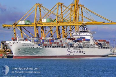
MAERSK DETROIT
Container Ship

Current Trip
| Time Travelled | 10 days |
|---|---|
| Remaining Time | --- |
| Distance Travelled | 4609.58 nm |
| Remaining Distance | --- |
| AVG Speed | 18.6 Knots |
| MAX Speed | 23.7 Knots |
| AVG Wind | 17.6 knots |
| MAX Wind | 28 knots |
| MIN Temp | 19°C / 66.2°F |
| MAX Temp | 29.3°C / 84.74°F |
| Draught | 15 m |
| Position Received | 1 d ago |
Current Position
| Longitude | --- |
|---|---|
| Latitude | --- |
| Status | Under way using engine |
| Speed | 17.5 Knots |
| Course | 316.3° |
| Area | South Atlantic Ocean |
| Station | T-AIS |
| Position Received | 1 d ago |
Information
The current position of MAERSK DETROIT is in South Atlantic Ocean with coordinates -34.43313° / 17.80851° as reported on 2025-03-02 11:15 by AIS to our vessel tracker app. The vessel's current speed is 17.5 Knots and is heading at the port of TANGER MED. The estimated time of arrival as calculated by MyShipTracking vessel tracking app is 2025-03-15 00:30 LT
The vessel MAERSK DETROIT (IMO: 9333034, MMSI: 338474000) is a Container Ship that was built in 2008 ( 17 years old ). It's sailing under the flag of [US] USA.
In this page you can find informations about the vessels current position, last detected port calls, and current voyage information. If the vessels is not in coverage by AIS you will find the latest position.
The current position of MAERSK DETROIT is detected by our AIS receivers and we are not responsible for the reliability of the data. The last position was recorded while the vessel was in Coverage by the Ais receivers of our vessel tracking app.
The current draught of MAERSK DETROIT as reported by AIS is 15 meters
Weather
| Temperature | 20.6°C / 69.08°F |
|---|---|
| Wind Speed | 15 knots |
| Direction | 158° SSE |
| Pressure | 1014.6 hPa |
| Humidity | 82.4 % |
| Cloud Coverage | --- |


Featured Company
Last Port Calls
| Port | Arrival | Departure | Time In Port |
|---|---|---|---|
| 2025-02-19 23:50 | 2025-02-21 00:15 | 1 d | |
| 2025-02-16 01:43 | 2025-02-17 07:37 | 1 d | |
| 2025-02-14 13:34 | 2025-02-15 03:51 | 14 h | |
| 2025-02-09 14:49 | 2025-02-10 17:52 | 1 d | |
| 2025-02-06 03:26 | 2025-02-07 01:11 | 21 h | |
| 2025-01-06 09:14 | 2025-01-07 08:45 | 23 h | |
| 2025-01-04 08:23 | 2025-01-05 00:49 | 16 h |
Last Trips
| Origin | Departure | Destination | Arrival | Distance | |
|---|---|---|---|---|---|
| 2025-02-17 13:07 | 2025-02-20 03:50 | 1105.02 nm | |||
| 2025-02-15 09:21 | 2025-02-16 07:13 | 257.77 nm | |||
| 2025-02-10 21:52 | 2025-02-14 19:04 | 1136.38 nm | |||
| 2025-02-07 05:11 | 2025-02-09 18:49 | 999.35 nm | |||
| 2025-01-07 03:45 | 2025-02-06 07:26 | 12581.10 nm | |||
| 2025-01-04 19:49 | 2025-01-06 04:14 | 318.96 nm | |||
| 2024-12-31 02:57 | 2025-01-04 03:23 | 1723.85 nm |
Events
| Time | Event | Details | Position / Dest | Info |
|---|---|---|---|---|
| 2025-03-02 11:22 | Status Changed | Default Under way using engine |
-34.40965 / 17.78130
MAPTM
|
Speed: 17.5 kn Course: 316.3° |
| 2025-03-02 11:15 | OUT of Coverage |
-34.43313 / 17.80851
South Atlantic Ocean
MAPTM
|
Speed: 17.5 kn Course: 316.3° |
|
| 2025-03-02 10:42 | Status Changed | Under way using engine Default |
-34.55136 / 17.94667
MAPTM
|
Speed: 17.5 kn Course: 315° |
| 2025-03-02 10:28 | Status Changed | Default Under way using engine |
-34.60132 / 18.00460
MAPTM
|
Speed: 17.6 kn Course: 308.6° |
| 2025-03-02 10:23 | Status Changed | Under way using engine Default |
-34.61701 / 18.02408
MAPTM
|
Speed: 17.8 kn Course: 291° |
| 2025-03-02 10:06 | Status Changed | Default Under way using engine |
-34.65306 / 18.11739
MAPTM
|
Speed: 18.6 kn Course: 291.8° |
| 2025-03-02 09:34 | Change Sea Area | South African part of the South Atlantic Ocean South African part of the Indian Ocean |
-34.71576 / 18.30455
South Atlantic Ocean
MAPTM
|
Speed: 19.1 kn Course: 293.3° |
| 2025-03-02 09:34 | Status Changed | Under way using engine Default |
-34.71576 / 18.30455
MAPTM
|
Speed: 19.2 kn Course: 285° |
| 2025-03-02 09:34 | IN Coverage |
-34.71576 / 18.30455
South Atlantic Ocean
MAPTM
|
Speed: 19.1 kn Course: 293.3° |
|
| 2025-02-28 16:01 | OUT of Coverage |
-30.43770 / 31.38478
Indian Ocean
MAPTM
|
Speed: 21.4 kn Course: 216.4° |