
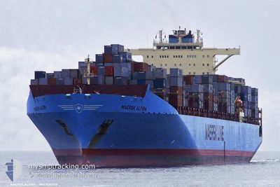
MAERSK ALFIRK
Container Ship
Current Trip
| Time Travelled | 17 h, 50 mins |
|---|---|
| Remaining Time | --- |
| Distance Travelled | 330.94 nm |
| Remaining Distance | --- |
| AVG Speed | 17.6 Knots |
| MAX Speed | 21 Knots |
| AVG Wind | 16.1 knots |
| MAX Wind | 22.4 knots |
| MIN Temp | 14.2°C / 57.56°F |
| MAX Temp | 17.9°C / 64.22°F |
| Draught | 15.3 m |
| Position Received | 11 h, 2 m ago |
Current Position
| Longitude | 130.62723° |
|---|---|
| Latitude | 35.54688° |
| Status | Under way using engine |
| Speed | 19.2 Knots |
| Course | 41.5° |
| Area | Japan Sea |
| Station | T-AIS |
| Position Received | 11 h, 2 m ago |
Info
Information
The current position of MAERSK ALFIRK is in Japan Sea with coordinates 35.54688° / 130.62723° as reported on 2024-05-21 09:34 by AIS to our vessel tracker app. The vessel's current speed is 19.2 Knots and is heading at the port of LOS ANGELES. The estimated time of arrival as calculated by MyShipTracking vessel tracking app is 2024-06-02 03:30 LT
The vessel MAERSK ALFIRK (IMO: 9342516, MMSI: 565747000) is a Container Ship that was built in 2007 ( 17 years old ). It's sailing under the flag of [SG] Singapore.
In this page you can find informations about the vessels current position, last detected port calls, and current voyage information. If the vessels is not in coverage by AIS you will find the latest position.
The current position of MAERSK ALFIRK is detected by our AIS receivers and we are not responsible for the reliability of the data. The last position was recorded while the vessel was in Coverage by the Ais receivers of our vessel tracking app.
The current draught of MAERSK ALFIRK as reported by AIS is 15.3 meters
Weather
| Temperature | 14.2°C / 57.56°F |
|---|---|
| Wind Speed | 8 knots |
| Direction | 169° S |
| Pressure | 1019.7 hPa |
| Humidity | 72.6 % |
| Cloud Coverage | --- |
Featured Company
Last Port Calls
| Port | Arrival | Departure | Time In Port |
|---|---|---|---|
| 2024-05-20 10:57 | 2024-05-21 11:46 | 1 d | |
| 2024-05-13 22:16 | 2024-05-14 14:12 | 15 h | |
| 2024-05-09 03:20 | 2024-05-10 04:24 | 1 d | |
| 2024-04-21 20:48 | 2024-04-25 06:36 | 3 d | |
| 2024-04-15 03:39 | 2024-04-19 05:59 | 4 d | |
| 2024-04-02 01:58 | 2024-04-03 16:46 | 1 d | |
| 2024-03-24 02:56 | 2024-03-24 19:37 | 16 h | |
| 2024-03-20 08:12 | 2024-03-20 22:56 | 14 h |
Most Visited Ports (Last year)
| Port | Arrivals | |
|---|---|---|
| 7 | ||
| 7 | ||
| 7 | ||
| 7 | ||
| 7 | ||
| 1 |
Last Trips
| Origin | Departure | Destination | Arrival | Distance | |
|---|---|---|---|---|---|
| 2024-05-14 14:12 | 2024-05-20 10:57 | 683.71 nm | |||
| 2024-05-10 04:24 | 2024-05-13 22:16 | 560.64 nm | |||
| 2024-04-25 06:36 | 2024-05-09 03:20 | 5928.67 nm | |||
| 2024-04-19 05:59 | 2024-04-21 20:48 | 534.80 nm | |||
| 2024-04-03 16:46 | 2024-04-15 03:39 | 5380.23 nm | |||
| 2024-03-24 19:37 | 2024-04-02 01:58 | 958.06 nm | |||
| 2024-03-20 22:56 | 2024-03-24 02:56 | 552.48 nm | |||
| 2024-02-28 20:20 | 2024-03-20 08:12 | 6346.87 nm |
Events
| Time | Event | Details | Position / Dest | Info |
|---|---|---|---|---|
| 2024-05-21 09:41 | Status Changed | Default Under way using engine |
35.57447 / 130.65723
KR PUS > US LGB
|
Speed: 19.2 kn Course: 41.5° |
| 2024-05-21 09:34 | Status Changed | Under way using engine Default |
35.54688 / 130.62723
KR PUS > US LGB
|
Speed: 19.2 kn Course: 42° |
| 2024-05-21 09:34 | OUT of Coverage |
35.54688 / 130.62723
Japan Sea
KR PUS > US LGB
|
Speed: 19.2 kn Course: 41.5° |
|
| 2024-05-21 09:33 | Status Changed | Default Under way using engine |
35.54242 / 130.62238
KR PUS > US LGB
|
Speed: 19.1 kn Course: 41.6° |
| 2024-05-21 09:25 | Change Sea Area | Japanese part of the Japan Sea South Korean part of the Japan Sea |
35.51370 / 130.59126
Japan Sea
KR PUS > US LGB
|
Speed: 19.1 kn Course: 41.6° |
| 2024-05-21 09:25 | Status Changed | Under way using engine Default |
35.51370 / 130.59126
KR PUS > US LGB
|
Speed: 19.1 kn Course: 41° |
| 2024-05-21 09:21 | IN Coverage |
35.51370 / 130.59126
Japan Sea
KR PUS > US LGB
|
Speed: 19.1 kn Course: 41.6° |
|
| 2024-05-21 07:47 | Status Changed | Default Under way using engine |
35.13340 / 130.17747
KR PUS > US LGB
|
Speed: 17.9 kn Course: 58.6° |
| 2024-05-21 07:44 | OUT of Coverage |
35.12506 / 130.16415
Japan Sea
KR PUS > US LGB
|
Speed: 17.9 kn Course: 58.6° |
|
| 2024-05-21 07:43 | Change Sea Area | South Korean part of the Japan Sea Japanese part of the Japan Sea |
35.12150 / 130.15681
Japan Sea
KR PUS > US LGB
|
Speed: 17.9 kn Course: 59.1° |