
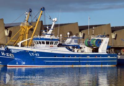
LT-43 ANNALIJDIA
Fishing
Current Trip
FISHINGGROUNDS
| Time Travelled | 4 days |
|---|---|
| Remaining Time | --- |
| Distance Travelled | 404.75 nm |
| Remaining Distance | --- |
| AVG Speed | 10 Knots |
| MAX Speed | 12.2 Knots |
| AVG Wind | 14.1 knots |
| MAX Wind | 25 knots |
| MIN Temp | 9.9°C / 49.82°F |
| MAX Temp | 13.7°C / 56.66°F |
| Draught | 0 m |
| Position Received | 1 d ago |
Current Position
| Longitude | 3.11268° |
|---|---|
| Latitude | 58.70115° |
| Status | Engaged in Fishing |
| Speed | 0.8 Knots |
| Course | 178° |
| Area | North Sea |
| Station | T-AIS |
| Position Received | 1 d ago |
Info
Information
The current position of LT-43 ANNALIJDIA is in North Sea with coordinates 58.70115° / 3.11268° as reported on 2024-06-05 11:42 by AIS to our vessel tracker app. The vessel's current speed is 0.8 Knots
The vessel LT-43 ANNALIJDIA (IMO: 9828821, MMSI: 232015678) is a Fishing It's sailing under the flag of [GB] United Kingdom.
In this page you can find informations about the vessels current position, last detected port calls, and current voyage information. If the vessels is not in coverage by AIS you will find the latest position.
The current position of LT-43 ANNALIJDIA is detected by our AIS receivers and we are not responsible for the reliability of the data. The last position was recorded while the vessel was in Coverage by the Ais receivers of our vessel tracking app.
Weather
| Temperature | 10.2°C / 50.36°F |
|---|---|
| Wind Speed | 18 knots |
| Direction | 258° WSW |
| Pressure | 1000.4 hPa |
| Humidity | 67.4 % |
| Cloud Coverage | 69 % |
Featured Company
Last Port Calls
| Port | Arrival | Departure | Time In Port |
|---|---|---|---|
| 2024-05-30 03:32 | 2024-06-02 21:22 | 3 d | |
| 2024-05-27 00:09 | 2024-05-27 01:13 | 1 h | |
| 2024-05-17 21:29 | 2024-05-20 21:02 | 2 d | |
| 2024-05-16 19:53 | 2024-05-16 21:18 | 1 h | |
| 2024-05-12 13:48 | 2024-05-15 16:45 | 3 d | |
| 2024-05-02 16:59 | 2024-05-08 13:29 | 5 d | |
| 2024-05-02 12:32 |
Most Visited Ports (Last year)
| Port | Arrivals | |
|---|---|---|
| 31 | ||
| 24 | ||
| 2 | ||
| 1 |
Last Trips
| Origin | Departure | Destination | Arrival | Distance | |
|---|---|---|---|---|---|
| 2024-05-27 03:13 | 2024-05-30 05:32 | 263.71 nm | |||
| 2024-05-20 23:02 | 2024-05-27 02:09 | 885.43 nm | |||
| 2024-05-16 23:18 | 2024-05-17 23:29 | 91.48 nm | |||
| 2024-05-15 18:45 | 2024-05-16 21:53 | 103.84 nm | |||
| 2024-05-08 15:29 | 2024-05-12 15:48 | 587.51 nm | |||
| 2024-05-02 14:32 | 2024-05-02 18:59 | 31.15 nm |
Events
| Time | Event | Details | Position / Dest | Info |
|---|---|---|---|---|
| 2024-06-05 11:42 | OUT of Coverage |
58.70115 / 3.11268
North Sea
|
Speed: 0.8 kn Course: 173.9° |
|
| 2024-06-05 11:28 | STOP Moving |
58.70472 / 3.11071
FISHINGGROUNDS
|
Speed: 0.2 kn Course: 179° |
|
| 2024-06-05 10:31 | START Moving |
58.71739 / 3.12550
FISHINGGROUNDS
|
Speed: 5.6 kn Course: 220.9° |
|
| 2024-06-05 09:19 | STOP Moving |
58.73944 / 3.10646
FISHINGGROUNDS
|
Speed: 0.3 kn Course: 161° |
|
| 2024-06-05 05:53 | IN Coverage |
58.70611 / 3.14244
North Sea
|
Speed: 10.1 kn Course: 327.4° |
|
| 2024-06-04 09:00 | OUT of Coverage |
58.33017 / 3.44473
North Sea
|
Speed: 10.7 kn Course: 354.5° |
|
| 2024-06-04 03:02 | IN Coverage |
57.32141 / 3.64655
North Sea
|
Speed: 10.7 kn Course: 355.3° |
|
| 2024-06-04 00:26 | OUT of Coverage |
56.86308 / 3.74021
North Sea
|
Speed: 10.4 kn Course: 353.8° |
|
| 2024-06-03 20:53 | Change Sea Area | Norwegian part of the North Sea Danish part of the North Sea |
56.26720 / 3.86737
North Sea
|
Speed: 10 kn Course: 350.4° |
| 2024-06-03 18:44 | Change Sea Area | Danish part of the North Sea German part of the North Sea |
55.90843 / 3.94214
North Sea
|
Speed: 10.4 kn Course: 358.1° |