
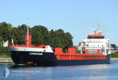
LONGVANN
General Cargo
Current Trip
| Time Travelled | 20 h, 10 mins |
|---|---|
| Remaining Time | 14 h, 28 mins |
| Distance Travelled | 181.90 nm |
| Remaining Distance | 138.99 nm |
| AVG Speed | 8.9 Knots |
| MAX Speed | 9.7 Knots |
| AVG Wind | 19.8 knots |
| MAX Wind | 23 knots |
| MIN Temp | 10.8°C / 51.44°F |
| MAX Temp | 12.7°C / 54.86°F |
| Draught | 3.8 m |
| Position Received | Now |
Current Position
| Longitude | 17.14172° |
|---|---|
| Latitude | 55.81113° |
| Status | Under way using engine |
| Speed | 9.3 Knots |
| Course | 72° |
| Area | Baltic Sea |
| Station | T-AIS |
| Position Received | Now |
Info
Information
The current position of LONGVANN is in Baltic Sea with coordinates 55.81113° / 17.14172° as reported on 2024-05-17 00:21 by AIS to our vessel tracker app. The vessel's current speed is 9.3 Knots and is heading at the port of LIEPAJA. The estimated time of arrival as calculated by MyShipTracking vessel tracking app is 2024-05-17 14:49 LT
The vessel LONGVANN (IMO: 9548304, MMSI: 246670000) is a General Cargo that was built in 2011 ( 13 years old ). It's sailing under the flag of [NL] Netherlands.
In this page you can find informations about the vessels current position, last detected port calls, and current voyage information. If the vessels is not in coverage by AIS you will find the latest position.
The current position of LONGVANN is detected by our AIS receivers and we are not responsible for the reliability of the data. The last position was recorded while the vessel was in Coverage by the Ais receivers of our vessel tracking app.
The current draught of LONGVANN as reported by AIS is 3.8 meters
Weather
| Temperature | 11.2°C / 52.16°F |
|---|---|
| Wind Speed | 17 knots |
| Direction | 116° ESE |
| Pressure | 1021.1 hPa |
| Humidity | 79.1 % |
| Cloud Coverage | 6 % |
Featured Company
Last Port Calls
| Port | Arrival | Departure | Time In Port |
|---|---|---|---|
| 2024-05-14 09:26 | 2024-05-16 04:11 | 1 d | |
| 2024-05-09 11:35 | 2024-05-10 16:45 | 1 d | |
| 2024-05-07 00:16 | 2024-05-07 22:07 | 21 h | |
| 2024-05-05 09:15 | 2024-05-06 10:42 | 1 d | |
| 2024-04-28 13:06 | 2024-04-30 21:30 | 2 d | |
| 2024-04-19 16:37 | 2024-04-21 12:02 | 1 d | |
| 2024-04-13 11:59 | 2024-04-14 00:21 | 12 h | |
| 2024-04-02 16:51 | 2024-04-03 18:08 | 1 d | |
| 2024-03-27 09:08 | 2024-03-30 04:18 | 2 d | |
| 2024-03-22 06:56 | 2024-03-23 09:17 | 1 d |
Most Visited Ports (Last year)
| Port | Arrivals | |
|---|---|---|
| 14 | ||
| 8 | ||
| 6 | ||
| 5 | ||
| 4 | ||
| 3 |
Last Trips
| Origin | Departure | Destination | Arrival | Distance | |
|---|---|---|---|---|---|
| 2024-05-10 18:45 | 2024-05-14 11:26 | 715.82 nm | |||
| 2024-05-08 00:07 | 2024-05-09 13:35 | 355.59 nm | |||
| 2024-05-06 12:42 | 2024-05-07 02:16 | 154.87 nm | |||
| 2024-04-30 23:30 | 2024-05-05 11:15 | 925.92 nm | |||
| 2024-04-21 13:02 | 2024-04-28 15:06 | 1033.39 nm | |||
| 2024-04-14 03:21 | 2024-04-19 17:37 | 1416.47 nm | |||
| 2024-04-03 20:08 | 2024-04-13 14:59 | 1880.53 nm | |||
| 2024-03-30 05:18 | 2024-04-02 18:51 | 794.28 nm | |||
| 2024-03-23 10:17 | 2024-03-27 10:08 | 749.68 nm | |||
| 2024-03-20 19:21 | 2024-03-22 07:56 | 398.94 nm |
Events
| Time | Event | Details | Position / Dest | Info |
|---|---|---|---|---|
| 2024-05-16 21:57 | START Moving |
55.70092 / 16.49933
LVLPX
|
Speed: 9.5 kn Course: 70° |
|
| 2024-05-16 21:56 | STOP Moving |
55.70032 / 16.49597
LVLPX
|
Speed: Course: 511° |
|
| 2024-05-16 18:41 | Detected in Sea | Swedish part of the Baltic Sea |
55.55642 / 15.64827
Baltic Sea
LVLPX
|
Speed: 9 kn Course: 72° |
| 2024-05-16 12:37 | Change Sea Area | Danish part of the Kattegat Swedish part of the Baltic Sea |
55.16002 / 14.26100
Kattegat
LVLPX
|
Speed: 9.5 kn Course: 117° |
| 2024-05-16 06:28 | Change Sea Area | Swedish part of the Baltic Sea Danish part of the Baltic Sea |
55.29253 / 12.65970
Baltic Sea
LVLPX
|
Speed: 8.9 kn Course: 110° |
| 2024-05-16 06:10 | Change Sea Area | Danish part of the Baltic Sea Danish part of the Kattegat |
55.31943 / 12.60895
Baltic Sea
LVLPX
|
Speed: 8.5 kn Course: 164° |
| 2024-05-16 04:44 | ETA Changed | 2024/05/17 14:00 2024/05/17 13:00 |
55.52140 / 12.50147
LVLPX
|
Speed: 8.9 kn Course: 160° |
| 2024-05-16 04:41 | Draught Changed | 3.8 4 |
55.52772 / 12.49818
LVLPX
|
Speed: 9 kn Course: 170° |
| 2024-05-16 04:41 | ETA Changed | 2024/05/17 13:00 2024/05/17 11:00 |
55.52772 / 12.49818
LVLPX
|
Speed: 9 kn Course: 170° |
| 2024-05-16 04:41 | Status Changed | Under way using engine Moored |
55.52772 / 12.49818
LVLPX
|
Speed: 9 kn Course: 171° |