
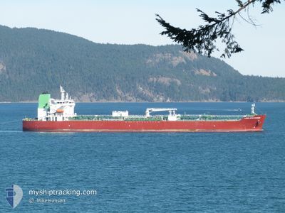
LONE STAR MARINER
Tanker
Current Trip
USTXT
| Time Travelled | 3 days |
|---|---|
| Remaining Time | --- |
| Distance Travelled | 756.43 nm |
| Remaining Distance | --- |
| AVG Speed | 10.5 Knots |
| MAX Speed | 12.8 Knots |
| AVG Wind | 16.2 knots |
| MAX Wind | 24 knots |
| MIN Temp | 13.9°C / 57.02°F |
| MAX Temp | 25.6°C / 78.08°F |
| Draught | 8.5 m |
| Position Received | 3 d ago |
Current Position
| Longitude | --- |
|---|---|
| Latitude | --- |
| Status | Under way using engine |
| Speed | 5.8 Knots |
| Course | 104.4° |
| Area | Gulf of Mexico |
| Station | T-AIS |
| Position Received | 3 d ago |
Info
Information
The current position of LONE STAR MARINER is in Gulf of Mexico with coordinates 29.37893° / -94.87240° as reported on 2025-02-14 22:46 by AIS to our vessel tracker app. The vessel's current speed is 5.8 Knots
The vessel LONE STAR MARINER (IMO: 9902859, MMSI: 538009133) is a Tanker It's sailing under the flag of [MH] Marshall Is.
In this page you can find informations about the vessels current position, last detected port calls, and current voyage information. If the vessels is not in coverage by AIS you will find the latest position.
The current position of LONE STAR MARINER is detected by our AIS receivers and we are not responsible for the reliability of the data. The last position was recorded while the vessel was in Coverage by the Ais receivers of our vessel tracking app.
The current draught of LONE STAR MARINER as reported by AIS is 8.5 meters
Weather
| Temperature | 23.2°C / 73.76°F |
|---|---|
| Wind Speed | 14 knots |
| Direction | 31° NNE |
| Pressure | 1016.3 hPa |
| Humidity | 82.5 % |
| Cloud Coverage | 49 % |
Featured Company
Last Port Calls
| Port | Arrival | Departure | Time In Port |
|---|---|---|---|
| 2025-02-12 11:02 | 2025-02-14 22:40 | 2 d | |
| 2024-12-27 15:59 | 2024-12-28 17:30 | 1 d | |
| 2024-12-22 11:22 | 2024-12-24 04:27 | 1 d | |
| 2024-12-17 06:52 | 2024-12-18 23:24 | 1 d | |
| 2024-12-09 02:10 | 2024-12-12 17:11 | 3 d | |
| 2024-12-03 11:24 | 2024-12-05 03:14 | 1 d |
Most Visited Ports (Last year)
| Port | Arrivals | |
|---|---|---|
| 10 | ||
| 5 | ||
| 5 | ||
| 2 | ||
| 1 | ||
| 1 |
Last Trips
| Origin | Departure | Destination | Arrival | Distance | |
|---|---|---|---|---|---|
| 2024-12-28 11:30 | 2025-02-12 05:02 | 2757.91 nm | |||
| 2024-12-23 22:27 | 2024-12-27 09:59 | 1031.25 nm | |||
| 2024-12-18 17:24 | 2024-12-22 05:22 | 68.77 nm | |||
| 2024-12-12 11:11 | 2024-12-17 00:52 | 1150.61 nm | |||
| 2024-12-04 21:14 | 2024-12-08 20:10 | 1182.58 nm | |||
| 2024-11-24 19:22 | 2024-12-03 05:24 | 1220.78 nm |
Events
| Time | Event | Details | Position / Dest | Info |
|---|---|---|---|---|
| 2025-02-15 06:26 | START Moving |
28.87973 / -94.13718
USTXT
|
Speed: 4.1 kn Course: 104° |
|
| 2025-02-15 05:05 | STOP Moving |
28.87083 / -94.12437
USTXT
|
Speed: 0.3 kn Course: 103° |
|
| 2025-02-14 22:55 | Status Changed | Default Under way using engine |
29.37461 / -94.85380
USTXT
|
Speed: 5.8 kn Course: 104.4° |
| 2025-02-14 22:46 | OUT of Coverage |
29.37893 / -94.87240
Gulf of Mexico
|
Speed: 5.8 kn Course: 104.4° |
|
| 2025-02-14 22:40 | PORT DEPARTURE |
|
29.38020 / -94.88183
USTXT
|
Speed: 4.7 kn Course: 83° |
| 2025-02-14 22:30 | START Moving |
29.37212 / -94.88810
[US] TEXAS CITY
|
Speed: 3.1 kn Course: 7° |
|
| 2025-02-14 22:19 | Status Changed | Under way using engine Default |
29.36774 / -94.89076
[US] TEXAS CITY
|
Speed: Course: 70° |
| 2025-02-14 22:07 | IN Coverage |
29.36775 / -94.89062
Gulf of Mexico
[US] TEXAS CITY
|
Speed: 0.8 kn Course: 87.1° |
|
| 2025-02-12 11:45 | Status Changed | Default Moored |
29.36770 / -94.89123
[US] TEXAS CITY
|
Speed: Course: 70° |
| 2025-02-12 11:40 | OUT of Coverage |
29.36771 / -94.89122
Gulf of Mexico
[US] TEXAS CITY
|
Speed: Course: 245.7° |