
LOKHOLMEN
Oil/Chemical Tanker
Current Trip
GOLA
| Time Travelled | 14 days |
|---|---|
| Remaining Time | --- |
| Distance Travelled | 615.66 nm |
| Remaining Distance | --- |
| AVG Speed | 9.8 Knots |
| MAX Speed | 13.8 Knots |
| AVG Wind | 12.6 knots |
| MAX Wind | 26.9 knots |
| MIN Temp | 9.9°C / 49.82°F |
| MAX Temp | 22.9°C / 73.22°F |
| Draught | 7.5 m |
| Position Received | 21 h, 52 m ago |
Current Position
| Longitude | --- |
|---|---|
| Latitude | --- |
| Status | At anchor |
| Speed | 0.3 Knots |
| Course | 35° |
| Area | Gulf of Mexico |
| Station | T-AIS |
| Position Received | 21 h, 52 m ago |
Info
Information
The current position of LOKHOLMEN is in Gulf of Mexico with coordinates 29.09057° / -94.69297° as reported on 2025-02-16 06:01 by AIS to our vessel tracker app. The vessel's current speed is 0.3 Knots
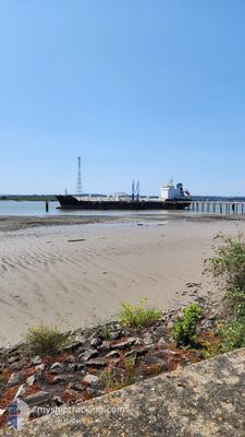
The vessel LOKHOLMEN (IMO: 9433303, MMSI: 538005550) is a Oil/Chemical Tanker that was built in 2009 ( 16 years old ). It's sailing under the flag of [MH] Marshall Is.
In this page you can find informations about the vessels current position, last detected port calls, and current voyage information. If the vessels is not in coverage by AIS you will find the latest position.
The current position of LOKHOLMEN is detected by our AIS receivers and we are not responsible for the reliability of the data. The last position was recorded while the vessel was in Coverage by the Ais receivers of our vessel tracking app.
The current draught of LOKHOLMEN as reported by AIS is 7.5 meters
Weather
| Temperature | 12.6°C / 54.68°F |
|---|---|
| Wind Speed | 17 knots |
| Direction | 28° NNE |
| Pressure | 1025.1 hPa |
| Humidity | 59.7 % |
| Cloud Coverage | --- |
Featured Company
Most Visited Ports (Last year)
| Port | Arrivals | |
|---|---|---|
| 22 | ||
| 9 | ||
| 7 | ||
| 6 | ||
| 5 | ||
| 5 |
Last Trips
| Origin | Departure | Destination | Arrival | Distance | |
|---|---|---|---|---|---|
| 2025-01-20 03:19 | 2025-02-01 18:09 | 187.88 nm | |||
| 2024-12-25 10:02 | 2025-01-19 06:09 | 213.86 nm | |||
| 2024-12-23 02:15 | 2024-12-25 09:56 | 48.79 nm | |||
| 2024-12-20 19:11 | 2024-12-21 08:51 | 20.98 nm | |||
| 2024-11-29 05:56 | 2024-12-19 20:49 | 5794.04 nm |
Events
| Time | Event | Details | Position / Dest | Info |
|---|---|---|---|---|
| 2025-02-16 23:11 | STOP Moving | 16.68 nm, South of GALVESTON |
29.04790 / -94.68741
GOLA
|
Speed: 0.3 kn Course: 20° |
| 2025-02-16 21:47 | START Moving | 14.53 nm, South East of GALVESTON |
29.08665 / -94.68687
GOLA
|
Speed: 5.5 kn Course: 161° |
| 2025-02-16 06:07 | Status Changed | Default At anchor |
29.09086 / -94.69321
GOLA
|
Speed: 0.3 kn Course: 35° |
| 2025-02-16 06:01 | OUT of Coverage |
29.09057 / -94.69297
Gulf of Mexico
|
Speed: 0.3 kn Course: 352.2° |
|
| 2025-02-16 05:58 | Status Changed | At anchor Default |
29.09046 / -94.69287
GOLA
|
Speed: 0.4 kn Course: 25° |
| 2025-02-16 05:52 | Destination Changed | GOLA USCRP>GOLA |
29.09038 / -94.69284
GOLA
|
Speed: 0.4 kn Course: 42° |
| 2025-02-16 05:46 | Status Changed | Default At anchor |
29.09043 / -94.69295
USCRP>GOLA
|
Speed: 0.3 kn Course: 51° |
| 2025-02-16 05:43 | Status Changed | At anchor Default |
29.09041 / -94.69299
USCRP>GOLA
|
Speed: 0.4 kn Course: 53° |
| 2025-02-16 05:10 | Status Changed | Default At anchor |
29.09036 / -94.69292
USCRP>GOLA
|
Speed: 0.4 kn Course: 71° |
| 2025-02-16 04:55 | Status Changed | At anchor Default |
29.09050 / -94.69292
USCRP>GOLA
|
Speed: 0.6 kn Course: 66° |